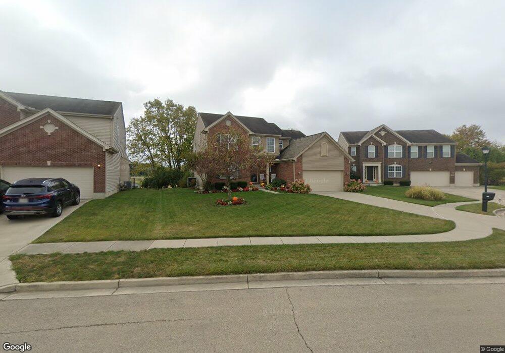
1506 Cameron Dr Fairborn, OH 45324
Estimated Value: $389,000 - $423,000
4
Beds
3
Baths
2,241
Sq Ft
$180/Sq Ft
Est. Value
About This Home
This home is located at 1506 Cameron Dr, Fairborn, OH 45324 and is currently estimated at $403,183, approximately $179 per square foot. 1506 Cameron Dr is a home located in Greene County with nearby schools including Fairborn Primary School, Fairborn Intermediate School, and Fairborn Middle School.
Ownership History
Date
Name
Owned For
Owner Type
Purchase Details
Closed on
Nov 19, 2010
Sold by
Inverness Group Incorporated
Bought by
Weinstein Mark D and Weinstein Lisa S
Current Estimated Value
Home Financials for this Owner
Home Financials are based on the most recent Mortgage that was taken out on this home.
Original Mortgage
$95,000
Outstanding Balance
$62,327
Interest Rate
4.16%
Mortgage Type
New Conventional
Estimated Equity
$340,856
Purchase Details
Closed on
Aug 26, 2010
Sold by
Hills Land & Development Company
Bought by
Inverness Group Incorporated
Home Financials for this Owner
Home Financials are based on the most recent Mortgage that was taken out on this home.
Original Mortgage
$20,000,000
Interest Rate
4.49%
Mortgage Type
Purchase Money Mortgage
Create a Home Valuation Report for This Property
The Home Valuation Report is an in-depth analysis detailing your home's value as well as a comparison with similar homes in the area
Home Values in the Area
Average Home Value in this Area
Purchase History
| Date | Buyer | Sale Price | Title Company |
|---|---|---|---|
| Weinstein Mark D | $206,600 | None Available | |
| Inverness Group Incorporated | $35,200 | Attorney |
Source: Public Records
Mortgage History
| Date | Status | Borrower | Loan Amount |
|---|---|---|---|
| Open | Weinstein Mark D | $95,000 | |
| Previous Owner | Inverness Group Incorporated | $20,000,000 |
Source: Public Records
Tax History Compared to Growth
Tax History
| Year | Tax Paid | Tax Assessment Tax Assessment Total Assessment is a certain percentage of the fair market value that is determined by local assessors to be the total taxable value of land and additions on the property. | Land | Improvement |
|---|---|---|---|---|
| 2024 | $5,813 | $124,320 | $16,490 | $107,830 |
| 2023 | $5,813 | $124,320 | $16,490 | $107,830 |
| 2022 | $5,177 | $92,050 | $13,740 | $78,310 |
| 2021 | $5,256 | $92,050 | $13,740 | $78,310 |
| 2020 | $5,285 | $92,050 | $13,740 | $78,310 |
| 2019 | $4,400 | $76,660 | $12,210 | $64,450 |
| 2018 | $4,449 | $76,660 | $12,210 | $64,450 |
| 2017 | $4,015 | $76,660 | $12,210 | $64,450 |
| 2016 | $4,016 | $68,990 | $12,210 | $56,780 |
| 2015 | $3,830 | $68,990 | $12,210 | $56,780 |
| 2014 | $3,706 | $68,990 | $12,210 | $56,780 |
Source: Public Records
Map
Nearby Homes
- 1395 Brookstone Dr
- 1281 Whitetail Dr
- 1105 Windsong Trail
- 1788 Fawnwood Ct
- 1878 Spring Meadows Dr
- 3488 Byron Rd
- 00 Trebein Rd
- 2719 Golden Leaf Dr Unit 18-201
- 1088 Brehm Blvd
- Lot 1 Trebein Rd
- 1506 Indigo Dr
- 1309 Candlelite Ln
- 631 Westwood Dr
- 1580 Primrose Ln
- 630 Hidden Valley Ct
- 1800 Ash Meadow Ct
- 1101 Arden Way
- DaVinci Plan at Arden Place - Maple Street Collection
- Danville Plan at Arden Place - Maple Street Collection
- Denali Plan at Arden Place - Maple Street Collection
- 1510 Cameron Dr
- 1502 Cameron Dr
- 1514 Cameron Dr
- 1500 Cameron Dr
- 1501 Cameron Dr
- 1513 Cameron Dr
- 1496 Cameron Dr
- 1518 Cameron Dr
- 1517 Cameron Dr
- 1493 Cameron Dr
- 2418 Gardner Dr
- 1492 Cameron Dr
- 1524 Cameron Dr
- 2414 Gardner Dr
- 2409 Copley Ave
- 1514 Cellini Ct
- 1487 Cameron Dr
- 1488 Cameron Dr
- 2403 Copley Ave
- 1506 Cellini Ct