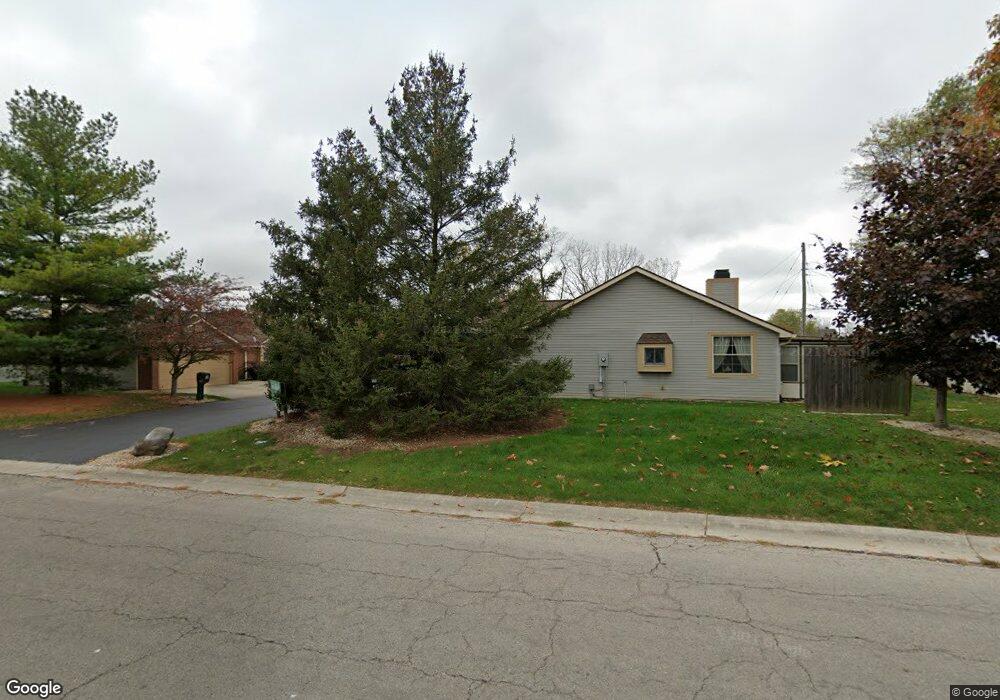
1506 Cross Pointe Cir Unit 1 Bellefontaine, OH 43311
Estimated Value: $162,000 - $182,000
2
Beds
2
Baths
889
Sq Ft
$193/Sq Ft
Est. Value
About This Home
This home is located at 1506 Cross Pointe Cir Unit 1, Bellefontaine, OH 43311 and is currently estimated at $171,393, approximately $192 per square foot. 1506 Cross Pointe Cir Unit 1 is a home located in Logan County with nearby schools including Bellefontaine Elementary School, Bellefontaine Intermediate School, and Bellefontaine Middle School.
Ownership History
Date
Name
Owned For
Owner Type
Purchase Details
Closed on
Oct 9, 2023
Sold by
Ahlers Sara
Bought by
Ball Joyce R
Current Estimated Value
Purchase Details
Closed on
Jul 19, 2011
Sold by
Castle Shirley M
Bought by
Hemmer Ll Charles Robert and Hemmer Sandra Jean
Purchase Details
Closed on
Dec 1, 2005
Bought by
Castle Shirley M
Purchase Details
Closed on
Jul 11, 2002
Bought by
Gostonczik Blair M
Purchase Details
Closed on
Aug 18, 1997
Bought by
Coons Barbara L
Create a Home Valuation Report for This Property
The Home Valuation Report is an in-depth analysis detailing your home's value as well as a comparison with similar homes in the area
Home Values in the Area
Average Home Value in this Area
Purchase History
| Date | Buyer | Sale Price | Title Company |
|---|---|---|---|
| Ball Joyce R | $149,900 | None Listed On Document | |
| Ball Joyce R | $149,900 | None Listed On Document | |
| Hemmer Ll Charles Robert | -- | Quality Choice Title | |
| Castle Shirley M | $76,000 | -- | |
| Gostonczik Blair M | $70,000 | -- | |
| Coons Barbara L | $65,000 | -- |
Source: Public Records
Tax History Compared to Growth
Tax History
| Year | Tax Paid | Tax Assessment Tax Assessment Total Assessment is a certain percentage of the fair market value that is determined by local assessors to be the total taxable value of land and additions on the property. | Land | Improvement |
|---|---|---|---|---|
| 2024 | $989 | $34,840 | $4,610 | $30,230 |
| 2023 | $989 | $34,840 | $4,610 | $30,230 |
| 2022 | $1,102 | $25,800 | $3,410 | $22,390 |
| 2021 | $762 | $25,800 | $3,410 | $22,390 |
| 2020 | $761 | $22,320 | $3,410 | $18,910 |
| 2019 | $778 | $22,320 | $3,410 | $18,910 |
| 2018 | $859 | $22,320 | $3,410 | $18,910 |
| 2016 | $826 | $20,600 | $3,410 | $17,190 |
| 2014 | $802 | $20,600 | $3,410 | $17,190 |
| 2013 | $802 | $20,600 | $3,410 | $17,190 |
| 2012 | $1,003 | $26,430 | $4,240 | $22,190 |
Source: Public Records
Map
Nearby Homes
- 1441 S Main St
- 1537 Eagle St Unit 10
- 1236 S Detroit St
- 1200 Erie St
- 1156 S Greenwood St
- 508 E Lake Ave
- 1530 County Road 1
- 501 Gunntown Rd Unit Lot 66
- 501 Gunntown Rd Unit Lot 57
- 501 Gunntown Rd Unit 107
- 907 Sherwood Loop
- 1025 Sherwood Loop
- Aldridge Plan at Ludlow Ridge
- 882 Sherwood Loop
- Henley Plan at Ludlow Ridge
- Harmony Plan at Ludlow Ridge
- Bellamy Plan at Ludlow Ridge
- Stamford Plan at Ludlow Ridge
- Fairton Plan at Ludlow Ridge
- Freeport Plan at Ludlow Ridge
- 1506 Cross Pointe Cir
- 1508 Cross Pointe Cir
- 1510 Cross Pointe Cir
- 1512 Cross Pointe Cir
- 228 Cross Pointe Cir
- 229 Cross Pointe Cir
- 1514 Cross Pointe Cir
- 230 Cross Pointe Cir
- 1516 Cross Pointe Cir
- 231 Cross Pointe Cir
- 1504 Wright St
- 1518 Cross Pointe Cir
- 1518 Wright St
- 1500 Wright St
- 1520 Wright St
- 1528 Wright St
- 1520 Cross Pointe Cir
- 1522 Wright St
- 1440 Wright St
- 301 Kelly Way