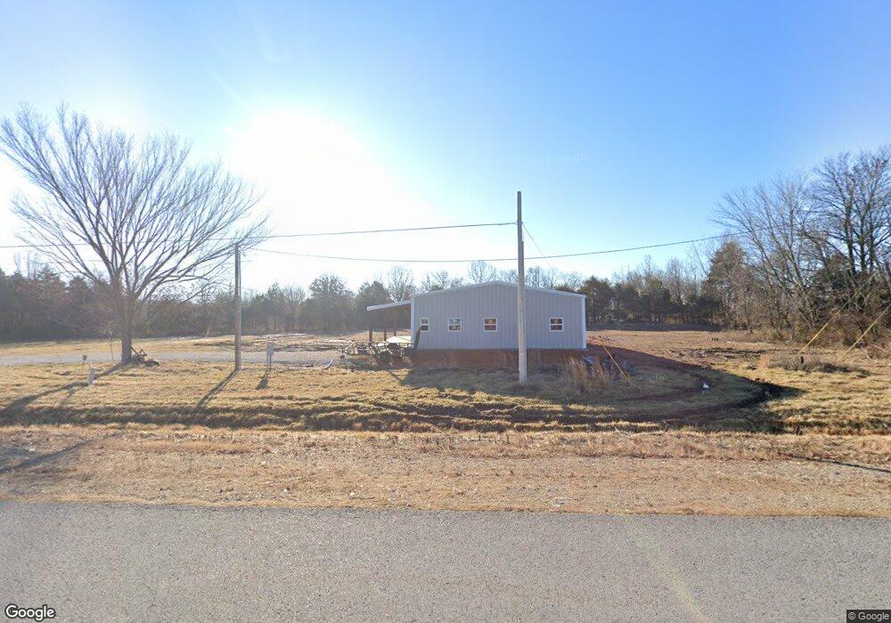
15067 Highway 62 Garfield, AR 72732
Estimated Value: $135,892 - $371,000
--
Bed
--
Bath
1,000
Sq Ft
$240/Sq Ft
Est. Value
About This Home
This home is located at 15067 Highway 62, Garfield, AR 72732 and is currently estimated at $239,723, approximately $239 per square foot. 15067 Highway 62 is a home located in Benton County with nearby schools including Pea Ridge Intermediate School, Pea Ridge Primary School, and Pea Ridge Junior High School.
Ownership History
Date
Name
Owned For
Owner Type
Purchase Details
Closed on
Nov 15, 2021
Sold by
Taylor Jimmy R
Bought by
Curry Duane and Curry Rebecca
Current Estimated Value
Purchase Details
Closed on
Mar 15, 2021
Sold by
Commissioner Of State Lands
Bought by
Taylor Jimmy R
Purchase Details
Closed on
Sep 12, 2012
Sold by
Taylor Harold L and Taylor Carolyn Y
Bought by
Taylor Jimmy R
Purchase Details
Closed on
Oct 4, 2000
Bought by
Austin
Purchase Details
Closed on
Dec 2, 1991
Bought by
Taylor
Purchase Details
Closed on
Sep 16, 1991
Bought by
Taylor
Purchase Details
Closed on
Apr 18, 1986
Bought by
King
Create a Home Valuation Report for This Property
The Home Valuation Report is an in-depth analysis detailing your home's value as well as a comparison with similar homes in the area
Home Values in the Area
Average Home Value in this Area
Purchase History
| Date | Buyer | Sale Price | Title Company |
|---|---|---|---|
| Curry Duane | $100,000 | Realty Title | |
| Taylor Jimmy R | $2,331 | None Listed On Document | |
| Taylor Jimmy R | $35,000 | None Available | |
| Austin | $25,000 | -- | |
| Taylor | -- | -- | |
| Taylor | $21,000 | -- | |
| King | -- | -- |
Source: Public Records
Tax History Compared to Growth
Tax History
| Year | Tax Paid | Tax Assessment Tax Assessment Total Assessment is a certain percentage of the fair market value that is determined by local assessors to be the total taxable value of land and additions on the property. | Land | Improvement |
|---|---|---|---|---|
| 2025 | $2,240 | $43,165 | $9,252 | $33,913 |
| 2024 | $381 | $9,252 | $9,252 | $0 |
| 2023 | $347 | $6,680 | $6,680 | $0 |
| 2022 | $363 | $6,680 | $6,680 | $0 |
| 2021 | $239 | $6,680 | $6,680 | $0 |
| 2020 | $224 | $6,660 | $6,510 | $150 |
| 2019 | $372 | $6,660 | $6,510 | $150 |
| 2018 | $372 | $6,660 | $6,510 | $150 |
| 2017 | $294 | $6,660 | $6,510 | $150 |
| 2016 | $294 | $6,660 | $6,510 | $150 |
| 2015 | $267 | $5,150 | $5,000 | $150 |
| 2014 | $267 | $5,000 | $5,000 | $0 |
Source: Public Records
Map
Nearby Homes
- 15047 U S 62
- 13610 Degraff Rd
- 15992 Boundary Line Rd
- 4.7 acres(Lot 1) of Boundary Line Rd
- 3 Acres (Lot 3) 1610 Boundary Line Rd
- 5 acres (Lot 5) 1610 Boundary Line Rd
- 15072 White Fawn Dr
- Tract 3 Sugar Creek Rd
- 15049 White Fawn Dr
- 12526 Avoca Hollow Dr
- 15112 Mills Terrace
- 13482 Sugar Creek Rd
- 13585 Andy Jack Rd
- 13672 Highway 72
- 12092 Guyll Ridge Rd
- 469 Sheppard Rd
- 13302 Byler Rd
- 969 Rader Rd
- TBD Rader Rd
- 0 Rader Rd Unit 1290308
- 15067 Highway 62
- 15057 U S Highway 62
- 15057 U S 62
- 15147 Highway 62
- 15147 Highway 62
- 13865 N Old Wire Rd
- 14958 E Highway 62
- 13970 N Old Wire Rd
- 14981 Highway 62
- 13962 N Old Wire Rd
- 14986 Highway 62
- 14998 Highway 62
- 14988 Highway 62
- 13944 N Old Wire Rd
- 15056 E Highway 62
- 13908 N Old Wire Rd
- 9.8Ac Hwy 62
- 0 E Lot 1 08 Acre Hwy 62 Hwy Unit 652731
- 9.85Ac Hwy 62
- 5Ac Hwy 62