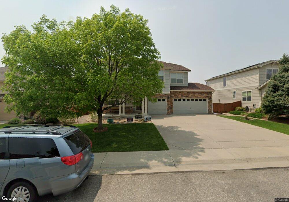
15067 St Paul St Thornton, CO 80602
The Haven at York Street NeighborhoodEstimated Value: $735,862 - $828,000
4
Beds
4
Baths
2,830
Sq Ft
$279/Sq Ft
Est. Value
About This Home
This home is located at 15067 St Paul St, Thornton, CO 80602 and is currently estimated at $789,716, approximately $279 per square foot. 15067 St Paul St is a home located in Adams County with nearby schools including Silver Creek Elementary School, Rocky Top Middle School, and Mountain Range High School.
Ownership History
Date
Name
Owned For
Owner Type
Purchase Details
Closed on
May 20, 2008
Sold by
Tousa Homes Inc
Bought by
Oram Peter and Oram Colette
Current Estimated Value
Home Financials for this Owner
Home Financials are based on the most recent Mortgage that was taken out on this home.
Original Mortgage
$197,000
Outstanding Balance
$124,629
Interest Rate
5.86%
Mortgage Type
Purchase Money Mortgage
Estimated Equity
$665,087
Create a Home Valuation Report for This Property
The Home Valuation Report is an in-depth analysis detailing your home's value as well as a comparison with similar homes in the area
Home Values in the Area
Average Home Value in this Area
Purchase History
| Date | Buyer | Sale Price | Title Company |
|---|---|---|---|
| Oram Peter | $408,800 | Ult |
Source: Public Records
Mortgage History
| Date | Status | Borrower | Loan Amount |
|---|---|---|---|
| Open | Oram Peter | $197,000 |
Source: Public Records
Tax History Compared to Growth
Tax History
| Year | Tax Paid | Tax Assessment Tax Assessment Total Assessment is a certain percentage of the fair market value that is determined by local assessors to be the total taxable value of land and additions on the property. | Land | Improvement |
|---|---|---|---|---|
| 2024 | $4,777 | $47,500 | $8,940 | $38,560 |
| 2023 | $4,728 | $49,850 | $9,670 | $40,180 |
| 2022 | $4,153 | $37,700 | $9,940 | $27,760 |
| 2021 | $4,291 | $37,700 | $9,940 | $27,760 |
| 2020 | $4,151 | $37,210 | $10,220 | $26,990 |
| 2019 | $4,160 | $37,210 | $10,220 | $26,990 |
| 2018 | $3,914 | $34,010 | $7,560 | $26,450 |
| 2017 | $3,558 | $34,010 | $7,560 | $26,450 |
| 2016 | $3,321 | $30,900 | $6,930 | $23,970 |
| 2015 | $3,316 | $30,900 | $6,930 | $23,970 |
| 2014 | -- | $30,680 | $6,210 | $24,470 |
Source: Public Records
Map
Nearby Homes
- 15193 St Paul St
- 3122 E 152nd Cir
- 3142 E 152nd Cir
- 3131 E 152nd Cir
- 14959 Harrison St
- 14985 Elizabeth St
- 15225 Milwaukee St
- Oliver Plan at Eastcreek Farm - The Camden Collection
- Graham Plan at Eastcreek Farm - The Camden Collection
- Haven Plan at Eastcreek Farm - The Camden Collection
- Hartford Plan at Eastcreek Farm - The Camden Collection
- Vibrant I Plan at Eastcreek Farm - Paired Homes
- Lucent II Plan at Eastcreek Farm - Paired Homes
- Lucent I Plan at Eastcreek Farm - Paired Homes
- Vibrant II Plan at Eastcreek Farm - Paired Homes
- 14928 Clayton St
- 3092 E 152nd Cir
- 3102 E 152nd Cir
- 3171 E 152nd Cir
- 15242 Saint Paul St
- 15063 St Paul St
- 15073 St Paul St
- 15066 Fillmore Way
- 15062 Fillmore Way
- 15057 St Paul St
- 15068 St Paul St
- 15074 Saint Paul St
- 15077 St Paul St
- 15056 Fillmore Way
- 15074 St Paul St
- 15064 St Paul St
- 15076 Fillmore Way
- 15083 St Paul St
- 15078 St Paul St
- 15058 St Paul St
- 15052 Fillmore Way
- 15084 St Paul St
- 15087 St Paul St
- 15088 St Paul St
- 15084 Saint Paul St