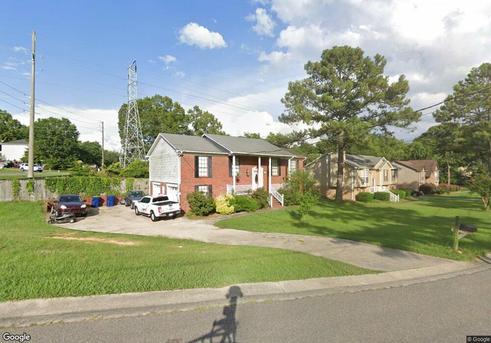
1507 Hill Spun Rd Alabaster, AL 35007
Estimated Value: $221,000 - $294,000
3
Beds
3
Baths
1,610
Sq Ft
$164/Sq Ft
Est. Value
About This Home
This home is located at 1507 Hill Spun Rd, Alabaster, AL 35007 and is currently estimated at $263,370, approximately $163 per square foot. 1507 Hill Spun Rd is a home located in Shelby County with nearby schools including Thompson Intermediate School, Thompson Middle School, and Thompson High School.
Ownership History
Date
Name
Owned For
Owner Type
Purchase Details
Closed on
Dec 29, 2008
Sold by
Us Bank National Association
Bought by
Tessier Paul A and Tessier Patsy S
Current Estimated Value
Home Financials for this Owner
Home Financials are based on the most recent Mortgage that was taken out on this home.
Original Mortgage
$80,000
Outstanding Balance
$53,690
Interest Rate
6.37%
Mortgage Type
Unknown
Estimated Equity
$209,680
Purchase Details
Closed on
Sep 23, 2008
Sold by
Wood Karen Lynn and Wood Rodger Weaver
Bought by
Us Bank Na
Create a Home Valuation Report for This Property
The Home Valuation Report is an in-depth analysis detailing your home's value as well as a comparison with similar homes in the area
Home Values in the Area
Average Home Value in this Area
Purchase History
| Date | Buyer | Sale Price | Title Company |
|---|---|---|---|
| Tessier Paul A | $100,000 | None Available | |
| Us Bank Na | $103,350 | None Available |
Source: Public Records
Mortgage History
| Date | Status | Borrower | Loan Amount |
|---|---|---|---|
| Open | Tessier Paul A | $80,000 |
Source: Public Records
Tax History Compared to Growth
Tax History
| Year | Tax Paid | Tax Assessment Tax Assessment Total Assessment is a certain percentage of the fair market value that is determined by local assessors to be the total taxable value of land and additions on the property. | Land | Improvement |
|---|---|---|---|---|
| 2024 | $1,261 | $23,360 | $0 | $0 |
| 2023 | $1,176 | $21,780 | $0 | $0 |
| 2022 | $1,137 | $21,060 | $0 | $0 |
| 2021 | $1,009 | $18,680 | $0 | $0 |
| 2020 | $931 | $17,240 | $0 | $0 |
| 2019 | $864 | $16,000 | $0 | $0 |
| 2017 | $744 | $13,780 | $0 | $0 |
| 2015 | $712 | $13,180 | $0 | $0 |
| 2014 | $696 | $12,880 | $0 | $0 |
Source: Public Records
Map
Nearby Homes
- 1424 King George Dr
- 1208 Siskin Dr
- 191 Sugar Hill Ln
- 0001 9th St NW
- 000 9th St NW
- 1445 Navajo Trail
- 205 Willow Point Cir
- 112 Portsouth Ln
- 1637 King James Dr
- 1324 Willow Creek Place
- 218 Willow Point Cir
- 2021 King Charles Place
- 1700 King James Dr
- 204 Portsouth Ln
- 100 Cape Cod Cir
- 255 Creekside Ln Unit 192
- 225 Portsouth Ln
- 278 Creekside Ln
- 196 King James Ct
- 1773 King James Dr
- 1330 Bunting Dr
- 1322 Bunting Dr
- 1455 Hill Spun Rd
- 1380 Waxwing Trail
- 1515 Hill Spun Rd
- 1518 Hill Spun Rd
- 1313 Bunting Dr
- 1408 King George Dr
- 1523 Hill Spun Rd
- 1314 Bunting Dr
- 1447 Hill Spun Rd
- 1372 Waxwing Trail
- 1372 Waxwing Trail Unit 6
- 1520 Hill Spun Rd
- 1363 Waxwing Trail
- 1308 Royalty Dr
- 1305 Bunting Dr
- 1416 King George Dr
- 1522 Hill Spun Rd
- 1306 Bunting Dr