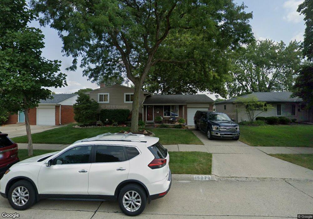
15072 Nola St Livonia, MI 48154
Estimated Value: $274,000 - $351,000
--
Bed
2
Baths
1,534
Sq Ft
$208/Sq Ft
Est. Value
About This Home
This home is located at 15072 Nola St, Livonia, MI 48154 and is currently estimated at $319,315, approximately $208 per square foot. 15072 Nola St is a home located in Wayne County with nearby schools including Randolph Elementary School, Johnson Upper Elementary School, and Frost Middle School.
Ownership History
Date
Name
Owned For
Owner Type
Purchase Details
Closed on
Mar 12, 2021
Sold by
Mcdonald Todd A
Bought by
Mcdonald Todd A and Mcdonald Christa L
Current Estimated Value
Home Financials for this Owner
Home Financials are based on the most recent Mortgage that was taken out on this home.
Original Mortgage
$125,000
Outstanding Balance
$92,707
Interest Rate
2.73%
Mortgage Type
New Conventional
Estimated Equity
$226,608
Purchase Details
Closed on
Dec 27, 2004
Sold by
Ehr Collen M and Fitzpatrick Colleen M
Bought by
Mcdonald Todd A
Purchase Details
Closed on
Aug 1, 1994
Sold by
Duggan Michael E
Bought by
Michael W and Michael Colleen M
Home Financials for this Owner
Home Financials are based on the most recent Mortgage that was taken out on this home.
Original Mortgage
$97,650
Interest Rate
8.72%
Mortgage Type
New Conventional
Create a Home Valuation Report for This Property
The Home Valuation Report is an in-depth analysis detailing your home's value as well as a comparison with similar homes in the area
Home Values in the Area
Average Home Value in this Area
Purchase History
| Date | Buyer | Sale Price | Title Company |
|---|---|---|---|
| Mcdonald Todd A | -- | Title One Inc | |
| Mcdonald Todd A | $175,000 | Metropolitan Title Company | |
| Michael W | $108,500 | -- |
Source: Public Records
Mortgage History
| Date | Status | Borrower | Loan Amount |
|---|---|---|---|
| Open | Mcdonald Todd A | $125,000 | |
| Previous Owner | Michael W | $97,650 |
Source: Public Records
Tax History Compared to Growth
Tax History
| Year | Tax Paid | Tax Assessment Tax Assessment Total Assessment is a certain percentage of the fair market value that is determined by local assessors to be the total taxable value of land and additions on the property. | Land | Improvement |
|---|---|---|---|---|
| 2025 | $1,839 | $141,600 | $0 | $0 |
| 2024 | $1,839 | $132,800 | $0 | $0 |
| 2023 | $1,755 | $125,200 | $0 | $0 |
| 2022 | $3,081 | $120,800 | $0 | $0 |
| 2021 | $2,993 | $111,900 | $0 | $0 |
| 2019 | $2,872 | $95,100 | $0 | $0 |
| 2018 | $1,484 | $89,500 | $0 | $0 |
| 2017 | $3,085 | $83,400 | $0 | $0 |
| 2016 | $2,761 | $83,400 | $0 | $0 |
| 2015 | $6,560 | $77,120 | $0 | $0 |
| 2012 | -- | $62,080 | $17,390 | $44,690 |
Source: Public Records
Map
Nearby Homes
- 15111 Houghton St
- 38063 Donald St
- 38540 5 Mile (Service Drive) Rd
- 14677 Newburgh Rd
- 14557 Richfield St
- 14411 Nola St
- 14367 Houghton St
- 39175 Parkhurst St
- 39050 Lyndon St
- 15659 Hunter Grove
- 37502 Ladywood St
- 14285 Adams St
- 15307 Williams St
- 14469 Bassett St
- 38502 Summers St
- 39237 Grennada St
- 37642 Scone Ct
- 37633 Scone Ct
- 37656 Schoolcraft Rd
- 37800 Schoolcraft Rd
- 15060 Nola St
- 15084 Nola St
- 15063 Susanna St
- 15048 Nola St
- 15108 Nola St
- 15049 Susanna St
- 15075 Susanna St
- 15039 Susanna St
- 15109 Susanna St
- 15036 Nola St
- 15120 Nola St
- 15061 Nola St
- 15085 Nola St Unit Bldg-Unit
- 15085 Nola St
- 15029 Susanna St
- 15109 Nola St Unit Bldg-Unit
- 15109 Nola St
- 15049 Nola St
- 15121 Susanna St
- 15020 Nola St