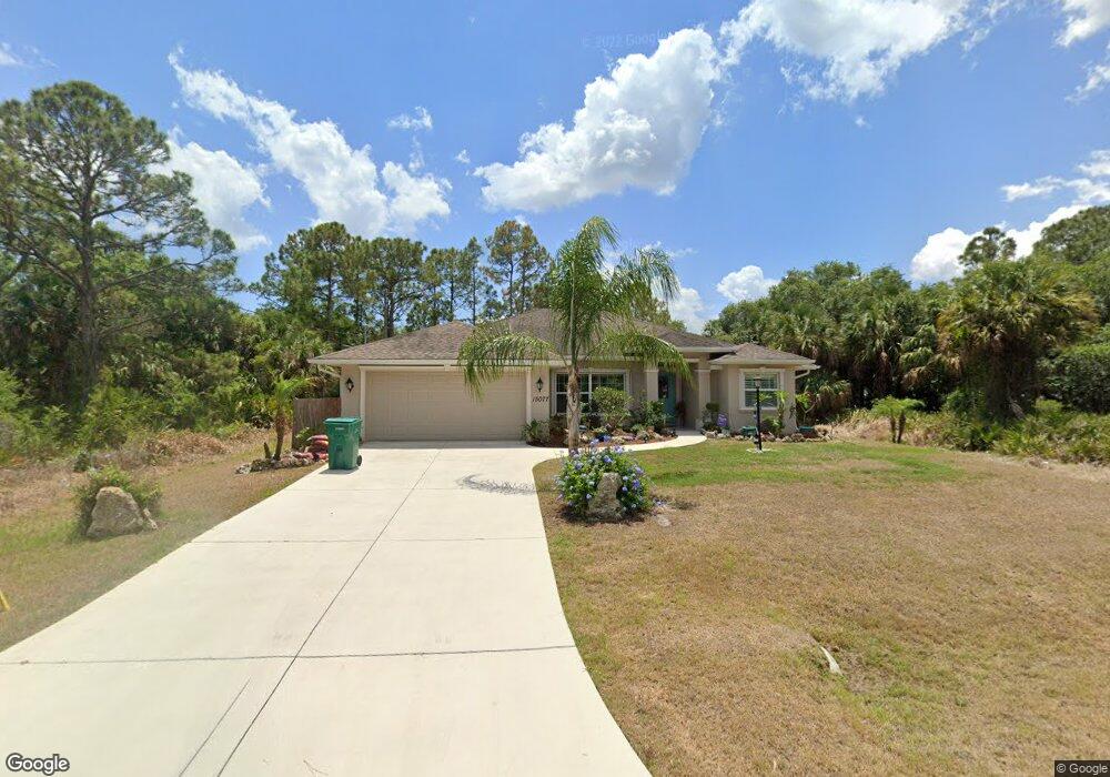
15077 Mcgraw Ave Port Charlotte, FL 33953
Northwest Port Charlotte NeighborhoodEstimated Value: $311,000 - $408,000
3
Beds
2
Baths
1,736
Sq Ft
$201/Sq Ft
Est. Value
About This Home
This home is located at 15077 Mcgraw Ave, Port Charlotte, FL 33953 and is currently estimated at $348,283, approximately $200 per square foot. 15077 Mcgraw Ave is a home located in Charlotte County with nearby schools including Liberty Elementary School, Murdock Middle School, and Port Charlotte High School.
Ownership History
Date
Name
Owned For
Owner Type
Purchase Details
Closed on
Aug 10, 2015
Sold by
Oddo Theresa
Bought by
Oddo Robert and Oddo Joanne L
Current Estimated Value
Purchase Details
Closed on
Nov 17, 2014
Sold by
Galbraith John A
Bought by
Oddo Theresa
Purchase Details
Closed on
Oct 27, 2009
Sold by
Galbraith John A and Galbraith Cynthia F
Bought by
Galbraith John A
Purchase Details
Closed on
Sep 7, 2004
Sold by
Abbott Paul
Bought by
Matthews Eric J and Galbraith John A
Purchase Details
Closed on
Aug 7, 1995
Sold by
Nationsbank Fl N A
Bought by
Hu Kun Huai Chu and Hu Ching Yao
Create a Home Valuation Report for This Property
The Home Valuation Report is an in-depth analysis detailing your home's value as well as a comparison with similar homes in the area
Home Values in the Area
Average Home Value in this Area
Purchase History
| Date | Buyer | Sale Price | Title Company |
|---|---|---|---|
| Oddo Robert | -- | None Available | |
| Oddo Theresa | $5,600 | Florida Abstract & Security | |
| Galbraith John A | -- | Attorney | |
| Matthews Eric J | $17,000 | -- | |
| Abbott Paul | $9,000 | -- | |
| Hu Kun Huai Chu | $18,100 | -- |
Source: Public Records
Tax History Compared to Growth
Tax History
| Year | Tax Paid | Tax Assessment Tax Assessment Total Assessment is a certain percentage of the fair market value that is determined by local assessors to be the total taxable value of land and additions on the property. | Land | Improvement |
|---|---|---|---|---|
| 2023 | $2,191 | $134,113 | $0 | $0 |
| 2022 | $2,169 | $130,207 | $0 | $0 |
| 2021 | $2,155 | $126,415 | $0 | $0 |
| 2020 | $2,106 | $124,670 | $0 | $0 |
| 2019 | $2,015 | $121,867 | $0 | $0 |
| 2018 | $1,853 | $119,595 | $0 | $0 |
| 2017 | $1,831 | $117,135 | $0 | $0 |
| 2016 | $1,816 | $114,726 | $0 | $0 |
| 2015 | $365 | $3,468 | $0 | $0 |
| 2014 | $256 | $2,842 | $0 | $0 |
Source: Public Records
Map
Nearby Homes
- 15087 Mcgraw Ave
- 15076 Elwood Ave
- 15060 Elwood Ave
- 15068 Mcgraw Ave
- 14473 and 295 Elwood Ave
- 15029 Elwood Ave
- 15045 Elwood Ave
- 344 Arbor St
- 352 Arbor St
- 328 Arbor St
- 320 Arbor St
- 367 Arbor St
- 15100 Elwood Ave
- 15100 Mcgraw Ave
- 15052 Mcgraw Ave
- 15044 Elwood Ave
- 15109 Dahlgren Ave
- 304 Milford St
- 303 Arbor St
- 15072 Dahlgren Ave