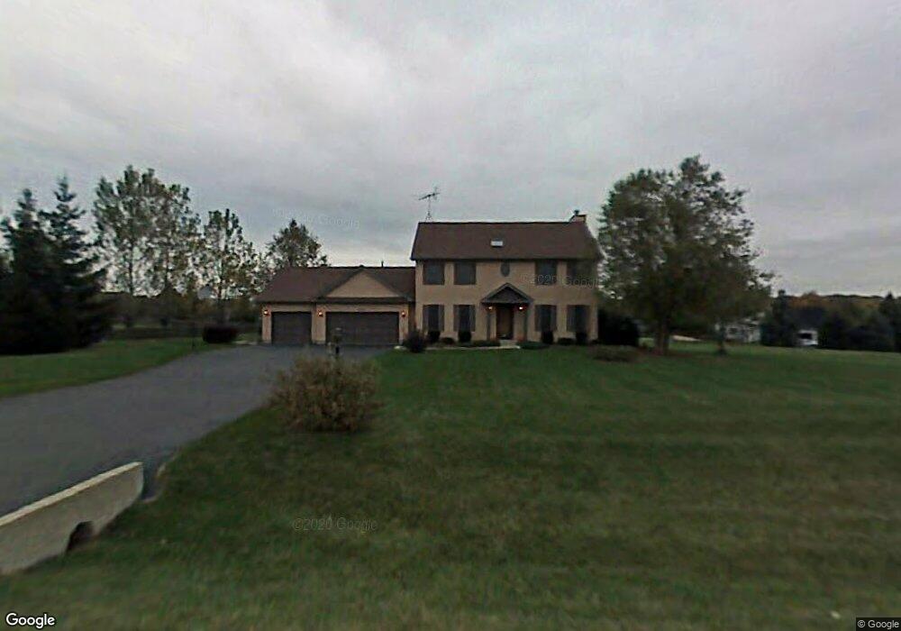
1508 Pine St Unit 1 Spring Grove, IL 60081
Estimated Value: $426,327 - $524,000
Studio
--
Bath
2,230
Sq Ft
$219/Sq Ft
Est. Value
About This Home
This home is located at 1508 Pine St Unit 1, Spring Grove, IL 60081 and is currently estimated at $489,332, approximately $219 per square foot. 1508 Pine St Unit 1 is a home located in McHenry County with nearby schools including Spring Grove Elementary School, Nippersink Middle School, and Richmond-Burton High School.
Ownership History
Date
Name
Owned For
Owner Type
Purchase Details
Closed on
Feb 24, 2016
Sold by
Clark Paul K and Clark Christy S
Bought by
The Paul K Clark & Christy S Clark Revoc
Current Estimated Value
Purchase Details
Closed on
Aug 27, 2002
Sold by
Layton Thomas E and Layton Ermine L
Bought by
Clark Paul K and Clark Christy S
Home Financials for this Owner
Home Financials are based on the most recent Mortgage that was taken out on this home.
Original Mortgage
$189,500
Interest Rate
6.56%
Create a Home Valuation Report for This Property
The Home Valuation Report is an in-depth analysis detailing your home's value as well as a comparison with similar homes in the area
Home Values in the Area
Average Home Value in this Area
Purchase History
| Date | Buyer | Sale Price | Title Company |
|---|---|---|---|
| The Paul K Clark & Christy S Clark Revoc | -- | Attorney | |
| Clark Paul K | $289,500 | Universal Title Services Inc |
Source: Public Records
Mortgage History
| Date | Status | Borrower | Loan Amount |
|---|---|---|---|
| Previous Owner | Clark Paul K | $189,500 |
Source: Public Records
Tax History
| Year | Tax Paid | Tax Assessment Tax Assessment Total Assessment is a certain percentage of the fair market value that is determined by local assessors to be the total taxable value of land and additions on the property. | Land | Improvement |
|---|---|---|---|---|
| 2024 | $9,219 | $130,742 | $21,072 | $109,670 |
| 2023 | $9,157 | $121,938 | $19,653 | $102,285 |
| 2022 | $8,623 | $107,264 | $17,288 | $89,976 |
| 2021 | $8,193 | $101,116 | $16,297 | $84,819 |
| 2020 | $8,009 | $96,660 | $15,579 | $81,081 |
| 2019 | $8,060 | $95,157 | $15,337 | $79,820 |
| 2018 | $8,223 | $92,215 | $14,863 | $77,352 |
| 2017 | $8,107 | $86,595 | $13,957 | $72,638 |
| 2016 | $8,138 | $82,700 | $13,329 | $69,371 |
| 2013 | -- | $72,148 | $14,208 | $57,940 |
Source: Public Records
Map
Nearby Homes
- 1711 Cedar Ln
- 1715 Cedar Ln
- 1848 Red Oak Ln
- 1852 Red Oak Ln
- 1971 Red Oak Ln
- 1975 Red Oak Ln
- 7388 English Oak Ln
- 1979 Red Oak Ln
- 7389 English Oak Ln
- 7373 English Oak Ln
- 7381 English Oak Ln
- 7377 English Oak Ln
- 7393 English Oak Ln
- 1410 Linden Rd
- Lot 36 Red Oak Ln
- 1876 Red Oak Ln
- 2003 Red Oak Ln
- 1992 Red Oak Ln
- LOT 9 Mayo Ct
- Lot 56 & 57 Beverly Way
- 1514 Pine St
- 1502 Pine St
- 1509 Spruce St
- 1509 Pine St
- 1513 Spruce St
- 6805 E Applewood Ln
- 1503 Pine St
- 1515 Pine St
- 1604 Pine St
- 1603 Spruce St
- Lot 35 E Applewood Ln
- 6718 E Applewood Ln
- 1510 Elm St Unit 1
- 1605 Pine St Unit 1
- 1504 Elm St
- 6811 E Applewood Ln
- 6712 E Applewood Ln
- 1609 Spruce St
- 1516 Elm St
- 1512 Spruce St
Your Personal Tour Guide
Ask me questions while you tour the home.