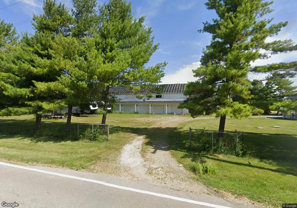
1508 State Route 503 Arcanum, OH 45304
Estimated Value: $225,000 - $304,000
3
Beds
2
Baths
1,888
Sq Ft
$139/Sq Ft
Est. Value
About This Home
This home is located at 1508 State Route 503, Arcanum, OH 45304 and is currently estimated at $262,421, approximately $138 per square foot. 1508 State Route 503 is a home located in Darke County with nearby schools including Arcanum Elementary School, Butler Middle School, and Arcanum High School.
Ownership History
Date
Name
Owned For
Owner Type
Purchase Details
Closed on
Apr 12, 2001
Sold by
Shepherd John C
Bought by
Godfrey Paula K and Godfrey Robert F
Current Estimated Value
Home Financials for this Owner
Home Financials are based on the most recent Mortgage that was taken out on this home.
Original Mortgage
$100,000
Outstanding Balance
$38,180
Interest Rate
7.5%
Mortgage Type
New Conventional
Estimated Equity
$224,241
Purchase Details
Closed on
Jun 1, 1989
Bought by
Godfrey Paula K and Godfrey Robert F
Create a Home Valuation Report for This Property
The Home Valuation Report is an in-depth analysis detailing your home's value as well as a comparison with similar homes in the area
Home Values in the Area
Average Home Value in this Area
Purchase History
| Date | Buyer | Sale Price | Title Company |
|---|---|---|---|
| Godfrey Paula K | $129,000 | -- | |
| Godfrey Paula K | $31,500 | -- |
Source: Public Records
Mortgage History
| Date | Status | Borrower | Loan Amount |
|---|---|---|---|
| Open | Godfrey Paula K | $100,000 |
Source: Public Records
Tax History Compared to Growth
Tax History
| Year | Tax Paid | Tax Assessment Tax Assessment Total Assessment is a certain percentage of the fair market value that is determined by local assessors to be the total taxable value of land and additions on the property. | Land | Improvement |
|---|---|---|---|---|
| 2024 | $1,856 | $53,420 | $6,570 | $46,850 |
| 2023 | $1,895 | $54,450 | $7,600 | $46,850 |
| 2022 | $1,704 | $44,030 | $6,380 | $37,650 |
| 2021 | $1,719 | $44,030 | $6,380 | $37,650 |
| 2020 | $1,666 | $44,030 | $6,380 | $37,650 |
| 2019 | $1,426 | $37,750 | $6,380 | $31,370 |
| 2018 | $1,415 | $37,750 | $6,380 | $31,370 |
| 2017 | $1,205 | $37,750 | $6,380 | $31,370 |
| 2016 | $1,207 | $33,970 | $6,190 | $27,780 |
| 2015 | $1,207 | $33,970 | $6,190 | $27,780 |
| 2014 | $1,222 | $33,970 | $6,190 | $27,780 |
| 2013 | $1,280 | $33,690 | $5,910 | $27,780 |
Source: Public Records
Map
Nearby Homes
- 6254 State Route 722
- 693 Friday Rd
- 0 Ohio 722 Unit 10051560
- 0 Ohio 722 Unit 10 Acres 1040185
- 0 Ohio 722 Unit 938536
- 0 Ohio 722
- 620 Pearl St
- 610 Pearl St
- 406 W South St
- 20 Wheatland Dr
- 3 Harvest Dr
- 604 W North St
- 21 Wheatland Dr
- 8 Harvest Dr
- 9 Harvest Dr
- 0 Friday Rd
- Oh-722
- 6977 Alternate State Route 49
- 9 Seminole Ln
- 246 N Main St
- 5911 Grubbs Rex Rd
- 5935 Grubbs Rex Rd
- 1491 State Route 503
- 1589 State Route 503
- 5969 Grubbs Rex Rd
- 5736 Grubbs Rex Rd
- 5736 Grubbs Rex Rd
- 1485 State Route 503
- 1485 Ohio 503
- 6009 Grubbs Rex Rd
- 115 Belle Terre Way
- 6006 Belle Terre Way
- 6026 Belle Terre Way
- 5694 Grubbs Rex Rd
- 6040 Belle Terre Way
- 6059 Grubbs Rex Rd
- 6019 Belle Terre Way
- 5667 Grubbs-Rex Rd
- 6048 Belle Terre Way
- 6051 Belle Terre Way