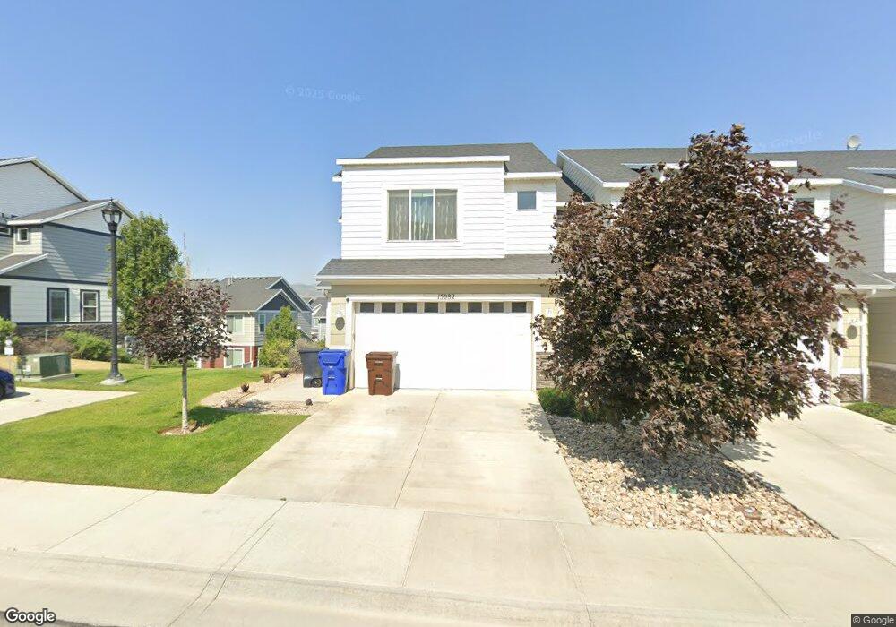
15082 S Gallant Dr Unit 147 Bluffdale, UT 84065
Estimated Value: $466,000 - $477,000
3
Beds
2
Baths
2,248
Sq Ft
$210/Sq Ft
Est. Value
About This Home
This home is located at 15082 S Gallant Dr Unit 147, Bluffdale, UT 84065 and is currently estimated at $472,282, approximately $210 per square foot. 15082 S Gallant Dr Unit 147 is a home located in Salt Lake County with nearby schools including Mountain Point Elementary School, Hidden Valley Middle School, and Riverton High School.
Ownership History
Date
Name
Owned For
Owner Type
Purchase Details
Closed on
Jun 1, 2015
Sold by
Dr Horton Inc
Bought by
Pedrosa Mario and Pedrosa Eunice
Current Estimated Value
Home Financials for this Owner
Home Financials are based on the most recent Mortgage that was taken out on this home.
Original Mortgage
$221,065
Outstanding Balance
$175,676
Interest Rate
4.5%
Mortgage Type
FHA
Estimated Equity
$296,606
Create a Home Valuation Report for This Property
The Home Valuation Report is an in-depth analysis detailing your home's value as well as a comparison with similar homes in the area
Home Values in the Area
Average Home Value in this Area
Purchase History
| Date | Buyer | Sale Price | Title Company |
|---|---|---|---|
| Pedrosa Mario | -- | Cottonwood Title |
Source: Public Records
Mortgage History
| Date | Status | Borrower | Loan Amount |
|---|---|---|---|
| Open | Pedrosa Mario | $221,065 |
Source: Public Records
Tax History Compared to Growth
Tax History
| Year | Tax Paid | Tax Assessment Tax Assessment Total Assessment is a certain percentage of the fair market value that is determined by local assessors to be the total taxable value of land and additions on the property. | Land | Improvement |
|---|---|---|---|---|
| 2025 | $2,303 | $480,200 | $59,500 | $420,700 |
| 2024 | $2,303 | $470,800 | $47,700 | $423,100 |
| 2023 | $2,303 | $431,300 | $45,000 | $386,300 |
| 2022 | $2,692 | $439,800 | $44,100 | $395,700 |
| 2021 | $2,051 | $333,700 | $38,000 | $295,700 |
| 2020 | $1,958 | $296,700 | $38,000 | $258,700 |
| 2019 | $1,972 | $293,100 | $38,000 | $255,100 |
| 2018 | $1,685 | $258,000 | $53,300 | $204,700 |
| 2017 | $1,621 | $237,500 | $53,300 | $184,200 |
| 2016 | $1,495 | $217,000 | $70,200 | $146,800 |
| 2015 | $833 | $64,800 | $64,800 | $0 |
Source: Public Records
Map
Nearby Homes
- 15098 S Bright Stars Dr
- 15144 S Bright Stars Dr
- 618 W Regent Garden Ln
- 15134 S White Hart Ln
- 15176 S Battle Dr
- 915 W Mckenna Rd
- 591 W Koins Way
- 15187 S Sabre Place
- 15207 S Dirks Bay
- 951 W Cushing Rd
- 981 W Freedom Point Way
- 14714 S Rising Star Way
- 14719 S Nob Ln
- 15413 S Navy Trails Ln
- 15434 S Navy Trails Ln
- 15436 W Navy Ln S
- 981 W Cyan Valley Way
- 1023 W Molly Pitcher Cir
- 1034 W Narrows Ln
- 1064 W Narrows Ln
- 15074 S Gallant Dr
- 15072 S Gallant Dr
- 15092 S Gallant Dr Unit 146
- 15092 S Gallant Dr
- 15075 S Bright Stars Dr Unit 26
- 15077 S Bright Stars Dr
- 15071 S Bright Stars Dr Unit 27
- 15071 S Bright Stars Dr
- 15067 S Bright Stars Dr Unit 28
- 15067 S Bright Stars Dr
- 15068 S Gallant Dr
- 15096 S Gallant Dr
- 15083 S Bright Stars Dr
- 15065 S Bright Stars Dr Unit 29
- 15083 S Gallant Dr Unit 100
- 15087 S Gallant Dr
- 15087 S Gallant Dr Unit 101
- 15087 S Bright Stars Dr Unit 23
- 15064 S Gallant Dr Unit 152
- 15064 S Gallant Dr