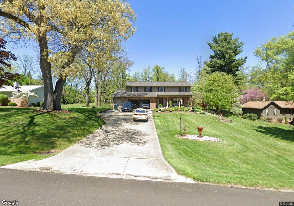
1509 Canyon St NE Uniontown, OH 44685
Estimated Value: $302,000 - $382,000
4
Beds
4
Baths
2,348
Sq Ft
$142/Sq Ft
Est. Value
About This Home
This home is located at 1509 Canyon St NE, Uniontown, OH 44685 and is currently estimated at $334,445, approximately $142 per square foot. 1509 Canyon St NE is a home located in Stark County with nearby schools including Lake Middle/High School and Lake Center Christian School.
Ownership History
Date
Name
Owned For
Owner Type
Purchase Details
Closed on
May 14, 2018
Sold by
Inks Deborah A
Bought by
Inks Deborah A and Deborah A Inks Revocable Trust
Current Estimated Value
Purchase Details
Closed on
Jan 31, 2005
Sold by
Inks Deborah A and Keblesh Deborah A
Bought by
Inks Deborah A
Home Financials for this Owner
Home Financials are based on the most recent Mortgage that was taken out on this home.
Original Mortgage
$118,650
Interest Rate
5.83%
Mortgage Type
Stand Alone Refi Refinance Of Original Loan
Purchase Details
Closed on
Jun 27, 1989
Create a Home Valuation Report for This Property
The Home Valuation Report is an in-depth analysis detailing your home's value as well as a comparison with similar homes in the area
Home Values in the Area
Average Home Value in this Area
Purchase History
| Date | Buyer | Sale Price | Title Company |
|---|---|---|---|
| Inks Deborah A | -- | None Available | |
| Inks Deborah A | -- | -- | |
| -- | $108,500 | -- |
Source: Public Records
Mortgage History
| Date | Status | Borrower | Loan Amount |
|---|---|---|---|
| Closed | Inks Deborah A | $118,650 |
Source: Public Records
Tax History Compared to Growth
Tax History
| Year | Tax Paid | Tax Assessment Tax Assessment Total Assessment is a certain percentage of the fair market value that is determined by local assessors to be the total taxable value of land and additions on the property. | Land | Improvement |
|---|---|---|---|---|
| 2025 | -- | $109,620 | $22,890 | $86,730 |
| 2024 | -- | $109,620 | $22,890 | $86,730 |
| 2023 | $3,697 | $79,240 | $14,280 | $64,960 |
| 2022 | $3,709 | $79,240 | $14,280 | $64,960 |
| 2021 | $3,752 | $79,240 | $14,280 | $64,960 |
| 2020 | $3,692 | $69,930 | $12,320 | $57,610 |
| 2019 | $3,658 | $69,930 | $12,320 | $57,610 |
| 2018 | $3,660 | $69,930 | $12,320 | $57,610 |
| 2017 | $3,346 | $59,400 | $12,320 | $47,080 |
| 2016 | $3,352 | $59,400 | $12,320 | $47,080 |
| 2015 | $3,350 | $59,400 | $12,320 | $47,080 |
| 2014 | $887 | $53,270 | $11,060 | $42,210 |
| 2013 | $1,444 | $53,270 | $11,060 | $42,210 |
Source: Public Records
Map
Nearby Homes
- 1037 Canyon St NE
- 11121 Geib Ave NE
- 2084 Hazel St NE
- 425 Tonawanda Trail SW
- 747 Grandview Cir
- 1180 Tessa Trail Unit 1180
- 11900 Geib Ave NE
- 778 Fair Vista Cir SW
- 786 Fair Vista Cir SW
- 550 Woodlands Glen Ave
- 531 Gentlebrook Blvd SW
- 225 Seneca Trail SW
- 525 Gentlebrook Blvd SW
- 1975 Eloise Cir NE
- 510 Meadow Cir SW Unit 11
- Unit 9 Meadow Trail SW Unit 9
- 12055 King Church Ave NW
- 330 Belle Ave SW
- 316 S Prospect Ave
- 12201 King Church Ave NW
- 1489 Canyon St NE
- 1527 Canyon St NE
- 1471 Canyon St NE
- 1545 Canyon St NE
- 1460 Saddle St NE
- 1466 Saddle St NE
- 1488 Canyon St NE
- 1526 Canyon St NE
- 1453 Canyon St NE
- 1563 Canyon St NE
- 1470 Canyon St NE
- 1544 Canyon St NE
- 1440 Saddle St NE
- 1452 Canyon St NE
- 1433 Canyon St NE
- 1581 Canyon St NE
- 1562 Canyon St NE
- 1471 Saddle St NE
- 1430 Canyon St NE
- 1424 Saddle St NE