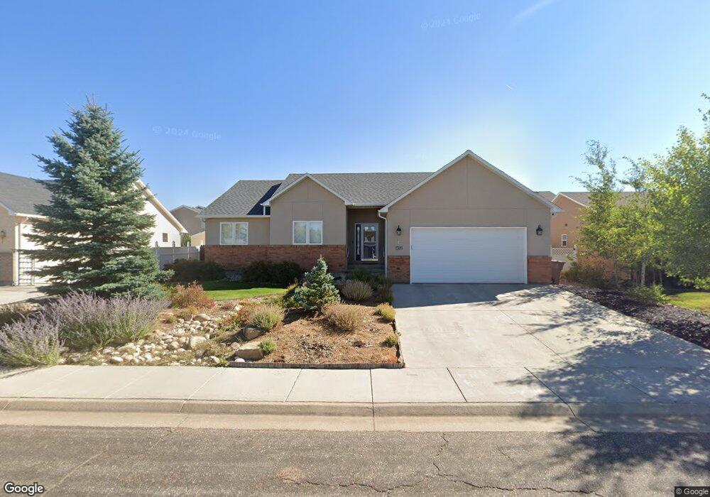
1509 Hackney Dr Laramie, WY 82070
Estimated Value: $490,000 - $548,000
4
Beds
3
Baths
1,600
Sq Ft
$324/Sq Ft
Est. Value
About This Home
This home is located at 1509 Hackney Dr, Laramie, WY 82070 and is currently estimated at $518,521, approximately $324 per square foot. 1509 Hackney Dr is a home located in Albany County with nearby schools including Beitel Elementary School, Laramie Middle School, and Laramie High School.
Ownership History
Date
Name
Owned For
Owner Type
Purchase Details
Closed on
Oct 14, 2016
Sold by
Greene Mark A and Marquis Kathleen
Bought by
Wood Daniel Gregory and Wood Elizabeth Brandee
Current Estimated Value
Home Financials for this Owner
Home Financials are based on the most recent Mortgage that was taken out on this home.
Original Mortgage
$252,500
Outstanding Balance
$202,426
Interest Rate
3.46%
Mortgage Type
New Conventional
Estimated Equity
$316,095
Create a Home Valuation Report for This Property
The Home Valuation Report is an in-depth analysis detailing your home's value as well as a comparison with similar homes in the area
Home Values in the Area
Average Home Value in this Area
Purchase History
| Date | Buyer | Sale Price | Title Company |
|---|---|---|---|
| Wood Daniel Gregory | -- | First American Title |
Source: Public Records
Mortgage History
| Date | Status | Borrower | Loan Amount |
|---|---|---|---|
| Open | Wood Daniel Gregory | $252,500 |
Source: Public Records
Tax History Compared to Growth
Tax History
| Year | Tax Paid | Tax Assessment Tax Assessment Total Assessment is a certain percentage of the fair market value that is determined by local assessors to be the total taxable value of land and additions on the property. | Land | Improvement |
|---|---|---|---|---|
| 2025 | $3,262 | $33,870 | $4,446 | $29,424 |
| 2024 | $3,262 | $44,684 | $5,700 | $38,984 |
| 2023 | $3,153 | $43,185 | $5,700 | $37,485 |
| 2022 | $2,448 | $33,532 | $6,277 | $27,255 |
| 2021 | $2,394 | $32,800 | $4,988 | $27,812 |
| 2020 | $2,221 | $30,425 | $4,631 | $25,794 |
| 2019 | $2,043 | $27,980 | $4,631 | $23,349 |
| 2018 | $1,902 | $26,054 | $4,631 | $21,423 |
| 2017 | $1,768 | $24,218 | $4,631 | $19,587 |
| 2016 | $1,953 | $26,755 | $4,631 | $22,124 |
| 2015 | $1,875 | $25,689 | $4,859 | $20,830 |
| 2014 | $1,885 | $25,823 | $0 | $0 |
Source: Public Records
Map
Nearby Homes
- 1517 Shetland Dr
- 1501 Arabian Dr
- TBD Sherman Hill Rd
- 4328 Beech St Unit SR1
- 4328 Beech St Unit 7
- 4609 Meadowlark Ln
- 4223 Moraine St
- 1702 Walsh Ct Unit C
- 4141 Cliff St
- 4500 E Meadowlark Ln Unit A
- 4031 Cliff St
- 1916 Peak Cir
- 4039 Bill Nye Ave
- 4037 Bill Nye Ave
- 4033 Bill Nye Ave
- 4029 Bill Nye Ave
- 429 Bill Nye Ave
- 3930 Buckskin Trail
- 3911 Buckskin Trail
- 3834 Buckskin Trail
- 1505 Hackney Dr
- 1513 Hackney Dr
- 1510 Clydesdale
- 1506 Clydesdale
- 1501 Hackney Dr
- 1510 Hackney Dr
- 1514 Hackney Dr
- 1506 Hackney Dr
- 1518 Clydesdale
- 1502 Clydesdale
- 1518 Hackney Dr
- 1502 Hackney Dr
- 1601 Hackney Dr
- 1602 Clydesdale
- 1602 Hackney Dr
- 1509 Shetland Dr
- 1509 Clydesdale
- 1513 Shetland Dr
- 1505 Shetland Dr
- 1513 Clydesdale