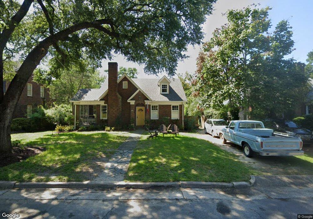
1509 Maple St Columbia, SC 29205
Melrose Heights NeighborhoodEstimated Value: $353,364 - $461,000
3
Beds
2
Baths
1,926
Sq Ft
$218/Sq Ft
Est. Value
About This Home
This home is located at 1509 Maple St, Columbia, SC 29205 and is currently estimated at $420,591, approximately $218 per square foot. 1509 Maple St is a home located in Richland County with nearby schools including Brennen Elementary School, Crayton Middle School, and A. C. Flora High School.
Ownership History
Date
Name
Owned For
Owner Type
Purchase Details
Closed on
Nov 19, 2013
Sold by
Nationstar Mortgage Llc
Bought by
Fern Joseph
Current Estimated Value
Purchase Details
Closed on
Nov 6, 2012
Sold by
Cross Marian H and United States Of America
Bought by
Nationstar Mortgage Llc and Champion Mortgage Co
Purchase Details
Closed on
Sep 7, 2011
Sold by
Estate Of Rose Yvette W Hunter
Bought by
Cross Marian H
Create a Home Valuation Report for This Property
The Home Valuation Report is an in-depth analysis detailing your home's value as well as a comparison with similar homes in the area
Home Values in the Area
Average Home Value in this Area
Purchase History
| Date | Buyer | Sale Price | Title Company |
|---|---|---|---|
| Fern Joseph | $117,500 | None Available | |
| Nationstar Mortgage Llc | $176,195 | None Available | |
| Cross Marian H | -- | -- |
Source: Public Records
Tax History Compared to Growth
Tax History
| Year | Tax Paid | Tax Assessment Tax Assessment Total Assessment is a certain percentage of the fair market value that is determined by local assessors to be the total taxable value of land and additions on the property. | Land | Improvement |
|---|---|---|---|---|
| 2024 | $1,073 | $155,400 | $0 | $0 |
| 2023 | $1,073 | $5,404 | $0 | $0 |
| 2022 | $979 | $135,100 | $39,900 | $95,200 |
| 2021 | $1,011 | $5,400 | $0 | $0 |
| 2020 | $1,066 | $5,400 | $0 | $0 |
| 2019 | $1,074 | $5,400 | $0 | $0 |
| 2018 | $956 | $4,700 | $0 | $0 |
| 2017 | $931 | $4,700 | $0 | $0 |
| 2016 | $898 | $4,700 | $0 | $0 |
| 2015 | $898 | $4,700 | $0 | $0 |
| 2014 | $3,285 | $117,500 | $0 | $0 |
| 2013 | -- | $7,050 | $0 | $0 |
Source: Public Records
Map
Nearby Homes
- 1302 Woodrow St
- 1409 Woodrow St
- 1315 Gladden St
- 1500 King St
- 1412 Hagood Ave
- 2903 Trenholm Rd
- 1516 Shirley St
- 2510 Bratton St
- 2920 Bratton St
- 2508 Bratton St
- 2506 Bratton St
- 2504 Bratton St
- 2502 Bratton St
- 2500 Bratton St
- 818 Tree St
- 3112 Trenholm Rd
- 2600 Stratford Rd
- 1224 Glenwood Rd
- 2904 Stratford Rd
- 2584 Cherry St