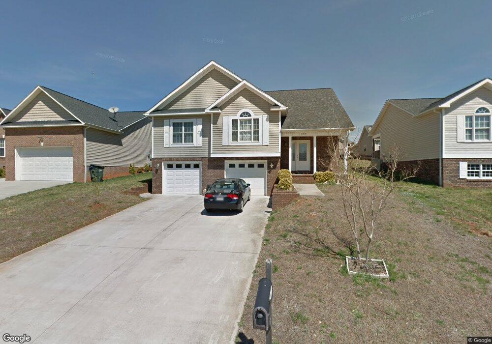
1509 Mayfair Dr Conover, NC 28613
Estimated Value: $289,937 - $332,000
3
Beds
2
Baths
1,444
Sq Ft
$213/Sq Ft
Est. Value
About This Home
This home is located at 1509 Mayfair Dr, Conover, NC 28613 and is currently estimated at $306,984, approximately $212 per square foot. 1509 Mayfair Dr is a home located in Catawba County with nearby schools including Claremont Elementary School, River Bend Middle School, and Bunker Hill High School.
Ownership History
Date
Name
Owned For
Owner Type
Purchase Details
Closed on
Feb 25, 2009
Sold by
Frazier Properties Inc
Bought by
Moua Thong and Thoa Moua
Current Estimated Value
Home Financials for this Owner
Home Financials are based on the most recent Mortgage that was taken out on this home.
Original Mortgage
$162,011
Outstanding Balance
$102,470
Interest Rate
5.03%
Mortgage Type
FHA
Estimated Equity
$204,514
Purchase Details
Closed on
Mar 5, 2007
Sold by
Shook Builder Supply Co and Allison Dent F
Bought by
Frazier Properties Inc
Home Financials for this Owner
Home Financials are based on the most recent Mortgage that was taken out on this home.
Original Mortgage
$116,000
Interest Rate
6.3%
Mortgage Type
Seller Take Back
Create a Home Valuation Report for This Property
The Home Valuation Report is an in-depth analysis detailing your home's value as well as a comparison with similar homes in the area
Home Values in the Area
Average Home Value in this Area
Purchase History
| Date | Buyer | Sale Price | Title Company |
|---|---|---|---|
| Moua Thong | $165,000 | None Available | |
| Frazier Properties Inc | $17,000 | None Available |
Source: Public Records
Mortgage History
| Date | Status | Borrower | Loan Amount |
|---|---|---|---|
| Open | Moua Thong | $162,011 | |
| Previous Owner | Frazier Properties Inc | $116,000 |
Source: Public Records
Tax History
| Year | Tax Paid | Tax Assessment Tax Assessment Total Assessment is a certain percentage of the fair market value that is determined by local assessors to be the total taxable value of land and additions on the property. | Land | Improvement |
|---|---|---|---|---|
| 2025 | $2,020 | $238,100 | $15,100 | $223,000 |
| 2024 | $2,020 | $238,100 | $15,100 | $223,000 |
| 2023 | $2,020 | $238,100 | $15,100 | $223,000 |
| 2022 | $1,884 | $169,000 | $15,100 | $153,900 |
| 2021 | $1,884 | $169,000 | $15,100 | $153,900 |
| 2020 | $1,884 | $169,000 | $15,100 | $153,900 |
| 2019 | $1,884 | $169,000 | $0 | $0 |
| 2018 | $1,536 | $137,800 | $15,100 | $122,700 |
| 2017 | $1,536 | $0 | $0 | $0 |
| 2016 | $1,536 | $0 | $0 | $0 |
| 2015 | $1,608 | $137,780 | $15,100 | $122,680 |
| 2014 | $1,608 | $159,200 | $16,200 | $143,000 |
Source: Public Records
Map
Nearby Homes
- 1636 Mayfair Dr
- 0000 Burris Rd
- 1687 Golden Cedar Ln
- 2109 Kyle Ct SE
- 805 Mount Olive Church Rd
- 1737 Bush Dr
- The Piedmont Plan at Rowe Crossing
- The Braselton II Plan at Rowe Crossing
- The Caldwell Plan at Rowe Crossing
- The Benson II Plan at Rowe Crossing
- The Coleman Plan at Rowe Crossing
- The Reynolds Plan at Rowe Crossing
- The Harrington Plan at Rowe Crossing
- 7.03 acres 5 W Hwy 10 Hwy
- 2474 Cedar Valley Dr
- 2081 N Whisnant Ave
- 1128 McRee Heights Cir
- 1818 N Rankin Ave
- 907 Goforth Rd
- 1820 N Hewitt Ave
- 1503 Mayfair Dr
- 1503 Mayfair Dr Unit 63
- 1515 Mayfair Dr
- 1497 Mayfair Dr Unit 64
- 1497 Mayfair Dr
- 1521 Mayfair Dr Unit 60
- 1521 Mayfair Dr
- 1617 Mayfair Dr
- 1623 Mayfair Dr
- 1605 Mayfair Dr
- 1925 Maius Dr Unit 30
- 1925 Maius Dr
- 1510 Mayfair Dr
- 1491 Mayfair Dr
- 1492 Mayfair Dr
- 1527 Mayfair Dr Unit 59
- 1527 Mayfair Dr
- 1599 Mayfair Dr
- 1629 Mayfair Dr
- 1926 Maius Dr Unit 36