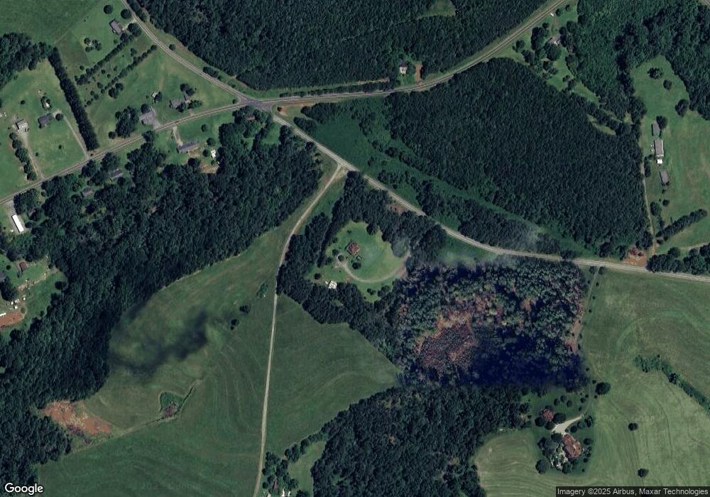
1509 Rock Corner Rd Forest City, NC 28043
Estimated Value: $288,000 - $405,000
3
Beds
3
Baths
2,075
Sq Ft
$170/Sq Ft
Est. Value
About This Home
This home is located at 1509 Rock Corner Rd, Forest City, NC 28043 and is currently estimated at $352,944, approximately $170 per square foot. 1509 Rock Corner Rd is a home located in Rutherford County with nearby schools including Mt. Vernon-Ruth Elementary School, R.S. Middle School, and R-S Central High School.
Ownership History
Date
Name
Owned For
Owner Type
Purchase Details
Closed on
Dec 21, 2018
Sold by
Carpenter Thomas R and Carpenter Tammy W
Bought by
Lail Marcus P and Lail Susan T
Current Estimated Value
Home Financials for this Owner
Home Financials are based on the most recent Mortgage that was taken out on this home.
Original Mortgage
$170,000
Outstanding Balance
$155,127
Interest Rate
4.9%
Mortgage Type
Purchase Money Mortgage
Estimated Equity
$197,817
Purchase Details
Closed on
Nov 12, 2010
Sold by
Clinton Paul Ervin
Bought by
Clinton Mary Alicia Calvert
Home Financials for this Owner
Home Financials are based on the most recent Mortgage that was taken out on this home.
Original Mortgage
$144,900
Interest Rate
3.75%
Mortgage Type
New Conventional
Create a Home Valuation Report for This Property
The Home Valuation Report is an in-depth analysis detailing your home's value as well as a comparison with similar homes in the area
Home Values in the Area
Average Home Value in this Area
Purchase History
| Date | Buyer | Sale Price | Title Company |
|---|---|---|---|
| Lail Marcus P | $170,000 | None Available | |
| Clinton Mary Alicia Calvert | -- | -- |
Source: Public Records
Mortgage History
| Date | Status | Borrower | Loan Amount |
|---|---|---|---|
| Open | Lail Marcus P | $170,000 | |
| Previous Owner | Clinton Mary Alicia Calvert | $144,900 |
Source: Public Records
Tax History Compared to Growth
Tax History
| Year | Tax Paid | Tax Assessment Tax Assessment Total Assessment is a certain percentage of the fair market value that is determined by local assessors to be the total taxable value of land and additions on the property. | Land | Improvement |
|---|---|---|---|---|
| 2025 | $1,860 | $293,300 | $45,000 | $248,300 |
| 2024 | $1,630 | $293,300 | $45,000 | $248,300 |
| 2023 | $1,292 | $293,300 | $45,000 | $248,300 |
| 2022 | $1,292 | $184,200 | $24,000 | $160,200 |
| 2021 | $1,292 | $184,200 | $24,000 | $160,200 |
| 2020 | $1,292 | $184,200 | $24,000 | $160,200 |
| 2019 | $1,247 | $184,200 | $24,000 | $160,200 |
Source: Public Records
Map
Nearby Homes
- 142 Padgett and Burns Rd
- 2401 Hudlow Rd
- 1583 Hudlow Rd 7a
- 1595 Hudlow Road 7b
- 1737 Whitesides Rd
- 0 Collins Rd Unit 3 CAR4287430
- 0 Collins Rd Unit 4 CAR4287443
- 0 Collins Rd Unit 5 CAR4287454
- 0 Collins Rd Unit 2
- 00 Horn Bottom Rd
- 2031 Us 64 Hwy
- 0 Pea Ridge Rd Unit 7 CAR3901978
- 0 Hudlow Rd Unit CAR4237255
- 0 Hudlow Rd Unit CAR4227518
- 324 Horn Bottom Rd
- 999 Pearidge Rd Unit 3
- 114 Aqua Dr
- 1090 Pearidge Rd
- 000 Farmer Johns Trail Unit 9
- 1217 Freeman Rd
- 2300 Whitesides Rd
- 2375 Whitesides Rd
- 2271 Whitesides Rd
- 0 Rock Corner Rd
- 2273 Whitesides Rd
- 2259 Whitesides Rd
- 2232 Whitesides Rd
- 2216 Whitesides Rd
- 2438 Whitesides Rd
- 1419 Rock Corner Rd
- 1661 Rock Corner Rd
- 2190 Whitesides Rd
- 2211 Whitesides Rd
- 160 Padgett Burns Rd
- 2160 Whitesides Rd Unit 21
- 2160/70 Whitesides Rd
- 142 Padgett Burns Rd
- 1684 Rock Corner Rd
- 2167 Whitesides Rd
- 125 Padgett Burns Rd
