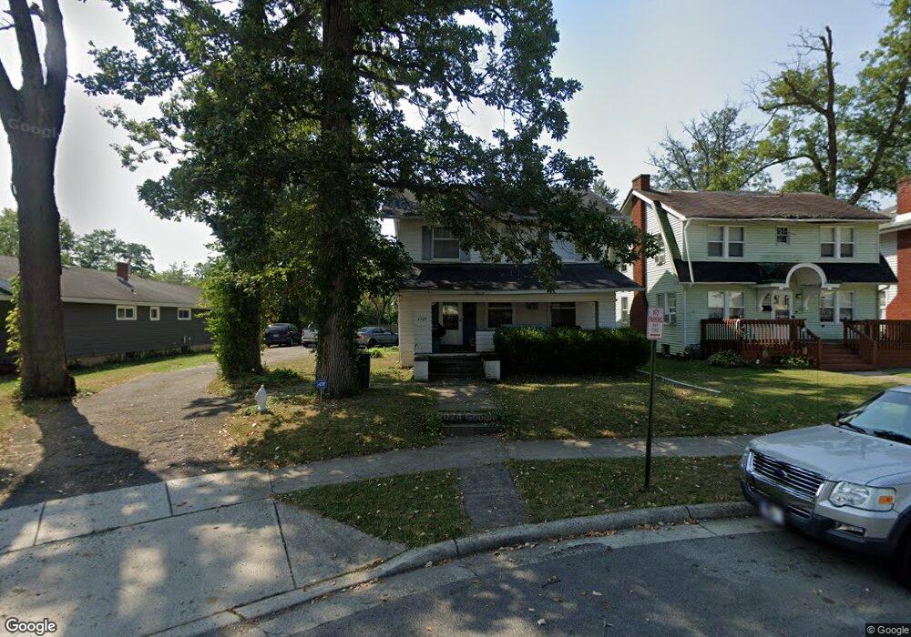
1509 W High St Lima, OH 45805
Westgate NeighborhoodEstimated Value: $148,281 - $185,000
3
Beds
2
Baths
1,638
Sq Ft
$103/Sq Ft
Est. Value
About This Home
This home is located at 1509 W High St, Lima, OH 45805 and is currently estimated at $168,070, approximately $102 per square foot. 1509 W High St is a home located in Allen County with nearby schools including Heritage Elementary School, Lima West Middle School, and Lima North Middle School.
Ownership History
Date
Name
Owned For
Owner Type
Purchase Details
Closed on
Oct 6, 1997
Sold by
Dahill Patrick
Bought by
Verhoff Gregory and Verhoff Cheryl
Current Estimated Value
Home Financials for this Owner
Home Financials are based on the most recent Mortgage that was taken out on this home.
Original Mortgage
$60,468
Outstanding Balance
$9,792
Interest Rate
7.54%
Mortgage Type
VA
Estimated Equity
$158,278
Purchase Details
Closed on
Jul 12, 1996
Sold by
Conrad Evelyn
Bought by
Dahill Patrick and Dahill Beth
Home Financials for this Owner
Home Financials are based on the most recent Mortgage that was taken out on this home.
Original Mortgage
$11,800
Interest Rate
8.09%
Mortgage Type
New Conventional
Purchase Details
Closed on
Feb 1, 1979
Bought by
Conrad Evelyn G
Create a Home Valuation Report for This Property
The Home Valuation Report is an in-depth analysis detailing your home's value as well as a comparison with similar homes in the area
Home Values in the Area
Average Home Value in this Area
Purchase History
We collect this data history from publicly available records. To have your information removed, we recommend requesting removal directly through your county’s website.
| Date | Buyer | Sale Price | Title Company |
|---|---|---|---|
| Verhoff Gregory | $58,850 | -- | |
| Dahill Patrick | $10,500 | -- | |
| Conrad Evelyn G | -- | -- |
Source: Public Records
Mortgage History
We collect this data history from publicly available records. To have your information removed, we recommend requesting removal directly through your county’s website.
| Date | Status | Borrower | Loan Amount |
|---|---|---|---|
| Open | Verhoff Gregory | $60,468 | |
| Previous Owner | Dahill Patrick | $11,800 |
Source: Public Records
Tax History
| Year | Tax Paid | Tax Assessment Tax Assessment Total Assessment is a certain percentage of the fair market value that is determined by local assessors to be the total taxable value of land and additions on the property. | Land | Improvement |
|---|---|---|---|---|
| 2024 | $1,742 | $48,930 | $10,010 | $38,920 |
| 2023 | $1,546 | $37,630 | $7,700 | $29,930 |
| 2022 | $1,555 | $37,630 | $7,700 | $29,930 |
| 2021 | $1,648 | $37,630 | $7,700 | $29,930 |
| 2020 | $1,507 | $30,380 | $7,350 | $23,030 |
| 2019 | $1,507 | $30,380 | $7,350 | $23,030 |
| 2018 | $1,487 | $30,380 | $7,350 | $23,030 |
| 2017 | $1,513 | $30,380 | $7,350 | $23,030 |
| 2016 | $1,527 | $30,380 | $7,350 | $23,030 |
| 2015 | $1,482 | $30,380 | $7,350 | $23,030 |
| 2014 | $1,482 | $29,050 | $7,280 | $21,770 |
| 2013 | $1,442 | $29,050 | $7,280 | $21,770 |
Source: Public Records
Map
Nearby Homes
- 1440 W Market St
- 1453 W Market St
- 1508 Oakland Pkwy
- 1607 W Wayne St
- 1517 Allentown Rd
- 1323 W Elm St
- 233 S Kenilworth Ave
- 1211 W Elm St
- 1817 Hillcrest Dr
- 511 N Nixon Ave
- 541 N Nixon Ave
- 1918 Oakland Pkwy
- 1150 Brice Ave
- 616 N Rosedale Ave
- 1209 Rice Ave
- 1160 Richie Ave
- 1534 Lakewood Ave
- 1600 Leland Ave
- 1619 Lakewood Ave
- 1027 Brice Ave
- 1513 W High St
- 1511 W High St
- 1515 W High St
- 1517 W High St
- 1519 W High St
- 1501 W High St
- 1521 W High St
- 113 N Woodlawn Ave
- 1414 W Market St
- 1418 W Market St
- 1525 W High St
- 1434 W Market St
- 1410 W Market St
- 1508 W High St
- 140 N Woodlawn Ave
- 1500 W High St
- 1520 W High St
- 1522 W High St
- 1533 W High St
- 1510 W High St
Your Personal Tour Guide
Ask me questions while you tour the home.