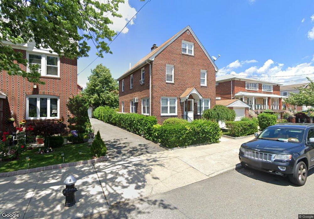
151-49 20th Rd Unit 2 Whitestone, NY 11357
Whitestone NeighborhoodEstimated Value: $1,326,000 - $1,376,000
3
Beds
1
Bath
1,250
Sq Ft
$1,084/Sq Ft
Est. Value
About This Home
This home is located at 151-49 20th Rd Unit 2, Whitestone, NY 11357 and is currently estimated at $1,355,242, approximately $1,084 per square foot. 151-49 20th Rd Unit 2 is a home located in Queens County with nearby schools including J.H.S. 194 William Carr, Flushing High School, and Holy Trinity School.
Ownership History
Date
Name
Owned For
Owner Type
Purchase Details
Closed on
Jul 25, 2025
Sold by
Frankola Family Trust and Pappas Trustee Irene
Bought by
Ma Jin Rui and Zhang Xiu Hong
Current Estimated Value
Home Financials for this Owner
Home Financials are based on the most recent Mortgage that was taken out on this home.
Original Mortgage
$1,012,500
Outstanding Balance
$1,009,901
Interest Rate
6.81%
Mortgage Type
Purchase Money Mortgage
Estimated Equity
$345,341
Purchase Details
Closed on
Oct 9, 2018
Sold by
Frankola Bruno and Pappas Irene
Bought by
Frankola Family Trust and Irene Pappas Trustee
Purchase Details
Closed on
Jul 1, 2009
Sold by
Frankola Bruno and Frankola Nidia
Bought by
Frankola Bruno and Pappas Irene
Purchase Details
Closed on
Apr 19, 2004
Sold by
Frankola Surviving Tenant Bruno and Frankola Surviving Tenant
Bought by
Frankola Bruno and Frankola Nidia
Create a Home Valuation Report for This Property
The Home Valuation Report is an in-depth analysis detailing your home's value as well as a comparison with similar homes in the area
Home Values in the Area
Average Home Value in this Area
Purchase History
| Date | Buyer | Sale Price | Title Company |
|---|---|---|---|
| Ma Jin Rui | $1,350,000 | -- | |
| Frankola Family Trust | -- | -- | |
| Frankola Family Trust | -- | -- | |
| Frankola Family Trust | -- | -- | |
| Frankola Bruno | -- | -- | |
| Frankola Bruno | -- | -- | |
| Frankola Bruno | -- | -- | |
| Frankola Bruno | -- | -- |
Source: Public Records
Mortgage History
| Date | Status | Borrower | Loan Amount |
|---|---|---|---|
| Open | Ma Jin Rui | $1,012,500 | |
| Closed | Frankola Bruno | $0 |
Source: Public Records
Tax History Compared to Growth
Tax History
| Year | Tax Paid | Tax Assessment Tax Assessment Total Assessment is a certain percentage of the fair market value that is determined by local assessors to be the total taxable value of land and additions on the property. | Land | Improvement |
|---|---|---|---|---|
| 2025 | $11,275 | $57,756 | $10,092 | $47,664 |
| 2024 | $11,275 | $56,135 | $11,288 | $44,847 |
| 2023 | $10,637 | $52,958 | $9,970 | $42,988 |
| 2022 | $9,974 | $80,220 | $15,600 | $64,620 |
| 2021 | $10,134 | $76,440 | $15,600 | $60,840 |
| 2020 | $10,188 | $81,900 | $15,600 | $66,300 |
| 2019 | $9,786 | $90,240 | $15,600 | $74,640 |
| 2018 | $8,996 | $44,132 | $10,835 | $33,297 |
| 2017 | $8,488 | $41,637 | $12,177 | $29,460 |
| 2016 | $8,022 | $41,637 | $12,177 | $29,460 |
| 2015 | $4,738 | $40,108 | $15,373 | $24,735 |
| 2014 | $4,738 | $38,983 | $14,207 | $24,776 |
Source: Public Records
Map
Nearby Homes
- 154-09 21st Ave
- 151-35 20th Rd
- 151-77 20th Ave
- 154-19 21st Ave
- 151-25 21st Ave
- 151-26 20th Ave
- 15411 Willets Point Blvd
- 151-58 22nd Ave
- 2005 Murray St
- 154-46 22nd Ave
- 20-39 150th St
- 17 Murray St Unit 4FL
- 17-02 Clintonville St
- 154-07 24th Rd
- 149-56 20th Ave
- 154-11 17th Ave
- 154-04 25th Ave
- 157-45 17th Rd Unit 1
- 150-29 16th Rd
- 15-59 150th Place