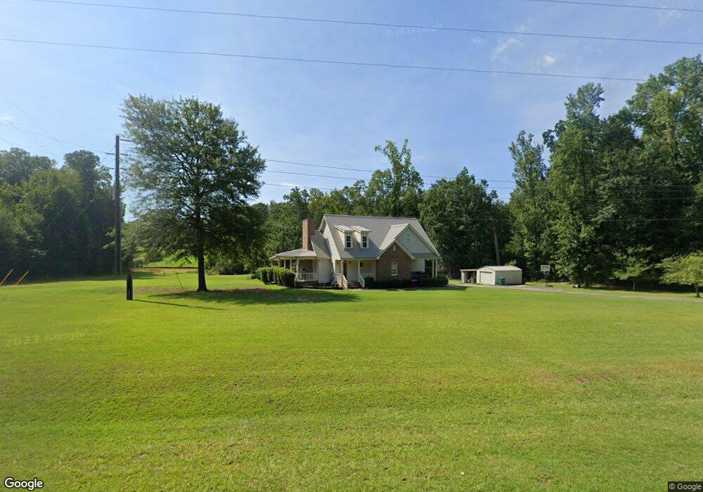
151 Airport Rd NE Milledgeville, GA 31061
Estimated Value: $365,543 - $548,000
--
Bed
--
Bath
2,043
Sq Ft
$225/Sq Ft
Est. Value
About This Home
This home is located at 151 Airport Rd NE, Milledgeville, GA 31061 and is currently estimated at $459,386, approximately $224 per square foot. 151 Airport Rd NE is a home located in Baldwin County with nearby schools including Lakeview Primary, Lakeview Academy, and Oak Hill Middle School.
Ownership History
Date
Name
Owned For
Owner Type
Purchase Details
Closed on
Feb 28, 2013
Sold by
Johnson Marion F
Bought by
Hutcheson Corey B and Teresita Hutcheson V
Current Estimated Value
Home Financials for this Owner
Home Financials are based on the most recent Mortgage that was taken out on this home.
Original Mortgage
$183,000
Outstanding Balance
$129,255
Interest Rate
3.56%
Mortgage Type
New Conventional
Estimated Equity
$330,131
Purchase Details
Closed on
Mar 19, 2010
Sold by
Johnson Amy M Mckenzie
Bought by
Johnson Marion F
Purchase Details
Closed on
Nov 6, 2003
Sold by
Mcmcjohnson Amy Mc
Bought by
Johnson Marion F
Purchase Details
Closed on
Apr 24, 2003
Sold by
Mckenzie Amy
Bought by
Johnson Marion F and Johnson Amy Mckenzi
Create a Home Valuation Report for This Property
The Home Valuation Report is an in-depth analysis detailing your home's value as well as a comparison with similar homes in the area
Home Values in the Area
Average Home Value in this Area
Purchase History
| Date | Buyer | Sale Price | Title Company |
|---|---|---|---|
| Hutcheson Corey B | $229,000 | -- | |
| Johnson Marion F | -- | -- | |
| Johnson Marion F | -- | -- | |
| Johnson Marion F | $10,000 | -- |
Source: Public Records
Mortgage History
| Date | Status | Borrower | Loan Amount |
|---|---|---|---|
| Open | Hutcheson Corey B | $183,000 |
Source: Public Records
Tax History Compared to Growth
Tax History
| Year | Tax Paid | Tax Assessment Tax Assessment Total Assessment is a certain percentage of the fair market value that is determined by local assessors to be the total taxable value of land and additions on the property. | Land | Improvement |
|---|---|---|---|---|
| 2025 | $2,579 | $105,808 | $1,300 | $104,508 |
| 2024 | $2,579 | $105,808 | $1,300 | $104,508 |
| 2023 | $1,979 | $81,216 | $1,084 | $80,132 |
| 2022 | $2,039 | $82,648 | $908 | $81,740 |
| 2021 | $1,907 | $72,960 | $9,480 | $63,480 |
| 2020 | $1,880 | $72,960 | $9,480 | $63,480 |
| 2019 | $1,884 | $72,960 | $9,480 | $63,480 |
| 2018 | $1,893 | $72,960 | $9,480 | $63,480 |
| 2017 | $1,860 | $72,960 | $9,480 | $63,480 |
| 2016 | $1,887 | $70,136 | $8,760 | $61,376 |
| 2015 | $1,891 | $70,576 | $8,760 | $61,816 |
| 2014 | $1,906 | $70,576 | $8,760 | $61,816 |
Source: Public Records
Map
Nearby Homes
- 103 Water Ridge Dr
- 105 Waterford Ct
- 350 Log Cabin Rd NE
- 514 High Bluff Ct NE
- 116 Newport Rd NE
- 410 High Bluff Ct NE
- 165 Log Cabin Rd NE
- 156 Log Cabin Rd NE
- 183 E Lakeview Dr NE
- 191A E Lakeview Dr NE Unit B
- 191 E Lakeview Dr
- 185 E Lakeview Dr NE
- 113 Island View Dr NE
- 111 Milledge Commons Dr
- 117 Milledge Commons Dr
- 109 Milledge Commons Dr
- 105 Milledge Commons Dr
- 119 Milledge Commons Dr
- 113 Milledge Commons Dr
- 0 Airport Rd NE Unit 8398652
- 0 Airport Rd NE Unit 8661942
- 0 Airport Rd NE Unit 8438952
- 0 Airport Rd NE Unit 3274047
- 152 Airport Rd NE
- 103 Water Ridge Dr Unit 13
- 105 Water Ridge Dr
- 107 Water Ridge Dr
- 107 Water Ridge Dr Unit 107 Water Ridge Dr
- 126 Waters Edge Dr NE
- 0 Water Ridge Dr Unit 7230544
- 0 Water Ridge Dr
- 132 Waters Edge Dr NE
- 181 Airport Rd NE
- 134 Water Ridge Dr
- 100 Water Ridge Dr
- 106 Water Ridge Dr
- 134 Waters Edge Dr NE
- 134 Waters Edge Dr NE
- 134 Waters Edge Dr NE