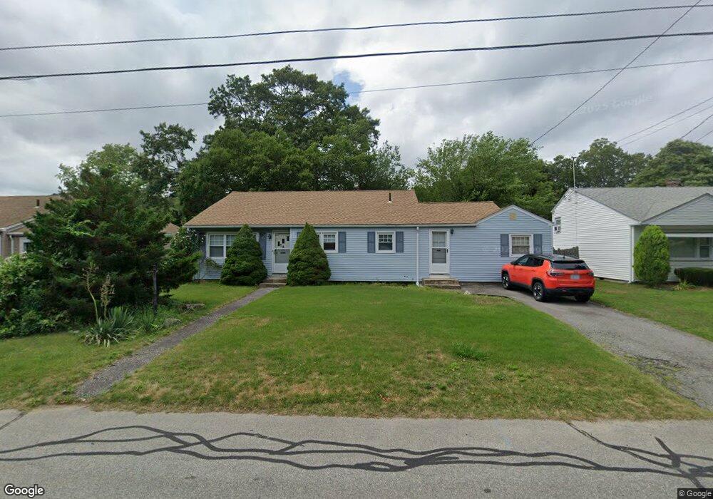
151 Aurora Dr Warwick, RI 02889
Conimicut-Shawomet NeighborhoodEstimated Value: $408,987 - $499,000
3
Beds
2
Baths
1,941
Sq Ft
$231/Sq Ft
Est. Value
About This Home
This home is located at 151 Aurora Dr, Warwick, RI 02889 and is currently estimated at $447,997, approximately $230 per square foot. 151 Aurora Dr is a home located in Kent County with nearby schools including Saint Kevin School and Bishop Hendricken High School.
Ownership History
Date
Name
Owned For
Owner Type
Purchase Details
Closed on
Nov 10, 2009
Sold by
Flynn Diane J
Bought by
Chasse Stephen N and Breault Kimberly V
Current Estimated Value
Home Financials for this Owner
Home Financials are based on the most recent Mortgage that was taken out on this home.
Original Mortgage
$177,450
Outstanding Balance
$114,335
Interest Rate
5.06%
Mortgage Type
Purchase Money Mortgage
Estimated Equity
$333,662
Purchase Details
Closed on
Mar 26, 2001
Sold by
Murphy Joseph P
Bought by
Flynn Diane J
Purchase Details
Closed on
May 30, 1991
Sold by
Gerstenblat Marshall
Bought by
Murphy Joseph P
Home Financials for this Owner
Home Financials are based on the most recent Mortgage that was taken out on this home.
Original Mortgage
$103,500
Interest Rate
9.35%
Mortgage Type
Purchase Money Mortgage
Create a Home Valuation Report for This Property
The Home Valuation Report is an in-depth analysis detailing your home's value as well as a comparison with similar homes in the area
Home Values in the Area
Average Home Value in this Area
Purchase History
| Date | Buyer | Sale Price | Title Company |
|---|---|---|---|
| Chasse Stephen N | $209,000 | -- | |
| Flynn Diane J | $60,000 | -- | |
| Murphy Joseph P | $109,000 | -- | |
| Murphy Joseph P | $109,000 | -- |
Source: Public Records
Mortgage History
| Date | Status | Borrower | Loan Amount |
|---|---|---|---|
| Open | Murphy Joseph P | $177,450 | |
| Previous Owner | Murphy Joseph P | $99,000 | |
| Previous Owner | Murphy Joseph P | $103,500 |
Source: Public Records
Tax History
| Year | Tax Paid | Tax Assessment Tax Assessment Total Assessment is a certain percentage of the fair market value that is determined by local assessors to be the total taxable value of land and additions on the property. | Land | Improvement |
|---|---|---|---|---|
| 2025 | $4,938 | $388,800 | $107,400 | $281,400 |
| 2024 | $4,943 | $341,600 | $93,300 | $248,300 |
| 2023 | $4,847 | $341,600 | $93,300 | $248,300 |
| 2022 | $4,377 | $233,700 | $54,200 | $179,500 |
| 2021 | $4,377 | $233,700 | $54,200 | $179,500 |
| 2020 | $4,377 | $233,700 | $54,200 | $179,500 |
| 2019 | $4,377 | $233,700 | $54,200 | $179,500 |
| 2018 | $4,048 | $194,600 | $54,200 | $140,400 |
| 2017 | $3,939 | $194,600 | $54,200 | $140,400 |
| 2016 | $3,939 | $194,600 | $54,200 | $140,400 |
| 2015 | $3,613 | $174,100 | $56,400 | $117,700 |
| 2014 | $3,492 | $174,100 | $56,400 | $117,700 |
| 2013 | $3,445 | $174,100 | $56,400 | $117,700 |
Source: Public Records
Map
Nearby Homes
- 63 Ramblewood Dr
- 44 Woodstock Dr
- 101 Farmland Rd
- 80 Twin Oak Dr
- 108 Fern St
- 55 Dixie Ave
- 404 Church Ave
- 0 Bethel St
- 103 Brightside Ave
- 355 Church Ave
- 46 Verndale St
- 18 Sevilla Ave
- 54 Ansonia Rd
- 35 Transit St
- 2 Overbrook Ave
- 17 Ardway Ave
- 72 W Shore Rd Unit 104
- 72 W Shore Rd Unit 3
- 21 Sarah Ln
- 112 Old Warwick Ave
- 159 Aurora Dr
- 143 Aurora Dr
- 150 Aurora Dr
- 158 Aurora Dr
- 142 Aurora Dr
- 167 Aurora Dr
- 133 Aurora Dr
- 140 Waterman Ave
- 166 Aurora Dr
- 130 Waterman Ave
- 132 Aurora Dr
- 150 Waterman Ave
- 175 Aurora Dr
- 176 Aurora Dr
- 118 Waterman Ave
- 115 Glenbrook Rd
- 183 Aurora Dr
- 107 Glenbrook Rd
- 125 Waterman Ave
- 97 Glenbrook Rd
Your Personal Tour Guide
Ask me questions while you tour the home.