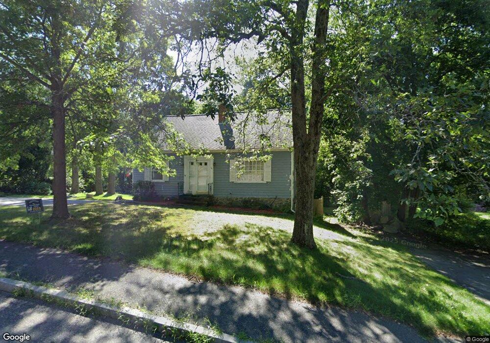
151 Boylston St Shrewsbury, MA 01545
Estimated Value: $549,582 - $615,000
3
Beds
2
Baths
1,624
Sq Ft
$360/Sq Ft
Est. Value
About This Home
This home is located at 151 Boylston St, Shrewsbury, MA 01545 and is currently estimated at $584,396, approximately $359 per square foot. 151 Boylston St is a home located in Worcester County with nearby schools including Spring Street Elementary School, Sherwood Middle School, and Oak Middle School.
Ownership History
Date
Name
Owned For
Owner Type
Purchase Details
Closed on
Mar 29, 2002
Sold by
Mascolo Richard and Mascolo Amy M
Bought by
Smith Justin C and Smith Jennifer A
Current Estimated Value
Purchase Details
Closed on
Jun 18, 1999
Sold by
Thompson Margaret and Thompson Victoria A
Bought by
Mascolo Richard and Mascolo Amy M
Purchase Details
Closed on
Mar 2, 1995
Sold by
Gordon Debra A
Bought by
Thompson Margaret and Thompson Victoria
Create a Home Valuation Report for This Property
The Home Valuation Report is an in-depth analysis detailing your home's value as well as a comparison with similar homes in the area
Home Values in the Area
Average Home Value in this Area
Purchase History
| Date | Buyer | Sale Price | Title Company |
|---|---|---|---|
| Smith Justin C | $261,000 | -- | |
| Smith Justin C | $261,000 | -- | |
| Mascolo Richard | $150,000 | -- | |
| Mascolo Richard | $150,000 | -- | |
| Thompson Margaret | $125,000 | -- | |
| Thompson Margaret | $125,000 | -- |
Source: Public Records
Mortgage History
| Date | Status | Borrower | Loan Amount |
|---|---|---|---|
| Open | Thompson Margaret | $220,000 | |
| Closed | Thompson Margaret | $207,200 |
Source: Public Records
Tax History Compared to Growth
Tax History
| Year | Tax Paid | Tax Assessment Tax Assessment Total Assessment is a certain percentage of the fair market value that is determined by local assessors to be the total taxable value of land and additions on the property. | Land | Improvement |
|---|---|---|---|---|
| 2025 | $54 | $445,400 | $247,700 | $197,700 |
| 2024 | $4,990 | $403,100 | $235,900 | $167,200 |
| 2023 | $4,919 | $374,900 | $235,900 | $139,000 |
| 2022 | $4,855 | $344,100 | $205,100 | $139,000 |
| 2021 | $4,123 | $312,600 | $190,800 | $121,800 |
| 2020 | $4,076 | $326,900 | $205,100 | $121,800 |
| 2019 | $3,741 | $297,600 | $178,100 | $119,500 |
| 2018 | $3,512 | $277,400 | $163,900 | $113,500 |
| 2017 | $3,370 | $262,700 | $149,200 | $113,500 |
| 2016 | $3,305 | $254,200 | $140,700 | $113,500 |
| 2015 | $3,077 | $233,100 | $122,100 | $111,000 |
Source: Public Records
Map
Nearby Homes
- 251 Boylston St Unit 253
- 3 Merriam Ave
- 20 Browning Rd
- 11 Adin Dr
- 2 Applewood Cir
- 17 Wilder Rd
- 7 Holman Heights Cir
- 34 Gates Rd
- 515 Main St
- 647 Main St
- 19 Grafton St
- 46-50 Wesleyan St
- 5 Highland Hill Dr
- 148 Spring St
- 35 Woodway Dr
- 20 Rawson Hill Dr
- 29 Elma Cir
- 10 Karen Ave
- 11 Cranbrook Rd
- Lot 11 High St
- 153 Boylston St
- 149 Boylston St
- 147 Boylston St
- 157 Boylston St
- 154 Boylston St
- 154 Boylston St
- 148 Boylston St
- 150 Boylston St
- 145 Boylston St
- 158 Boylston St
- 163 Boylston St
- 160 Boylston St
- 143 Boylston St
- 146 Boylston St
- 94 Boylston Cir
- 84 Boylston Cir
- 92 Boylston Cir
- 82 Boylston Cir
- 166 Boylston St
- 140 Boylston St