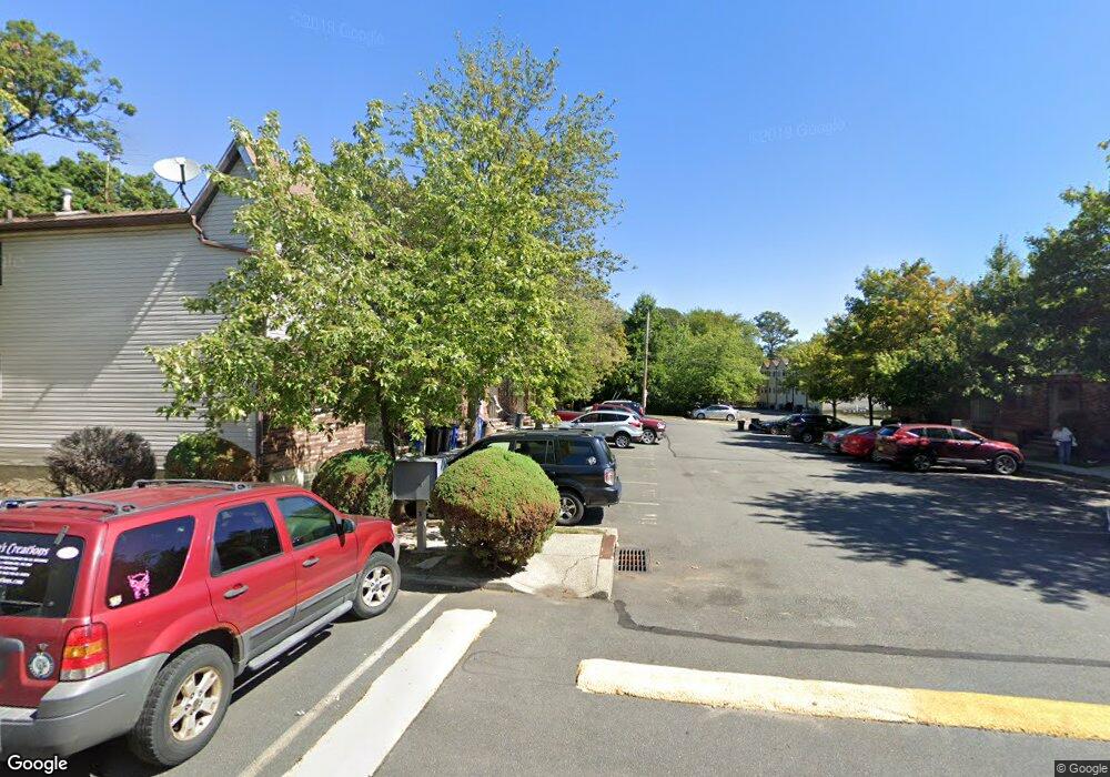
151 Colon Ave Unit 8A Staten Island, NY 10308
Great Kills NeighborhoodEstimated Value: $439,140 - $463,000
--
Bed
--
Bath
1,047
Sq Ft
$433/Sq Ft
Est. Value
About This Home
This home is located at 151 Colon Ave Unit 8A, Staten Island, NY 10308 and is currently estimated at $453,035, approximately $432 per square foot. 151 Colon Ave Unit 8A is a home located in Richmond County with nearby schools including P.S. 32 The Gifford School, Myra S. Barnes Intermediate School 24, and Susan E Wagner High School.
Ownership History
Date
Name
Owned For
Owner Type
Purchase Details
Closed on
Mar 12, 2003
Sold by
Deross Betty Jean M and Stoutland Herbert M
Bought by
Deross Betty Jean M
Current Estimated Value
Purchase Details
Closed on
May 30, 2002
Sold by
Deross Betty Jean M
Bought by
Deross Betty Jean M and Stoutland Herbert M
Purchase Details
Closed on
Jan 11, 2001
Sold by
Schiels Brian D
Bought by
Deross Betty Jean M
Create a Home Valuation Report for This Property
The Home Valuation Report is an in-depth analysis detailing your home's value as well as a comparison with similar homes in the area
Home Values in the Area
Average Home Value in this Area
Purchase History
| Date | Buyer | Sale Price | Title Company |
|---|---|---|---|
| Deross Betty Jean M | -- | Fidelity National Title Ins | |
| Deross Betty Jean M | -- | Fidelity National Title Ins | |
| Deross Betty Jean M | $140,000 | Fidelity National Title Ins |
Source: Public Records
Tax History Compared to Growth
Tax History
| Year | Tax Paid | Tax Assessment Tax Assessment Total Assessment is a certain percentage of the fair market value that is determined by local assessors to be the total taxable value of land and additions on the property. | Land | Improvement |
|---|---|---|---|---|
| 2025 | $3,502 | $26,999 | $1,396 | $25,603 |
| 2024 | $3,502 | $25,519 | $1,465 | $24,054 |
| 2023 | $3,340 | $16,448 | $1,484 | $14,964 |
| 2022 | $3,098 | $21,159 | $2,145 | $19,014 |
| 2021 | $3,081 | $19,838 | $2,145 | $17,693 |
| 2020 | $3,099 | $20,288 | $2,145 | $18,143 |
| 2019 | $3,039 | $17,641 | $2,145 | $15,496 |
| 2018 | $2,794 | $13,707 | $1,775 | $11,932 |
| 2017 | $2,636 | $12,932 | $1,818 | $11,114 |
| 2016 | $2,439 | $12,200 | $1,806 | $10,394 |
| 2015 | $2,324 | $12,200 | $1,899 | $10,301 |
| 2014 | $2,324 | $12,108 | $1,944 | $10,164 |
Source: Public Records
Map
Nearby Homes
- 221 B Katan Ave
- 28 N Rhett Ave
- 68 Margaret St
- 108 Giffords Ln
- 151 Abingdon Ave
- 17 Wilson Ave
- 15 Woodland Ave
- 21 Wilson Ave
- 63 Genesee Ave
- 223 Abingdon Ave
- 200 Giffords Ln
- 271 Doane Ave
- 67 Wilson Ave
- 96 Genesee Ave
- 270 Leverett Ave
- 43 Fern Ave
- 12 Saccheri Ct
- 248 Abingdon Ave
- 4157 Amboy Rd Unit H
- 52 Pleasant St
- 26A Katan Loop Unit 28A
- 28B Katan Loop
- 28A Katan Loop Unit 27A
- 32A Katan Loop Unit 25A
- 34B Katan Loop
- 34A Katan Loop
- 251A Katan Ave Unit 23A
- 255 Katan Ave Unit 21B
- 21A Katan Ave Unit 21A
- 33A Katan Loop Unit A
- 31B Katan Loop Unit B
- 29B Katan Loop Unit 15B
- 29 Katan Loop Unit A
- 29B Katan Loop Unit 13B
- 31B Katan Loop Unit 12B
- 33 Katan Ave Unit B
- 21A Katan Loop Unit 11A
- 153 Colon Ave Unit 9A
- 151 Colon Ave
- 149 Colon Ave Unit 7B
