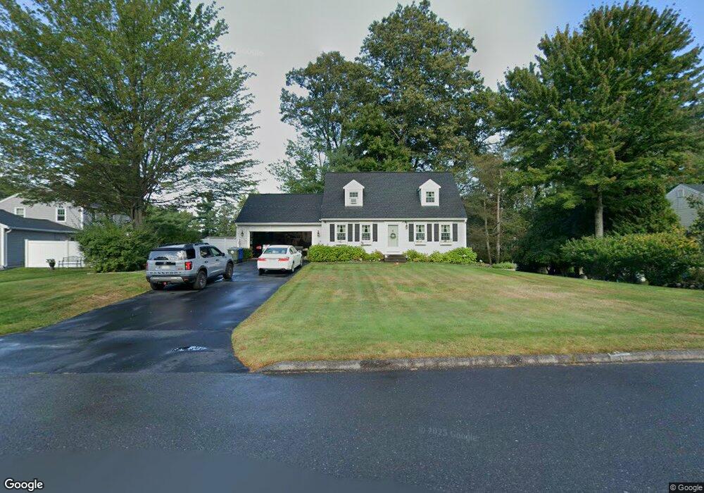
151 Dale Ave Leominster, MA 01453
Estimated Value: $485,000 - $566,000
3
Beds
2
Baths
1,326
Sq Ft
$402/Sq Ft
Est. Value
About This Home
This home is located at 151 Dale Ave, Leominster, MA 01453 and is currently estimated at $532,947, approximately $401 per square foot. 151 Dale Ave is a home located in Worcester County with nearby schools including Leominster High School, St. Leo School, and St Bernards Elementary School.
Create a Home Valuation Report for This Property
The Home Valuation Report is an in-depth analysis detailing your home's value as well as a comparison with similar homes in the area
Home Values in the Area
Average Home Value in this Area
Tax History Compared to Growth
Tax History
| Year | Tax Paid | Tax Assessment Tax Assessment Total Assessment is a certain percentage of the fair market value that is determined by local assessors to be the total taxable value of land and additions on the property. | Land | Improvement |
|---|---|---|---|---|
| 2025 | $6,584 | $469,300 | $144,100 | $325,200 |
| 2024 | $6,315 | $435,200 | $137,200 | $298,000 |
| 2023 | $6,154 | $396,000 | $119,300 | $276,700 |
| 2022 | $5,849 | $353,200 | $103,700 | $249,500 |
| 2021 | $5,691 | $313,900 | $80,800 | $233,100 |
| 2020 | $5,223 | $290,500 | $80,800 | $209,700 |
| 2019 | $5,121 | $276,200 | $76,900 | $199,300 |
| 2018 | $5,018 | $259,600 | $74,700 | $184,900 |
| 2017 | $4,739 | $240,200 | $69,800 | $170,400 |
| 2016 | $4,619 | $235,900 | $69,800 | $166,100 |
| 2015 | $4,502 | $231,600 | $69,800 | $161,800 |
| 2014 | $4,396 | $232,700 | $76,100 | $156,600 |
Source: Public Records
Map
Nearby Homes
- 11 Dale Ave
- 75 Dale Ave
- 14 Stetson St
- 40 Flaggler Rd
- 291 Joslin St
- 67 Bernice Ave
- 51 Claflin St
- 70 Kilburn St
- 1084 Main St
- 17 Fernwood Dr Unit G
- 51 Fox Meadow Rd Unit C
- 14 Fernwood Dr Unit D
- 828 Lancaster Ave
- 29 Lakeview Ave
- 633 Main St
- 593 Main St Unit SL4
- 121 Morningside St Unit 121
- 66 Hamilton St Unit 3
- 9 Winter Hill Rd
- 31 Park Ave