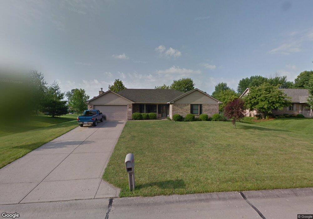
151 Deborah Ln Whiteland, IN 46184
Estimated Value: $324,691 - $368,000
3
Beds
2
Baths
1,813
Sq Ft
$193/Sq Ft
Est. Value
About This Home
This home is located at 151 Deborah Ln, Whiteland, IN 46184 and is currently estimated at $349,673, approximately $192 per square foot. 151 Deborah Ln is a home located in Johnson County with nearby schools including Whiteland Elementary School, Clark-Pleasant Middle School, and Whiteland Community High School.
Ownership History
Date
Name
Owned For
Owner Type
Purchase Details
Closed on
Sep 16, 2009
Sold by
Foley Grant W and Foley Andrea D
Bought by
Farris Michael
Current Estimated Value
Home Financials for this Owner
Home Financials are based on the most recent Mortgage that was taken out on this home.
Original Mortgage
$165,938
Outstanding Balance
$108,523
Interest Rate
5.19%
Estimated Equity
$241,150
Create a Home Valuation Report for This Property
The Home Valuation Report is an in-depth analysis detailing your home's value as well as a comparison with similar homes in the area
Home Values in the Area
Average Home Value in this Area
Purchase History
| Date | Buyer | Sale Price | Title Company |
|---|---|---|---|
| Farris Michael | -- | None Available |
Source: Public Records
Mortgage History
| Date | Status | Borrower | Loan Amount |
|---|---|---|---|
| Open | Farris Michael | $165,938 |
Source: Public Records
Tax History Compared to Growth
Tax History
| Year | Tax Paid | Tax Assessment Tax Assessment Total Assessment is a certain percentage of the fair market value that is determined by local assessors to be the total taxable value of land and additions on the property. | Land | Improvement |
|---|---|---|---|---|
| 2025 | $3,026 | $288,200 | $49,400 | $238,800 |
| 2024 | $3,026 | $289,200 | $49,400 | $239,800 |
| 2023 | $3,059 | $289,200 | $49,400 | $239,800 |
| 2022 | $2,649 | $256,700 | $49,400 | $207,300 |
| 2021 | $1,931 | $187,700 | $35,300 | $152,400 |
| 2020 | $1,881 | $180,200 | $35,300 | $144,900 |
| 2019 | $1,881 | $180,200 | $35,300 | $144,900 |
| 2018 | $1,620 | $158,800 | $32,700 | $126,100 |
| 2017 | $1,583 | $156,500 | $32,700 | $123,800 |
| 2016 | $1,574 | $165,100 | $32,700 | $132,400 |
| 2014 | $1,377 | $135,000 | $32,700 | $102,300 |
| 2013 | $1,377 | $137,300 | $32,700 | $104,600 |
Source: Public Records
Map
Nearby Homes
- 8 Marys Ct
- 241 Deborah Ln
- 254 Halldale Dr
- 83 Palmetto Dr
- 372 Wert Ln
- 272 Mcnair Rd
- 288 Mcnair Rd
- 161 Kiawah Dr
- 661 Woodview Dr
- 800 Beechwood Ct
- 818 Beechwood Ct
- 1139 Beechwood Ct
- 836 Beechwood Ct
- 1047 Beechwood Ct
- 807 Beechwood Ct
- 752 Beechwood Ct
- 899 Beechwood Ct
- 835 Beechwood Ct
- 867 Beechwood Ct
- 338 Mcnair Rd