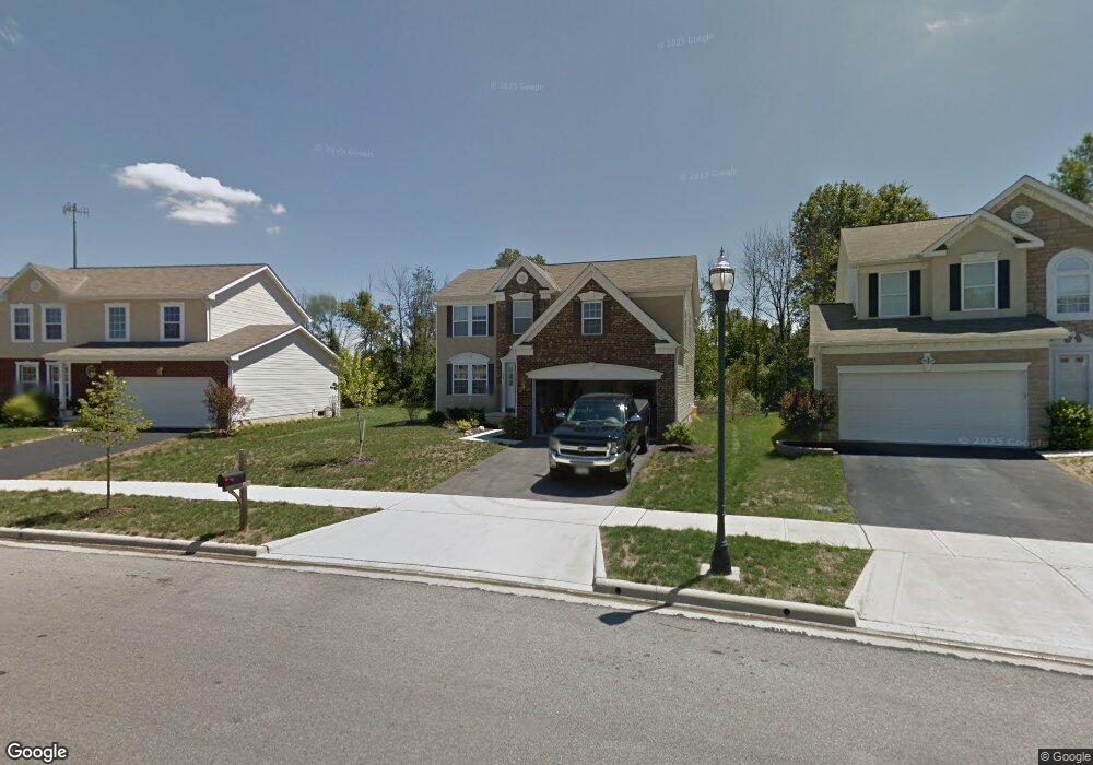
151 Firestone Dr Delaware, OH 43015
Estimated Value: $395,467 - $423,000
4
Beds
3
Baths
2,328
Sq Ft
$174/Sq Ft
Est. Value
About This Home
This home is located at 151 Firestone Dr, Delaware, OH 43015 and is currently estimated at $405,117, approximately $174 per square foot. 151 Firestone Dr is a home located in Delaware County with nearby schools including Robert F. Schultz Elementary School, John C. Dempsey Middle School, and Rutherford B. Hayes High School.
Ownership History
Date
Name
Owned For
Owner Type
Purchase Details
Closed on
Aug 18, 2010
Sold by
Maronda Homes Inc Of Ohio
Bought by
Friebel Jeffrey C and Cline Cynthia D
Current Estimated Value
Home Financials for this Owner
Home Financials are based on the most recent Mortgage that was taken out on this home.
Original Mortgage
$166,300
Outstanding Balance
$109,718
Interest Rate
4.5%
Mortgage Type
FHA
Estimated Equity
$295,400
Purchase Details
Closed on
May 22, 2007
Sold by
Curtis Farms Llc
Bought by
Maronda Homes Inc Of Ohio
Create a Home Valuation Report for This Property
The Home Valuation Report is an in-depth analysis detailing your home's value as well as a comparison with similar homes in the area
Home Values in the Area
Average Home Value in this Area
Purchase History
| Date | Buyer | Sale Price | Title Company |
|---|---|---|---|
| Friebel Jeffrey C | -- | Stewart Title | |
| Maronda Homes Inc Of Ohio | -- | Stewart Title |
Source: Public Records
Mortgage History
| Date | Status | Borrower | Loan Amount |
|---|---|---|---|
| Open | Friebel Jeffrey C | $166,300 |
Source: Public Records
Tax History
| Year | Tax Paid | Tax Assessment Tax Assessment Total Assessment is a certain percentage of the fair market value that is determined by local assessors to be the total taxable value of land and additions on the property. | Land | Improvement |
|---|---|---|---|---|
| 2024 | $5,430 | $107,800 | $21,770 | $86,030 |
| 2023 | $5,439 | $107,800 | $21,770 | $86,030 |
| 2022 | $4,682 | $79,660 | $14,980 | $64,680 |
| 2021 | $4,778 | $79,660 | $14,980 | $64,680 |
| 2020 | $4,828 | $79,660 | $14,980 | $64,680 |
| 2019 | $4,927 | $73,780 | $14,980 | $58,800 |
| 2018 | $5,096 | $73,780 | $14,980 | $58,800 |
| 2017 | $5,051 | $56,040 | $9,140 | $46,900 |
| 2016 | $3,668 | $56,040 | $9,140 | $46,900 |
| 2015 | $3,686 | $56,040 | $9,140 | $46,900 |
| 2014 | $3,738 | $56,040 | $9,140 | $46,900 |
| 2013 | $3,756 | $56,040 | $9,140 | $46,900 |
Source: Public Records
Map
Nearby Homes
- 181 Delaware Dr
- 100 Gold Dust Ct
- 100 Quarry Ct
- 90 Richards Dr
- 236 Richards Dr
- 238 Richards Dr
- 112 Silverline Dr
- 440 Steeplechase St
- 1016 Boulder Dr
- 195 Lenell Loop
- 865 Canal St
- 351 W William St
- 345 Lenell Loop
- 53 Neil St
- 65 Neil St
- 297 W William St
- 103 Oak Hill Ave
- 168 London Rd
- 69 Greenhedge Cir Unit 69
- 247 Lonepine Rd
- 151 Firestone Dr Unit 10287
- 155 Firestone Dr
- 155 Firestone Dr Unit 10286
- 147 Firestone Dr
- 143 Firestone Dr
- 159 Firestone Dr Unit 10285
- 159 Firestone Dr
- 139 Firestone Dr
- 139 Firestone Dr Unit 10290
- 163 Firestone Dr
- 148 Firestone Dr
- 154 Firestone Dr
- 154 Firestone Dr Unit 10277
- 114 Carolyn Ln
- 158 Firestone Dr
- 167 Firestone Dr
- 167 Firestone Dr
- 167 Firestone Dr Unit 10283
- 131 Firestone Dr
- 131 Firestone Dr Unit 10291
Your Personal Tour Guide
Ask me questions while you tour the home.