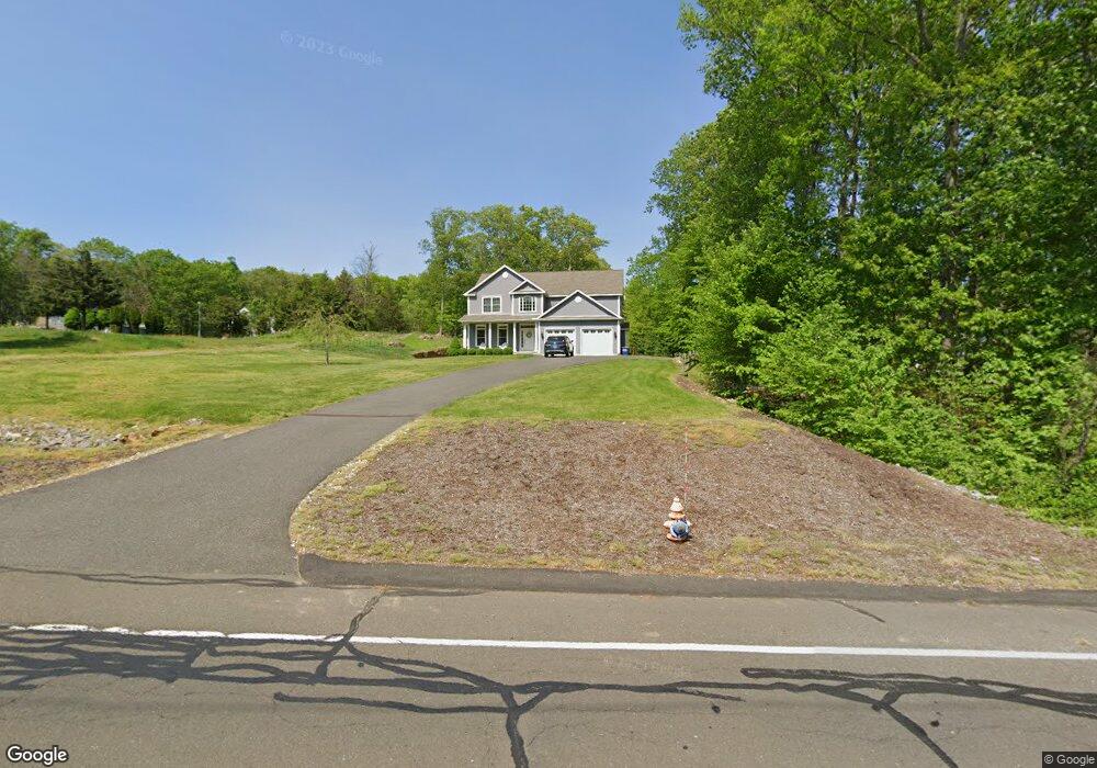
151 Hurd Rd Unit Lot 1 Trumbull, CT 06611
Daniel Farm District NeighborhoodEstimated Value: $932,995 - $1,021,000
4
Beds
3
Baths
2,850
Sq Ft
$343/Sq Ft
Est. Value
About This Home
This home is located at 151 Hurd Rd Unit Lot 1, Trumbull, CT 06611 and is currently estimated at $977,749, approximately $343 per square foot. 151 Hurd Rd Unit Lot 1 is a home located in Fairfield County with nearby schools including Daniels Farm School, Hillcrest Middle School, and Trumbull High School.
Ownership History
Date
Name
Owned For
Owner Type
Purchase Details
Closed on
Nov 8, 2024
Sold by
Jones Lauren C and Jones James E
Bought by
C L
Current Estimated Value
Purchase Details
Closed on
Dec 10, 2014
Sold by
Hurd Llc
Bought by
Jones James and Jones Lauren
Home Financials for this Owner
Home Financials are based on the most recent Mortgage that was taken out on this home.
Original Mortgage
$554,400
Interest Rate
3.98%
Mortgage Type
New Conventional
Purchase Details
Closed on
May 17, 2013
Sold by
Raymond Egan Est
Bought by
Hurd Llc
Purchase Details
Closed on
May 16, 2013
Sold by
Raymond Egan Est
Bought by
Delmastro John and Delmastro Mary
Create a Home Valuation Report for This Property
The Home Valuation Report is an in-depth analysis detailing your home's value as well as a comparison with similar homes in the area
Home Values in the Area
Average Home Value in this Area
Purchase History
| Date | Buyer | Sale Price | Title Company |
|---|---|---|---|
| C L | -- | None Available | |
| C L | -- | None Available | |
| Jones James | $625,000 | -- | |
| Hurd Llc | $265,000 | -- | |
| Hurd Llc | $25,000 | -- | |
| Delmastro John | $5,000 | -- | |
| Jones James | $625,000 | -- | |
| Hurd Llc | $265,000 | -- | |
| Delmastro John | $5,000 | -- |
Source: Public Records
Mortgage History
| Date | Status | Borrower | Loan Amount |
|---|---|---|---|
| Previous Owner | Delmastro John | $554,400 |
Source: Public Records
Tax History Compared to Growth
Tax History
| Year | Tax Paid | Tax Assessment Tax Assessment Total Assessment is a certain percentage of the fair market value that is determined by local assessors to be the total taxable value of land and additions on the property. | Land | Improvement |
|---|---|---|---|---|
| 2025 | $16,222 | $439,390 | $144,060 | $295,330 |
| 2024 | $15,115 | $420,910 | $144,060 | $276,850 |
| 2023 | $14,871 | $420,910 | $144,060 | $276,850 |
| 2022 | $14,633 | $420,910 | $144,060 | $276,850 |
| 2021 | $14,257 | $390,110 | $131,110 | $259,000 |
| 2020 | $13,985 | $390,110 | $131,110 | $259,000 |
| 2018 | $13,640 | $390,110 | $131,110 | $259,000 |
| 2017 | $13,365 | $390,110 | $131,110 | $259,000 |
| 2016 | $13,096 | $390,110 | $131,110 | $259,000 |
| 2015 | $13,252 | $390,200 | $131,200 | $259,000 |
| 2014 | $6,131 | $184,500 | $131,200 | $53,300 |
Source: Public Records
Map
Nearby Homes
- 184 Hurd Rd
- 36 Moose Hill Rd
- 1209 Daniels Farm Rd
- 43 Moose Hill Rd
- 118 Greenbrier Rd
- 121 Lewis Rd
- 119 Lewis Rd
- 3 Pam Bar Dr
- 6 Brookview Dr
- 93 Putting Green Rd N
- 75 Roosevelt Dr
- 10 Greenwood Ln
- 18 Skating Pond Rd
- 184 Putting Green Rd
- 19 Hazel Ct
- 31 Parlor Rock Rd
- 57 Gray Rock Rd
- 340 Moose Hill Rd
- 6 Dartmouth Dr
- 349 Spring Hill Rd