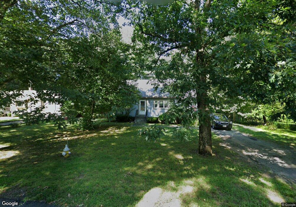
151 Janice Cir Wrentham, MA 02093
Estimated Value: $546,000 - $559,000
4
Beds
1
Bath
1,092
Sq Ft
$505/Sq Ft
Est. Value
About This Home
This home is located at 151 Janice Cir, Wrentham, MA 02093 and is currently estimated at $551,655, approximately $505 per square foot. 151 Janice Cir is a home located in Norfolk County with nearby schools including Delaney Elementary School, Charles E Roderick, and The Sage School.
Ownership History
Date
Name
Owned For
Owner Type
Purchase Details
Closed on
Sep 16, 1987
Sold by
Hunt Eugenew J
Bought by
Monahan Edward F
Current Estimated Value
Home Financials for this Owner
Home Financials are based on the most recent Mortgage that was taken out on this home.
Original Mortgage
$63,000
Interest Rate
10.35%
Mortgage Type
Purchase Money Mortgage
Create a Home Valuation Report for This Property
The Home Valuation Report is an in-depth analysis detailing your home's value as well as a comparison with similar homes in the area
Home Values in the Area
Average Home Value in this Area
Purchase History
| Date | Buyer | Sale Price | Title Company |
|---|---|---|---|
| Monahan Edward F | $152,900 | -- |
Source: Public Records
Mortgage History
| Date | Status | Borrower | Loan Amount |
|---|---|---|---|
| Open | Monahan Edward F | $75,000 | |
| Closed | Monahan Edward F | $59,500 | |
| Closed | Monahan Edward F | $63,000 |
Source: Public Records
Tax History Compared to Growth
Tax History
| Year | Tax Paid | Tax Assessment Tax Assessment Total Assessment is a certain percentage of the fair market value that is determined by local assessors to be the total taxable value of land and additions on the property. | Land | Improvement |
|---|---|---|---|---|
| 2025 | $5,871 | $506,600 | $297,300 | $209,300 |
| 2024 | $5,710 | $475,800 | $297,300 | $178,500 |
| 2023 | $5,404 | $428,200 | $270,200 | $158,000 |
| 2022 | $4,622 | $338,100 | $208,000 | $130,100 |
| 2021 | $4,802 | $341,300 | $217,900 | $123,400 |
| 2020 | $4,610 | $323,500 | $196,500 | $127,000 |
| 2019 | $4,260 | $301,700 | $181,400 | $120,300 |
| 2018 | $4,071 | $285,900 | $181,500 | $104,400 |
| 2017 | $3,866 | $271,300 | $178,000 | $93,300 |
| 2016 | $3,813 | $267,000 | $172,800 | $94,200 |
| 2015 | $3,727 | $248,800 | $166,200 | $82,600 |
| 2014 | $3,460 | $226,000 | $146,500 | $79,500 |
Source: Public Records
Map
Nearby Homes
- 1 Lorraine Metcalf Dr
- 270 Dedham St
- 362 East St
- 10 Nature View Dr
- 15 Nature View Dr
- 65 Pond St
- 319 Taunton St
- 131 Creek St Unit 7
- 25 Foxboro Rd
- 246 Forest Grove Ave
- 11 Earle Stewart Ln
- 120 Hawes St
- 10 W Birch Rd
- 3 Oak Rd
- 0 W Birch Rd
- Lot 3 - 14 Earle Stewart Ln
- 483 Thurston St
- Lot 1 - Blueberry 2 Car Plan at King Philip Estates
- Lot 8 - Blueberry 2 Car Plan at King Philip Estates
- Lot 6 - Blueberry 3 Car Plan at King Philip Estates
- 159 Janice Cir
- 145 Hamilton Rd
- 167 Janice Cir
- 154 Janice Cir
- 136 Hamilton Rd
- 162 Janice Cir
- 137 Hamilton Rd
- 175 Janice Cir
- 186 Janice Cir
- 129 Hamilton Rd
- 226 Janice Cir
- 218 Janice Cir
- 183 Janice Cir
- 124 Hamilton Rd
- 121 Hamilton Rd
- 198 Janice Cir
- 80 Lorraine Metcalf Dr
- 90 Lorraine Metcalf Dr
- 70 Lorraine Metcalf Dr
- 191 Janice Cir