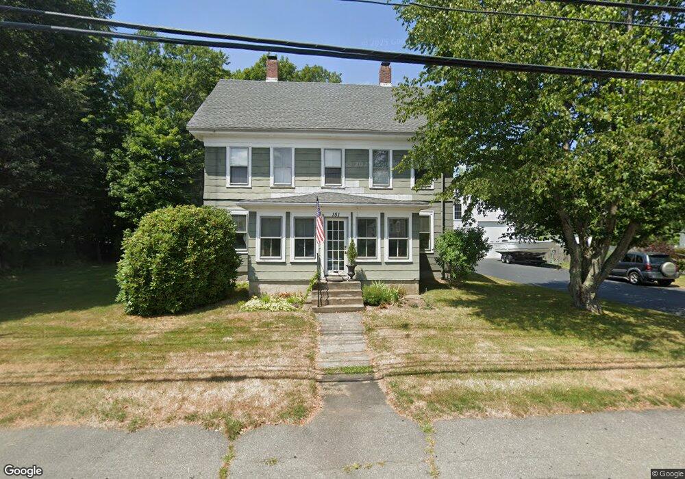
151 Main St Unit 151 Groveland, MA 01834
Estimated Value: $707,000 - $727,000
4
Beds
1
Bath
1,904
Sq Ft
$377/Sq Ft
Est. Value
About This Home
This home is located at 151 Main St Unit 151, Groveland, MA 01834 and is currently estimated at $718,087, approximately $377 per square foot. 151 Main St Unit 151 is a home located in Essex County with nearby schools including Pentucket Regional High School.
Ownership History
Date
Name
Owned For
Owner Type
Purchase Details
Closed on
Apr 28, 2006
Sold by
Bartholomew Dean R and Bartholomew Kathleen M
Bought by
Billis Constantine V and Billis Deborah R
Current Estimated Value
Home Financials for this Owner
Home Financials are based on the most recent Mortgage that was taken out on this home.
Original Mortgage
$300,000
Interest Rate
6.4%
Mortgage Type
Purchase Money Mortgage
Purchase Details
Closed on
Jul 29, 1991
Sold by
Deveney Kevin P and Deveney Karen
Bought by
Richard Fitzgerald and Richard Fitzgerald
Create a Home Valuation Report for This Property
The Home Valuation Report is an in-depth analysis detailing your home's value as well as a comparison with similar homes in the area
Home Values in the Area
Average Home Value in this Area
Purchase History
| Date | Buyer | Sale Price | Title Company |
|---|---|---|---|
| Billis Constantine V | $400,000 | -- | |
| Richard Fitzgerald | $152,000 | -- |
Source: Public Records
Mortgage History
| Date | Status | Borrower | Loan Amount |
|---|---|---|---|
| Open | Richard Fitzgerald | $279,704 | |
| Closed | Richard Fitzgerald | $300,000 | |
| Previous Owner | Richard Fitzgerald | $140,000 |
Source: Public Records
Tax History Compared to Growth
Tax History
| Year | Tax Paid | Tax Assessment Tax Assessment Total Assessment is a certain percentage of the fair market value that is determined by local assessors to be the total taxable value of land and additions on the property. | Land | Improvement |
|---|---|---|---|---|
| 2025 | $7,680 | $605,200 | $189,800 | $415,400 |
| 2024 | $7,554 | $557,900 | $187,800 | $370,100 |
| 2023 | $7,181 | $546,900 | $193,700 | $353,200 |
| 2022 | $7,051 | $487,300 | $170,000 | $317,300 |
| 2021 | $6,263 | $425,500 | $150,200 | $275,300 |
| 2020 | $5,191 | $369,500 | $136,400 | $233,100 |
| 2019 | $4,791 | $333,900 | $132,400 | $201,500 |
| 2018 | $4,516 | $307,400 | $120,600 | $186,800 |
| 2017 | $4,643 | $316,300 | $139,900 | $176,400 |
| 2016 | $4,470 | $296,200 | $133,300 | $162,900 |
| 2015 | $3,746 | $256,400 | $105,000 | $151,400 |
| 2014 | $3,590 | $238,400 | $105,000 | $133,400 |
Source: Public Records
Map
Nearby Homes
- 3 Marjorie St
- 33 Groveland Commons Way
- 7 Marjorie St
- 18-1/2 Cannon Hill Ave
- 8 Wood St
- 20 Francis Ave
- 280 E Broadway
- 22-26 Wood St
- 28 Coffin Ave
- 19 Orchard Ave Unit F
- 47 Gardner St
- 23 Orchard Ave Unit E
- 0 E Broadway Unit 73335816
- 144 Old Ferry Rd Unit H
- 98 King St
- 6 Highland Ave
- 100 King St
- 63 Old Ferry Rd
- 358 Main St
- 6 Katie Ln