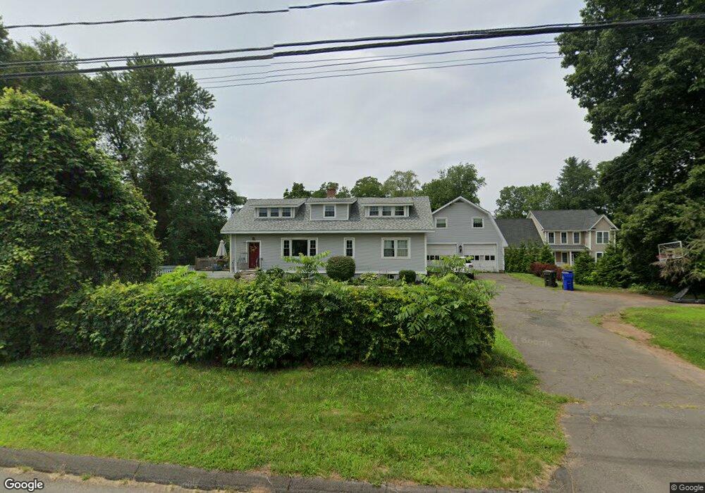
151 Maple Hill Ave Newington, CT 06111
Estimated Value: $442,000 - $533,000
4
Beds
2
Baths
2,660
Sq Ft
$179/Sq Ft
Est. Value
About This Home
This home is located at 151 Maple Hill Ave, Newington, CT 06111 and is currently estimated at $475,259, approximately $178 per square foot. 151 Maple Hill Ave is a home located in Hartford County with nearby schools including Anna Reynolds School, Martin Kellogg Middle School, and Newington High School.
Ownership History
Date
Name
Owned For
Owner Type
Purchase Details
Closed on
May 20, 2014
Sold by
Budney Stephen H
Bought by
Developemen Maple Hill
Current Estimated Value
Home Financials for this Owner
Home Financials are based on the most recent Mortgage that was taken out on this home.
Original Mortgage
$103,167
Outstanding Balance
$78,662
Interest Rate
4.42%
Estimated Equity
$396,597
Purchase Details
Closed on
Dec 27, 2007
Sold by
Budney Stephen H
Bought by
Budney Julia B
Create a Home Valuation Report for This Property
The Home Valuation Report is an in-depth analysis detailing your home's value as well as a comparison with similar homes in the area
Home Values in the Area
Average Home Value in this Area
Purchase History
| Date | Buyer | Sale Price | Title Company |
|---|---|---|---|
| Developemen Maple Hill | $220,000 | -- | |
| Budney Julia B | $80,000 | -- |
Source: Public Records
Mortgage History
| Date | Status | Borrower | Loan Amount |
|---|---|---|---|
| Open | Developemen Maple Hill | $103,167 |
Source: Public Records
Tax History
| Year | Tax Paid | Tax Assessment Tax Assessment Total Assessment is a certain percentage of the fair market value that is determined by local assessors to be the total taxable value of land and additions on the property. | Land | Improvement |
|---|---|---|---|---|
| 2025 | $8,765 | $219,230 | $59,350 | $159,880 |
| 2024 | $8,697 | $219,230 | $59,350 | $159,880 |
| 2023 | $8,410 | $219,230 | $59,350 | $159,880 |
| 2022 | $8,438 | $219,230 | $59,350 | $159,880 |
| 2021 | $8,508 | $219,230 | $59,350 | $159,880 |
| 2020 | $7,618 | $193,940 | $57,230 | $136,710 |
| 2019 | $7,651 | $193,940 | $57,230 | $136,710 |
| 2018 | $7,467 | $193,940 | $57,230 | $136,710 |
| 2017 | $7,096 | $193,940 | $57,230 | $136,710 |
| 2016 | $6,746 | $188,690 | $57,230 | $131,460 |
| 2015 | $7,963 | $222,430 | $88,320 | $134,110 |
| 2014 | $6,099 | $175,420 | $88,320 | $87,100 |
Source: Public Records
Map
Nearby Homes
- 1 Old Farm Dr
- 7 Old Farm Dr
- 9 Old Farm Dr
- 24 Old Musket Dr
- 446 Maple Hill Ave
- 20 Browning Ave
- 15 Lester St
- 1235 East St Unit B
- 46 Florence St
- 175 Amherst St
- 227 Amherst St
- 55 Coles Ave
- 42 Sunset Rd
- 129 Glenview Dr
- 140 Dowd St
- 325 Barbour Rd
- 495 New Britain Ave
- 77 Thorniley St
- 38 Northwood Rd
- 17 Whiteside St
- 147 Maple Hill Ave
- 152 Maple Hill Ave
- 166 Maple Hill Ave
- 165 Maple Hill Ave
- 149 Maple Hill Ave
- 11 Spruce St
- 18 Spruce St
- 140 Maple Hill Ave
- 144 Maple Hill Ave
- 174 Maple Hill Ave
- 19 Spruce St
- 131 Maple Hill Ave
- 169 Maple Hill Ave
- 173 Maple Hill Ave
- 26 Spruce St
- 20 Hemlock St
- 23 Spruce St
- 175 Maple Hill Ave
- 27 Spruce St
- 32 Spruce St
Your Personal Tour Guide
Ask me questions while you tour the home.