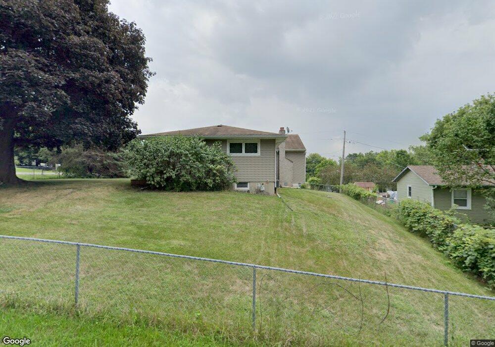
151 Memory Ln Carpentersville, IL 60110
Estimated Value: $261,000 - $301,000
3
Beds
--
Bath
1,200
Sq Ft
$234/Sq Ft
Est. Value
About This Home
This home is located at 151 Memory Ln, Carpentersville, IL 60110 and is currently estimated at $281,310, approximately $234 per square foot. 151 Memory Ln is a home located in Kane County with nearby schools including Parkview Elementary School, Carpentersville Middle School, and Dundee-Crown High School.
Ownership History
Date
Name
Owned For
Owner Type
Purchase Details
Closed on
Apr 26, 2005
Sold by
Bromund Rudolph K and Bromund Rudolph X
Bought by
Bromund Catherine
Current Estimated Value
Home Financials for this Owner
Home Financials are based on the most recent Mortgage that was taken out on this home.
Original Mortgage
$83,000
Interest Rate
6.07%
Mortgage Type
Fannie Mae Freddie Mac
Create a Home Valuation Report for This Property
The Home Valuation Report is an in-depth analysis detailing your home's value as well as a comparison with similar homes in the area
Home Values in the Area
Average Home Value in this Area
Purchase History
| Date | Buyer | Sale Price | Title Company |
|---|---|---|---|
| Bromund Catherine | -- | Mid America Title Company |
Source: Public Records
Mortgage History
| Date | Status | Borrower | Loan Amount |
|---|---|---|---|
| Closed | Bromund Catherine | $83,000 |
Source: Public Records
Tax History Compared to Growth
Tax History
| Year | Tax Paid | Tax Assessment Tax Assessment Total Assessment is a certain percentage of the fair market value that is determined by local assessors to be the total taxable value of land and additions on the property. | Land | Improvement |
|---|---|---|---|---|
| 2024 | $4,422 | $77,517 | $12,709 | $64,808 |
| 2023 | $4,644 | $69,747 | $11,435 | $58,312 |
| 2022 | $4,654 | $65,613 | $11,435 | $54,178 |
| 2021 | $4,501 | $61,952 | $10,797 | $51,155 |
| 2020 | $4,404 | $60,559 | $10,554 | $50,005 |
| 2019 | $4,265 | $57,489 | $10,019 | $47,470 |
| 2018 | $4,161 | $54,828 | $9,821 | $45,007 |
| 2017 | $3,965 | $51,289 | $9,187 | $42,102 |
| 2016 | $3,684 | $45,644 | $13,691 | $31,953 |
| 2015 | -- | $42,770 | $12,829 | $29,941 |
| 2014 | -- | $41,589 | $12,475 | $29,114 |
| 2013 | -- | $42,862 | $12,857 | $30,005 |
Source: Public Records
Map
Nearby Homes
- 135 Indian Ln
- 1040 Rosewood Dr
- 181 Skyline Dr
- 494 Rosewood Dr
- 484 Rosewood Dr
- 496 Oakhurst Ln
- 1033 Rosewood Dr
- 7 Austin Ave
- 4 Austin Ave
- 1105 Denver Dr
- 1514 Amarillo Dr
- 34 Hickory Dr
- 105 Siesta Rd
- 116 Ensenada Ct
- Lot 6B Ravine Rd
- Lot 6A Ravine Rd
- Lot 6 Ravine Rd
- 7 Hickory Dr
- 57 Robin Rd
- 200 Amarillo Dr
- 149 Memory Ln
- 153 Sunset Dr
- 136 Skyline Dr
- 147 Sunset Dr
- 139 Indian Ln
- 157 Sunset Dr
- 146 Memory Ln
- 152 Skyline Dr Unit 3
- 161 Sunset Dr Unit 3
- 156 Sunset Dr Unit 3
- 118 Skyline Dr
- 123 Skyline Dr
- 127 Skyline Dr
- 138 Memory Ln
- 129 Sunset Dr
- 160 Skyline Dr
- 138 Indian Ln
- 116 Skyline Dr
- 165 Sunset Dr Unit 3