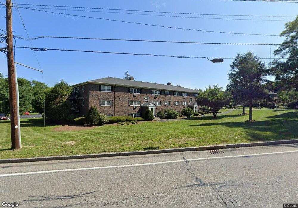
151 Milk St Unit 22 Westborough, MA 01581
Estimated Value: $215,000 - $240,000
1
Bed
1
Bath
635
Sq Ft
$358/Sq Ft
Est. Value
About This Home
This home is located at 151 Milk St Unit 22, Westborough, MA 01581 and is currently estimated at $227,567, approximately $358 per square foot. 151 Milk St Unit 22 is a home located in Worcester County with nearby schools including Westborough High School, Ebridge Montessori School, and Westboro Knowledge Beginnings.
Ownership History
Date
Name
Owned For
Owner Type
Purchase Details
Closed on
Dec 19, 2023
Sold by
State Street 2011 Rt and Hebert
Bought by
Madison Landing Llc
Current Estimated Value
Purchase Details
Closed on
Dec 15, 2011
Sold by
Charlton Road Realty L
Bought by
State Street 2011 Rt and Hebert
Purchase Details
Closed on
Oct 15, 2009
Sold by
G & C Re Llc
Bought by
Charlton Road Rlty Llc
Purchase Details
Closed on
Oct 2, 2000
Sold by
Melfa Victor J and Melfa Karen C
Bought by
Greene Steven and Carbonneau Jon
Home Financials for this Owner
Home Financials are based on the most recent Mortgage that was taken out on this home.
Original Mortgage
$55,000
Interest Rate
7.94%
Mortgage Type
Purchase Money Mortgage
Create a Home Valuation Report for This Property
The Home Valuation Report is an in-depth analysis detailing your home's value as well as a comparison with similar homes in the area
Home Values in the Area
Average Home Value in this Area
Purchase History
| Date | Buyer | Sale Price | Title Company |
|---|---|---|---|
| Madison Landing Llc | -- | None Available | |
| State Street 2011 Rt | $70,000 | -- | |
| Charlton Road Rlty Llc | -- | -- | |
| Greene Steven | $69,900 | -- |
Source: Public Records
Mortgage History
| Date | Status | Borrower | Loan Amount |
|---|---|---|---|
| Previous Owner | Greene Steven | $55,000 | |
| Previous Owner | Greene Steven | $44,700 |
Source: Public Records
Tax History Compared to Growth
Tax History
| Year | Tax Paid | Tax Assessment Tax Assessment Total Assessment is a certain percentage of the fair market value that is determined by local assessors to be the total taxable value of land and additions on the property. | Land | Improvement |
|---|---|---|---|---|
| 2025 | $3,838 | $235,600 | $0 | $235,600 |
| 2024 | $3,069 | $187,000 | $0 | $187,000 |
| 2023 | $2,605 | $154,700 | $0 | $154,700 |
| 2022 | $2,688 | $145,400 | $0 | $145,400 |
| 2021 | $2,267 | $122,300 | $0 | $122,300 |
| 2020 | $2,285 | $124,700 | $0 | $124,700 |
| 2019 | $2,071 | $113,000 | $0 | $113,000 |
| 2018 | $1,970 | $106,700 | $0 | $106,700 |
| 2017 | $1,721 | $96,700 | $0 | $96,700 |
| 2016 | $1,622 | $91,300 | $0 | $91,300 |
| 2015 | $1,716 | $92,300 | $0 | $92,300 |
Source: Public Records
Map
Nearby Homes
- 155 Milk St Unit 5
- 9 Shaker Way
- 8 Stagecoach Cir Unit 8
- 52 Treetop Park Unit 52
- 22 Treetop Park
- 9 Treetop Park
- 19 Treetop Park Unit 19
- 196 -198 Turnpike Rd
- 3 Dover Way
- 19 Fisher St
- 4403 Peters Farm Way Unit 403
- 7 Mayberry Dr Unit H
- 48 High Street Extension
- 14 Mayberry Dr Unit 10
- 43 Church St
- 23 Water St
- 6 Folly Ln
- 5 Chauncy Cir
- 14 Grove St Unit 2
- 59 Indian Meadow Dr
- 151 Milk St Unit 23
- 151 Milk St Unit 21
- 151 Milk St Unit 20
- 151 Milk St Unit 19
- 151 Milk St Unit 18
- 151 Milk St Unit 17
- 151 Milk St Unit 16
- 151 Milk St Unit 15
- 151 Milk St Unit 14
- 151 Milk St Unit 12A
- 151 Milk St Unit 12
- 151 Milk St Unit 10
- 151 Milk St Unit 9
- 151 Milk St Unit 8
- 151 Milk St Unit 7
- 151 Milk St Unit 6
- 151 Milk St Unit 5
- 151 Milk St Unit 4
- 151 Milk St Unit 3
- 151 Milk St Unit 2