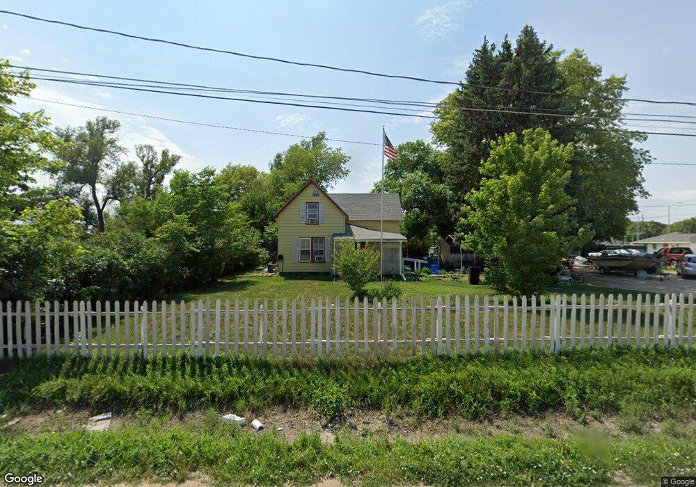
151 N Barnes Ave Hastings, NE 68901
Estimated Value: $142,000 - $212,000
3
Beds
1
Bath
1,216
Sq Ft
$145/Sq Ft
Est. Value
About This Home
This home is located at 151 N Barnes Ave, Hastings, NE 68901 and is currently estimated at $176,213, approximately $144 per square foot. 151 N Barnes Ave is a home located in Adams County with nearby schools including Hastings Senior High School, Zion Lutheran School, and St. Michael's Preschool & Elementary School.
Ownership History
Date
Name
Owned For
Owner Type
Purchase Details
Closed on
Sep 26, 2007
Sold by
Zubrod Ronald C
Bought by
Hayes Scott
Current Estimated Value
Home Financials for this Owner
Home Financials are based on the most recent Mortgage that was taken out on this home.
Original Mortgage
$144,406
Outstanding Balance
$92,265
Interest Rate
6.66%
Mortgage Type
FHA
Estimated Equity
$83,948
Create a Home Valuation Report for This Property
The Home Valuation Report is an in-depth analysis detailing your home's value as well as a comparison with similar homes in the area
Home Values in the Area
Average Home Value in this Area
Purchase History
| Date | Buyer | Sale Price | Title Company |
|---|---|---|---|
| Hayes Scott | $48,000 | None Available |
Source: Public Records
Mortgage History
| Date | Status | Borrower | Loan Amount |
|---|---|---|---|
| Open | Hayes Scott | $144,406 |
Source: Public Records
Tax History Compared to Growth
Tax History
| Year | Tax Paid | Tax Assessment Tax Assessment Total Assessment is a certain percentage of the fair market value that is determined by local assessors to be the total taxable value of land and additions on the property. | Land | Improvement |
|---|---|---|---|---|
| 2024 | $1,915 | $118,299 | $26,019 | $92,280 |
| 2023 | $2,133 | $103,348 | $26,019 | $77,329 |
| 2022 | $2,328 | $103,348 | $26,019 | $77,329 |
| 2021 | $1,583 | $72,205 | $19,620 | $52,585 |
| 2020 | $1,503 | $69,701 | $19,620 | $50,081 |
| 2019 | $1,417 | $66,425 | $19,620 | $46,805 |
| 2018 | $1,312 | $61,180 | $14,375 | $46,805 |
| 2017 | $1,311 | $61,180 | $0 | $0 |
| 2016 | $1,229 | $57,315 | $14,375 | $42,940 |
| 2011 | -- | $0 | $0 | $0 |
Source: Public Records
Map
Nearby Homes
- 142 N Barnes Ave
- 126 N Barnes Ave
- 149 Chestnut Ave
- 151 Chestnut Ave
- 2018 W 2nd St
- 139 Chestnut Ave
- 135 Chestnut Ave
- 127 Chestnut Ave
- 2215 W 2nd St
- 154 N Laird Ave
- 150 N Laird Ave
- 148 N Laird Ave
- 2217 W 2nd St
- 142 N Laird Ave
- 124 N Laird Ave
- 1931 W 3rd St
- 108 N Laird Ave
- 1922 W 2nd St
- 1923 W 3rd St
- 1918 W 2nd St