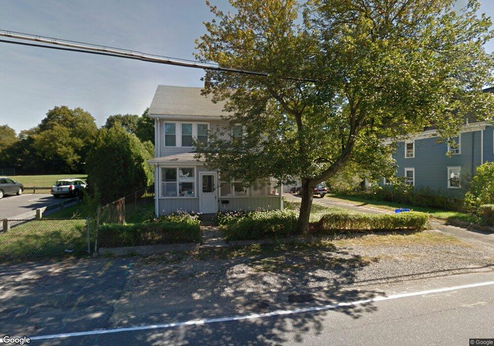
151 N Main St Natick, MA 01760
Estimated Value: $700,000 - $814,000
4
Beds
2
Baths
1,680
Sq Ft
$447/Sq Ft
Est. Value
About This Home
This home is located at 151 N Main St, Natick, MA 01760 and is currently estimated at $750,313, approximately $446 per square foot. 151 N Main St is a home located in Middlesex County with nearby schools including Natick High School, Wilson Middle School, and Bennett-Hemenway (Ben-Hem) Elementary School.
Ownership History
Date
Name
Owned For
Owner Type
Purchase Details
Closed on
Dec 17, 2010
Sold by
Est Kruspki Lena B and Kruspki David L
Bought by
Leung Stephen
Current Estimated Value
Home Financials for this Owner
Home Financials are based on the most recent Mortgage that was taken out on this home.
Original Mortgage
$240,800
Outstanding Balance
$158,552
Interest Rate
4.23%
Mortgage Type
Purchase Money Mortgage
Estimated Equity
$591,761
Create a Home Valuation Report for This Property
The Home Valuation Report is an in-depth analysis detailing your home's value as well as a comparison with similar homes in the area
Home Values in the Area
Average Home Value in this Area
Purchase History
| Date | Buyer | Sale Price | Title Company |
|---|---|---|---|
| Leung Stephen | $301,000 | -- |
Source: Public Records
Mortgage History
| Date | Status | Borrower | Loan Amount |
|---|---|---|---|
| Open | Leung Stephen | $240,800 |
Source: Public Records
Tax History Compared to Growth
Tax History
| Year | Tax Paid | Tax Assessment Tax Assessment Total Assessment is a certain percentage of the fair market value that is determined by local assessors to be the total taxable value of land and additions on the property. | Land | Improvement |
|---|---|---|---|---|
| 2025 | $6,083 | $508,600 | $384,200 | $124,400 |
| 2024 | $5,874 | $479,100 | $361,600 | $117,500 |
| 2023 | $5,780 | $457,300 | $347,900 | $109,400 |
| 2022 | $5,557 | $416,600 | $316,100 | $100,500 |
| 2021 | $0 | $410,500 | $298,100 | $112,400 |
| 2020 | $4,465 | $413,300 | $284,500 | $128,800 |
| 2019 | $0 | $413,300 | $284,500 | $128,800 |
| 2018 | $4,175 | $384,000 | $271,000 | $113,000 |
| 2017 | $4,437 | $328,900 | $230,700 | $98,200 |
| 2016 | $4,196 | $309,200 | $211,800 | $97,400 |
| 2015 | $4,169 | $301,700 | $211,800 | $89,900 |
Source: Public Records
Map
Nearby Homes
- 7 Jackson Ct Unit B
- 287 Bacon St
- 293 Bacon St Unit A
- 12 Linden St
- 58 N Main St Unit 304
- 8 Flynn St
- 34 N Main St Unit 2
- 4 Willow St
- 2 Yuba Place
- 8 Stanley St
- 26 Walnut St
- 20 Florence St Unit B
- 16 Harvard St
- 13 Sheffield Rd
- 49 Summer St
- 7 Sheffield Rd
- 58 W Central St
- 278 N Main St
- 4 Richard Rd
- 8 Hartford St
- 149 N Main St
- 149 N Main St Unit A
- 147 N Main St
- 145 N Main St
- 36 Franconia Ave
- 40 Franconia Ave
- 144 N Main St
- 1 Jackson Ct
- 42 Franconia Ave
- 38 Franconia Ave
- 150 N Main St
- 143 N Main St
- 34 Franconia Ave
- 140 N Main St
- 44 Franconia Ave
- 152 N Main St
- 141 N Main St
- 9 Overhill Rd
- 136 N Main St
- 7 A Jackson Ct Unit &A