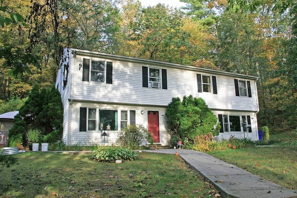
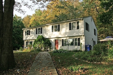
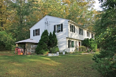
151 Pantry Rd West Hatfield, MA 01088
Estimated payment $3,051/month
About This Home
Rare 2-family duplex, just over the Northampton line. Well maintained 0n wooded lot ( approximately 3.3 acres) and set back nicely from the road. All electric for bothunits and located quietly // yet immediate access to highway travel.
Property Details
Home Type
- Multi-Family
Est. Annual Taxes
- $5,633
Year Built
- Built in 1985
Lot Details
- 3.33 Acre Lot
- Wooded Lot
Home Design
- Duplex
- Manufactured Home on a slab
Interior Spaces
- 2,288 Sq Ft Home
- Property has 2 Levels
Bedrooms and Bathrooms
- 4 Bedrooms
Parking
- 2 Car Parking Spaces
- Off-Street Parking
Utilities
- Private Sewer
Community Details
- 2 Units
- Net Operating Income $14,400
Listing and Financial Details
- Assessor Parcel Number 3625138
Map
Home Values in the Area
Average Home Value in this Area
Tax History
| Year | Tax Paid | Tax Assessment Tax Assessment Total Assessment is a certain percentage of the fair market value that is determined by local assessors to be the total taxable value of land and additions on the property. | Land | Improvement |
|---|---|---|---|---|
| 2025 | $5,663 | $409,200 | $144,900 | $264,300 |
| 2024 | $5,548 | $362,400 | $125,000 | $237,400 |
| 2023 | $4,659 | $345,600 | $118,500 | $227,100 |
| 2022 | $4,342 | $317,600 | $107,300 | $210,300 |
| 2021 | $4,379 | $308,600 | $98,300 | $210,300 |
| 2020 | $4,175 | $308,600 | $98,300 | $210,300 |
| 2019 | $4,070 | $293,000 | $88,000 | $205,000 |
| 2018 | $4,029 | $296,700 | $88,000 | $208,700 |
| 2017 | $3,973 | $300,500 | $88,000 | $212,500 |
| 2016 | $3,961 | $300,500 | $88,000 | $212,500 |
| 2015 | $3,727 | $283,000 | $83,300 | $199,700 |
| 2014 | $3,551 | $280,300 | $78,800 | $201,500 |
Property History
| Date | Event | Price | List to Sale | Price per Sq Ft |
|---|---|---|---|---|
| 09/30/2025 09/30/25 | For Sale | $489,900 | -- | $214 / Sq Ft |
Purchase History
| Date | Type | Sale Price | Title Company |
|---|---|---|---|
| Quit Claim Deed | -- | None Available | |
| Deed | $272,000 | -- | |
| Deed | $165,000 | -- |
Mortgage History
| Date | Status | Loan Amount | Loan Type |
|---|---|---|---|
| Previous Owner | $181,000 | Purchase Money Mortgage | |
| Previous Owner | $131,000 | No Value Available | |
| Previous Owner | $132,000 | Purchase Money Mortgage |
Source: MLS Property Information Network (MLS PIN)
MLS Number: 73437444
APN: HATF-000207-000006
Disclaimer: Certain information contained herein is derived from information provided by parties other than Homes.com. All information provided is deemed reliable, but is not guaranteed to be accurate and should be independently verified.
![]() The property listing data and information, or the Images, set forth herein were provided to MLS Property Information Network, Inc. from third party sources, including sellers, lessors and public records, and were compiled by MLS Property Information Network, Inc. The property listing data and information, and the Images, are for the personal, non-commercial use of consumers having a good faith interest in purchasing or leasing listed properties of the type displayed to them and may not be used for any purpose other than to identify prospective properties which such consumers may have a good faith interest in purchasing or leasing. MLS Property Information Network, Inc. and its subscribers disclaim any and all representations and warranties as to the accuracy of the property listing data and information, or as to the accuracy of any of the Images, set forth herein.
The property listing data and information, or the Images, set forth herein were provided to MLS Property Information Network, Inc. from third party sources, including sellers, lessors and public records, and were compiled by MLS Property Information Network, Inc. The property listing data and information, and the Images, are for the personal, non-commercial use of consumers having a good faith interest in purchasing or leasing listed properties of the type displayed to them and may not be used for any purpose other than to identify prospective properties which such consumers may have a good faith interest in purchasing or leasing. MLS Property Information Network, Inc. and its subscribers disclaim any and all representations and warranties as to the accuracy of the property listing data and information, or as to the accuracy of any of the Images, set forth herein.
- 147 Pantry Rd
- 320 West St
- LOT D Mountain Rd
- 0 Pantry Rd Unit 73430264
- 166 Rocks Rd
- 139 West St Unit 7
- 121 West St
- 0 Straits Rd
- 3 Depot Rd
- 71 Chestnut St
- 34 Gore Ave
- 2B Linseed Rd
- 0 Old Stage Rd Unit 73394977
- 136 Main St
- 0 North St Unit 73407299
- 116 Christian Ln
- 256 River Dr
- 32 Swamp Rd
- 37 N Farms Rd
- 21 Dwight St
- 177 West St
- 28 Stockbridge St
- 28 River Rd
- 26 Hadley Rd Unit 26 Hadley Rd
- 312-380 Hatfield St
- 80 Damon Rd Unit 7-306
- 653 Amherst Rd
- 279 Amherst Rd
- 253 Amherst Rd
- 248 Amherst Rd
- 73 Barrett St
- 15G Brandywine
- 36 N Maple St
- 74 Barrett St Unit 306 Coachlight
- 171 N Main St Unit 2 fl
- 6 Graves St Unit D
- 43 Bates St Unit 2
- 43 Bates St Unit 1
- 23 N Maple St
- 25 Graves St
