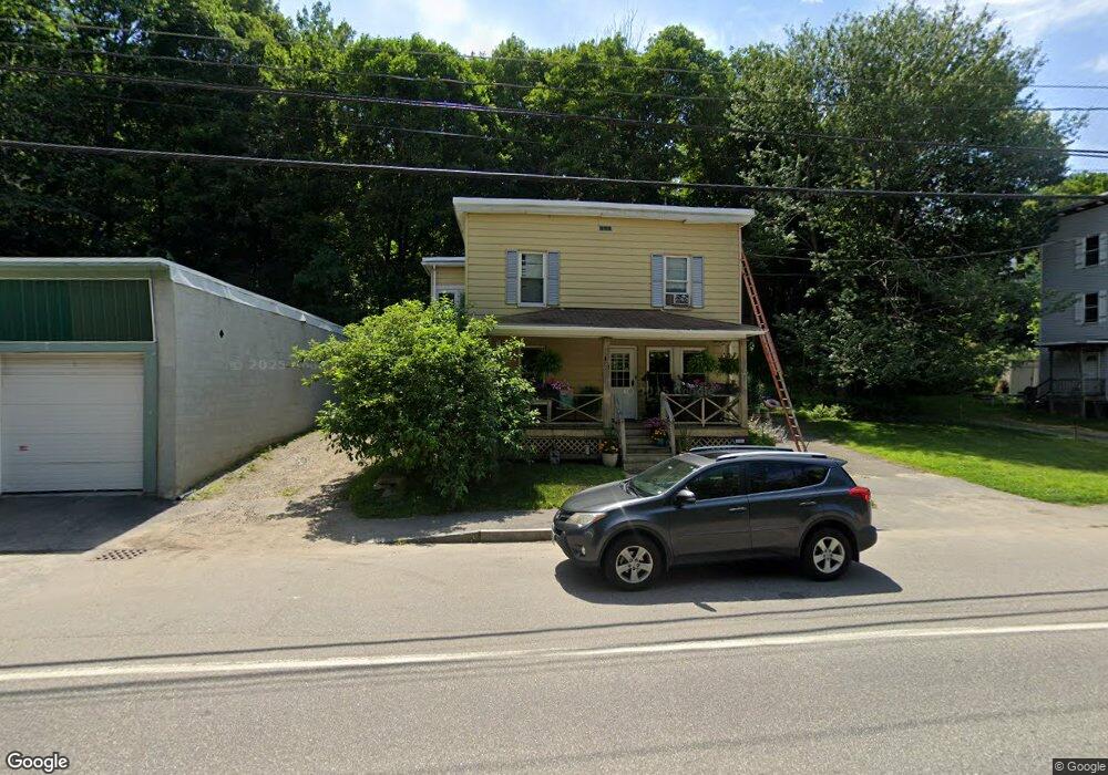
151 Riverside Dr Auburn, ME 04210
Estimated Value: $260,607 - $414,000
7
Beds
2
Baths
2,396
Sq Ft
$142/Sq Ft
Est. Value
About This Home
This home is located at 151 Riverside Dr, Auburn, ME 04210 and is currently estimated at $340,652, approximately $142 per square foot. 151 Riverside Dr is a home located in Androscoggin County with nearby schools including Walton School, Auburn Middle School, and Edward Little High School.
Ownership History
Date
Name
Owned For
Owner Type
Purchase Details
Closed on
May 19, 2023
Sold by
Major Michael J
Bought by
Mahan Sarah E
Current Estimated Value
Home Financials for this Owner
Home Financials are based on the most recent Mortgage that was taken out on this home.
Original Mortgage
$152,000
Outstanding Balance
$146,679
Interest Rate
6.28%
Mortgage Type
Purchase Money Mortgage
Estimated Equity
$193,973
Purchase Details
Closed on
Jul 31, 2006
Sold by
Curry Charles K
Bought by
Callahan Timothy D
Home Financials for this Owner
Home Financials are based on the most recent Mortgage that was taken out on this home.
Original Mortgage
$101,900
Interest Rate
6.67%
Mortgage Type
Purchase Money Mortgage
Create a Home Valuation Report for This Property
The Home Valuation Report is an in-depth analysis detailing your home's value as well as a comparison with similar homes in the area
Home Values in the Area
Average Home Value in this Area
Purchase History
| Date | Buyer | Sale Price | Title Company |
|---|---|---|---|
| Mahan Sarah E | $160,000 | None Available | |
| Callahan Timothy D | -- | -- | |
| Callahan Timothy D | -- | -- |
Source: Public Records
Mortgage History
| Date | Status | Borrower | Loan Amount |
|---|---|---|---|
| Open | Mahan Sarah E | $152,000 | |
| Previous Owner | Callahan Timothy D | $1,755 | |
| Previous Owner | Callahan Timothy D | $10,000 | |
| Previous Owner | Callahan Timothy D | $5,000 | |
| Previous Owner | Callahan Timothy D | $101,900 | |
| Previous Owner | Callahan Timothy D | $38,478 |
Source: Public Records
Tax History
| Year | Tax Paid | Tax Assessment Tax Assessment Total Assessment is a certain percentage of the fair market value that is determined by local assessors to be the total taxable value of land and additions on the property. | Land | Improvement |
|---|---|---|---|---|
| 2025 | $4,114 | $179,800 | $35,000 | $144,800 |
| 2024 | $4,001 | $179,800 | $35,000 | $144,800 |
| 2023 | $3,645 | $160,200 | $31,100 | $129,100 |
| 2022 | $3,046 | $133,900 | $25,900 | $108,000 |
| 2021 | $3,189 | $133,900 | $25,900 | $108,000 |
| 2020 | $3,107 | $130,800 | $25,900 | $104,900 |
| 2019 | $3,107 | $130,800 | $25,900 | $104,900 |
| 2018 | $3,097 | $130,800 | $25,900 | $104,900 |
| 2017 | $3,007 | $130,800 | $25,900 | $104,900 |
| 2016 | $2,923 | $130,800 | $25,900 | $104,900 |
| 2015 | $2,780 | $130,800 | $25,900 | $104,900 |
| 2013 | -- | $130,800 | $25,900 | $104,900 |
Source: Public Records
Map
Nearby Homes
- 147 Riverside Dr
- 176 Second St
- 153 Riverside Dr
- 180 Second St
- 180 Second St Unit 1
- 10 Brook St
- 6 Brook St
- 144 Riverside Dr
- 188 Second St
- 193 Second St
- 193 Second St Unit and
- 20 Brook St
- 137 Riverside Dr
- 155 2nd St
- 24 Brook St
- 160 Third St
- 130 Riverside Dr
- 125 Riverside Dr
- 126 Riverside Dr
- 127 Riverside Dr
Your Personal Tour Guide
Ask me questions while you tour the home.