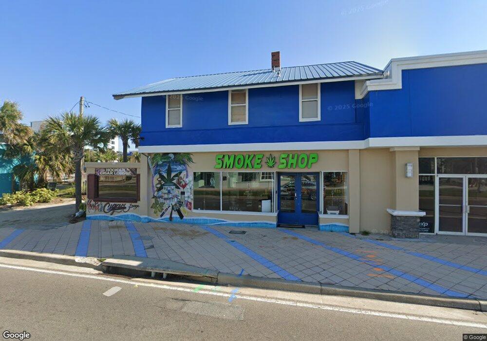
151 S Atlantic Ave Daytona Beach, FL 32118
Estimated Value: $420,795
--
Bed
2
Baths
1,739
Sq Ft
$242/Sq Ft
Est. Value
About This Home
This home is located at 151 S Atlantic Ave, Daytona Beach, FL 32118 and is currently estimated at $420,795, approximately $241 per square foot. 151 S Atlantic Ave is a home located in Volusia County with nearby schools including R.J. Longstreet Elementary School, Campbell Middle School, and Mainland High School.
Ownership History
Date
Name
Owned For
Owner Type
Purchase Details
Closed on
Jun 28, 2021
Sold by
Proxbrownfneld Inc
Bought by
Sandals Us Llc
Current Estimated Value
Purchase Details
Closed on
Apr 4, 2001
Sold by
Hannan Tim
Bought by
Kucharzyk Leonard and Nesbitt Joan
Purchase Details
Closed on
Apr 15, 1992
Bought by
Strange Pamela
Purchase Details
Closed on
Oct 15, 1976
Bought by
Strange Pamela
Create a Home Valuation Report for This Property
The Home Valuation Report is an in-depth analysis detailing your home's value as well as a comparison with similar homes in the area
Home Values in the Area
Average Home Value in this Area
Purchase History
| Date | Buyer | Sale Price | Title Company |
|---|---|---|---|
| Sandals Us Llc | $350,000 | Attorney | |
| Kucharzyk Leonard | $200,000 | -- | |
| Strange Pamela | $190,000 | -- | |
| Strange Pamela | $65,000 | -- |
Source: Public Records
Tax History Compared to Growth
Tax History
| Year | Tax Paid | Tax Assessment Tax Assessment Total Assessment is a certain percentage of the fair market value that is determined by local assessors to be the total taxable value of land and additions on the property. | Land | Improvement |
|---|---|---|---|---|
| 2025 | $3,563 | $217,034 | $115,864 | $101,170 |
| 2024 | $3,563 | $200,798 | $69,650 | $131,148 |
| 2023 | $3,563 | $198,766 | $69,650 | $129,116 |
| 2022 | $3,387 | $186,353 | $69,650 | $116,703 |
| 2021 | $2,554 | $132,104 | $67,163 | $64,941 |
| 2020 | $2,660 | $137,400 | $67,163 | $70,237 |
| 2019 | $2,633 | $133,867 | $67,163 | $66,704 |
| 2018 | $2,707 | $132,960 | $64,675 | $68,285 |
| 2017 | $2,488 | $142,296 | $0 | $0 |
| 2016 | $2,161 | $139,369 | $0 | $0 |
| 2015 | $2,246 | $138,400 | $0 | $0 |
| 2014 | $2,243 | $137,302 | $0 | $0 |
Source: Public Records
Map
Nearby Homes
- 0 S Atlantic Ave
- 0 S Ocean Ave
- 219 S Atlantic Ave Unit 108
- 219 S Atlantic Ave Unit 120
- 219 S Atlantic Ave Unit 333
- 219 S Atlantic Ave Unit 235
- 219 S Atlantic Ave Unit 206
- 219 S Atlantic Ave Unit 204
- 219 S Atlantic Ave Unit 208
- 219 S Atlantic Ave Unit 409
- 219 S Atlantic Ave Unit 135
- 219 S Atlantic Ave Unit 207
- 219 S Atlantic Ave Unit 112
- 219 S Atlantic Ave Unit 338
- 219 S Atlantic Ave Unit 408
- 129 S Wild Olive Ave
- 313 S Atlantic Ave Unit 411
- 313 S Atlantic Ave Unit 631
- 313 S Atlantic Ave Unit 202/204
- 313 S Atlantic Ave Unit 629
- 143 S Atlantic Ave
- 140 S Atlantic Ave
- 153 S Ocean Ave
- 146 S Coates St
- 156 S Coates St
- 142 S Coates St
- 150 S Coates St
- 136 S Coates St
- 128 S Atlantic Ave
- 0 S Atlantic Ave Unit 2 MFRV4940897
- 209 S Atlantic Ave
- 114 S Ocean Ave
- 103 S Ocean Ave
- 706 5th Ave
- 116 Ocean Cir
- 147 S Grandview Ave
- 108 S Ocean Ave
- 215 S Grandview Ave
- 219 S Atlantic Ave
- 219 S Atlantic Ave Unit 219
