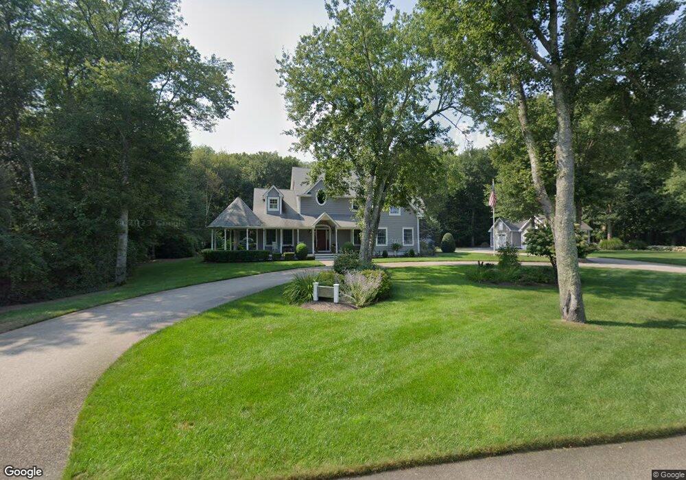
151 S Pier Rd Narragansett, RI 02882
Estimated Value: $1,508,000 - $2,138,000
4
Beds
4
Baths
2,800
Sq Ft
$649/Sq Ft
Est. Value
About This Home
This home is located at 151 S Pier Rd, Narragansett, RI 02882 and is currently estimated at $1,818,215, approximately $649 per square foot. 151 S Pier Rd is a home located in Washington County with nearby schools including Narragansett Elementary School, Narragansett Pier Middle School, and Narragansett High School.
Ownership History
Date
Name
Owned For
Owner Type
Purchase Details
Closed on
Sep 1, 2016
Sold by
Tikoian M Elizabeth
Bought by
Tikoian M Elizabeth
Current Estimated Value
Purchase Details
Closed on
Jun 5, 2002
Sold by
Rycal Llc
Bought by
Tikoian Michael M and Elizabeth Tikoian M
Create a Home Valuation Report for This Property
The Home Valuation Report is an in-depth analysis detailing your home's value as well as a comparison with similar homes in the area
Home Values in the Area
Average Home Value in this Area
Purchase History
| Date | Buyer | Sale Price | Title Company |
|---|---|---|---|
| Tikoian M Elizabeth | -- | -- | |
| Tikoian M Elizabeth | -- | -- | |
| Tikoian Michael M | $143,500 | -- |
Source: Public Records
Mortgage History
| Date | Status | Borrower | Loan Amount |
|---|---|---|---|
| Previous Owner | Tikoian Michael M | $290,000 | |
| Previous Owner | Tikoian Michael M | $250,000 | |
| Previous Owner | Tikoian Michael M | $260,000 |
Source: Public Records
Tax History Compared to Growth
Tax History
| Year | Tax Paid | Tax Assessment Tax Assessment Total Assessment is a certain percentage of the fair market value that is determined by local assessors to be the total taxable value of land and additions on the property. | Land | Improvement |
|---|---|---|---|---|
| 2025 | $10,330 | $1,521,400 | $726,800 | $794,600 |
| 2024 | $9,923 | $1,515,000 | $726,800 | $788,200 |
| 2023 | $9,622 | $1,033,500 | $494,600 | $538,900 |
| 2022 | $9,302 | $1,033,500 | $494,600 | $538,900 |
| 2021 | $9,157 | $1,033,500 | $494,600 | $538,900 |
| 2020 | $8,180 | $780,500 | $372,800 | $407,700 |
| 2019 | $7,985 | $780,500 | $372,800 | $407,700 |
| 2018 | $7,766 | $780,500 | $372,800 | $407,700 |
| 2017 | $7,795 | $738,200 | $339,100 | $399,100 |
| 2016 | $7,293 | $723,500 | $339,100 | $384,400 |
| 2015 | $7,192 | $723,500 | $339,100 | $384,400 |
| 2014 | $7,271 | $724,200 | $339,100 | $385,100 |
Source: Public Records
Map
Nearby Homes
- 140 S Pier Rd
- 126 Boon St
- 137 Kingstown Rd
- 49 Westmoreland St
- 137A Kingstown Rd
- 16 Courtway St
- 56 Wanda St
- 27 Westmoreland St
- 20 Narragansett Ave Unit 905
- 30 Sweet Meadows Ct Unit 26
- 6 Pendleton Place
- 0 Hazard Ave
- 38 Eisenhower Place
- 128 Camden Ct
- 19 Castle Rd
- 73 Camden Ct
- 45 Cherry Ln Unit C
- 39 Hazard Ave
- 576 Point Judith Rd
- 98 Meadow Ave
- 0 Black Alder Trail Unit 108282
- 0 Black Alder Trail Unit 103273
- 0 Black Alder Trail Unit 632137
- 0 Black Alder Trail Unit 9081
- 0 Black Alder Trail Unit 754247
- 0 Black Alder Trail Unit 540675
- 0 Black Alder Trail Unit 830677
- 0 Black Alder Trail Unit 930569
- 0 Black Alder Trail Unit 996804
- 0 Ouida St Unit 1011594
- 0 Devigne St Unit 1011593
- 0 Parkway Dr Unit 1050924
- 31 Banfield Ln
- 0 Norman Dr Unit 1135463
- 111 Kenyon Farm #4 Rd
- 101 Kenyon Farm #5 Rd
- 115 Kenyon Farm Rd
- 0 Sylvan Lot #22 Rd Unit 1315616
- 4 Hoberg St
- 145 S Pier Rd