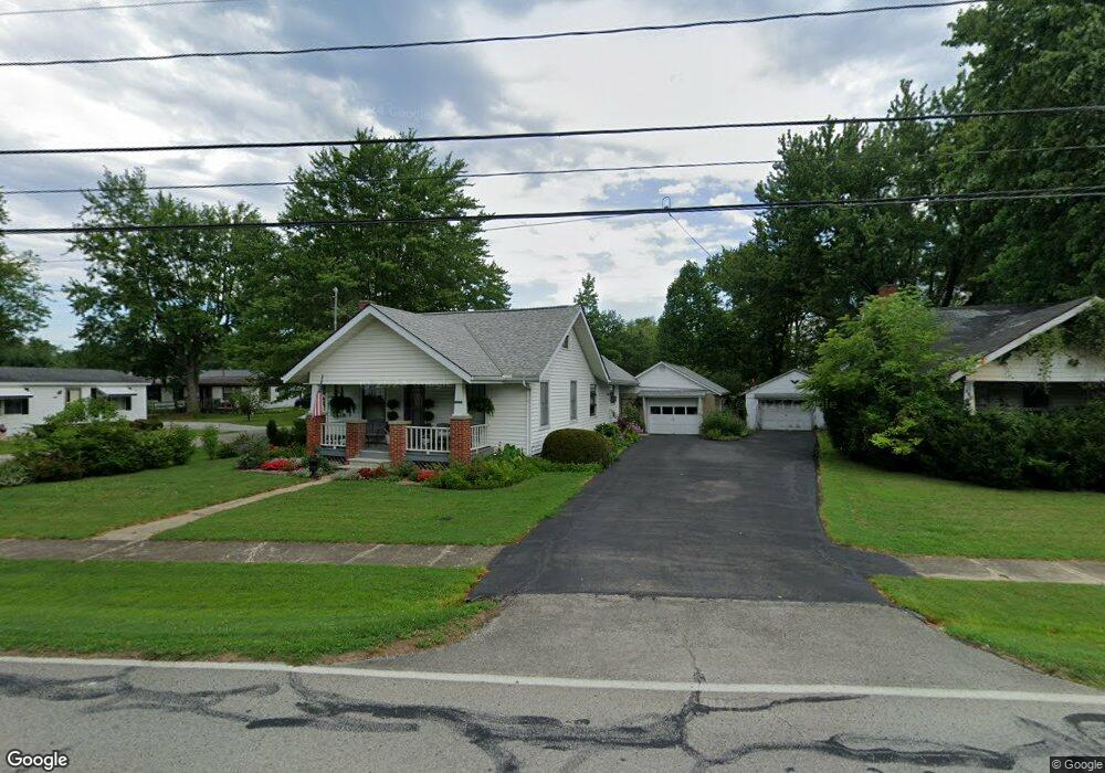
151 Sardinia Mowrystwn Rd Sardinia, OH 45171
Estimated Value: $127,845 - $200,000
2
Beds
1
Bath
1,300
Sq Ft
$123/Sq Ft
Est. Value
About This Home
This home is located at 151 Sardinia Mowrystwn Rd, Sardinia, OH 45171 and is currently estimated at $159,961, approximately $123 per square foot. 151 Sardinia Mowrystwn Rd is a home located in Brown County with nearby schools including Sardinia Elementary School, Russellville Elementary School, and Eastern Middle School.
Ownership History
Date
Name
Owned For
Owner Type
Purchase Details
Closed on
Aug 16, 2007
Sold by
Hud
Bought by
Barton Thomas James
Current Estimated Value
Home Financials for this Owner
Home Financials are based on the most recent Mortgage that was taken out on this home.
Original Mortgage
$51,900
Outstanding Balance
$8,503
Interest Rate
6.77%
Mortgage Type
Unknown
Estimated Equity
$151,458
Purchase Details
Closed on
Dec 29, 2006
Sold by
Bradford Dustin and Schneider Stacey R
Bought by
Hud
Purchase Details
Closed on
Aug 5, 2004
Sold by
Campbell Betty J
Bought by
Bradford Dustin and Schneider Stacy R
Home Financials for this Owner
Home Financials are based on the most recent Mortgage that was taken out on this home.
Original Mortgage
$77,418
Interest Rate
6.35%
Mortgage Type
FHA
Create a Home Valuation Report for This Property
The Home Valuation Report is an in-depth analysis detailing your home's value as well as a comparison with similar homes in the area
Home Values in the Area
Average Home Value in this Area
Purchase History
| Date | Buyer | Sale Price | Title Company |
|---|---|---|---|
| Barton Thomas James | $57,900 | Lakeside Title & Escrow Agen | |
| Hud | $65,000 | None Available | |
| Bradford Dustin | $78,633 | -- |
Source: Public Records
Mortgage History
| Date | Status | Borrower | Loan Amount |
|---|---|---|---|
| Open | Barton Thomas James | $51,900 | |
| Previous Owner | Bradford Dustin | $77,418 |
Source: Public Records
Tax History Compared to Growth
Tax History
| Year | Tax Paid | Tax Assessment Tax Assessment Total Assessment is a certain percentage of the fair market value that is determined by local assessors to be the total taxable value of land and additions on the property. | Land | Improvement |
|---|---|---|---|---|
| 2024 | $1,066 | $30,850 | $1,200 | $29,650 |
| 2023 | $1,066 | $23,830 | $1,020 | $22,810 |
| 2022 | $886 | $23,830 | $1,020 | $22,810 |
| 2021 | $878 | $23,830 | $1,020 | $22,810 |
| 2020 | $794 | $20,720 | $890 | $19,830 |
| 2019 | $789 | $20,720 | $890 | $19,830 |
| 2018 | $783 | $20,720 | $890 | $19,830 |
| 2017 | $676 | $18,220 | $970 | $17,250 |
| 2016 | $676 | $18,220 | $970 | $17,250 |
| 2015 | $711 | $18,220 | $970 | $17,250 |
| 2014 | $711 | $18,140 | $890 | $17,250 |
| 2013 | $709 | $18,140 | $890 | $17,250 |
Source: Public Records
Map
Nearby Homes
- 159 Sardinia-Mowrystown Rd
- 0 Horse Shoe Dr Unit 1857810
- 1 Duncanson Rd
- 874 Waynoka Dr
- 151 Winchester St
- 175 Winchester St
- 7450 King Rd
- 6 Mohican Cove
- 9 E Mohican Cove
- 20 W Mohican Cove
- 0 Mochican Cove Unit 1833148
- 0 Creek - Lot# 2795 Dr Unit 1803735
- 129 N Main St
- 0 Sitting Bull Dr Unit 1845345
- Ac Bachman Rd
- 0 N St Rt 32 Unit 1745639
- 7603 Tricounty Hwy
- 13427 Stieman Rd
- 0 Duncanson Rd Unit 5150881
- 0 Duncanson Rd Unit 5150848
- 153 Sardinia Mowrystwn Rd
- 107 Thompson St
- 159 Sardinia Mowrystwn Rd
- 150 Sardinia Mowrystwn Rd
- 110 Thompson St
- 111 Thompson St
- 140 Sardinia-Mowrystown Rd
- 146 Sardinia Mowrystwn Rd
- 141 Sardinia Mowrystwn Rd
- 114 Thompson St
- 154 Sardinia Mowrystwn Rd
- 141 Sardinia-Mowrystown Rd
- 141 Mowrystown Rd
- 110 Kelly St
- 113 Thompson St
- 144 Sardinia Mowrystwn Rd
- 112 Kelly St
- 140 Sardinia Mowrystwn Rd
- 115 Thompson St
- 163 Sardinia Mowrystwn Rd