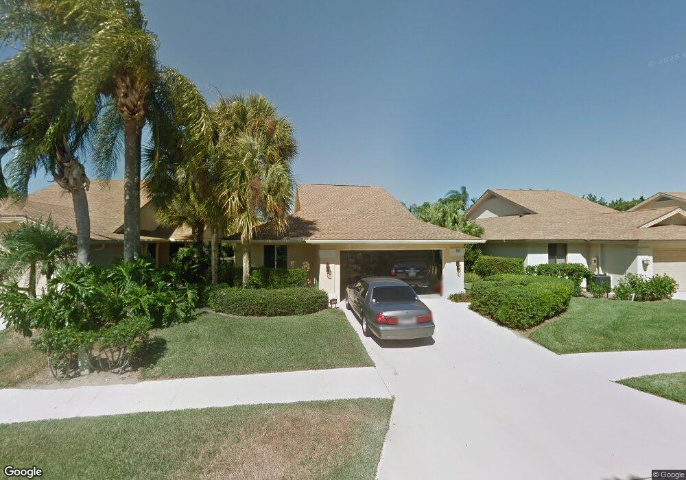
151 Seashore Dr Jupiter, FL 33477
The Bluffs NeighborhoodEstimated Value: $912,000 - $1,127,000
3
Beds
2
Baths
1,889
Sq Ft
$529/Sq Ft
Est. Value
About This Home
This home is located at 151 Seashore Dr, Jupiter, FL 33477 and is currently estimated at $999,907, approximately $529 per square foot. 151 Seashore Dr is a home located in Palm Beach County with nearby schools including William T. Dwyer High School, Lighthouse Elementary School, and Beacon Cove Intermediate School.
Ownership History
Date
Name
Owned For
Owner Type
Purchase Details
Closed on
Jun 12, 2017
Sold by
Falsetti Sharen A and Soli Robert R
Bought by
Soli Robert R and Falsetti Sharen A
Current Estimated Value
Purchase Details
Closed on
Sep 27, 2011
Sold by
Robinson Michael
Bought by
Falsetti Sharen A
Purchase Details
Closed on
Apr 24, 1998
Sold by
Bellemare Richard W and Bellemare Maria F
Bought by
Falsetti Sharen A
Home Financials for this Owner
Home Financials are based on the most recent Mortgage that was taken out on this home.
Original Mortgage
$95,000
Interest Rate
7.09%
Mortgage Type
New Conventional
Create a Home Valuation Report for This Property
The Home Valuation Report is an in-depth analysis detailing your home's value as well as a comparison with similar homes in the area
Home Values in the Area
Average Home Value in this Area
Purchase History
| Date | Buyer | Sale Price | Title Company |
|---|---|---|---|
| Soli Robert R | -- | Attorney | |
| Falsetti Sharen A | -- | Attorney | |
| Falsetti Sharen A | $140,000 | -- |
Source: Public Records
Mortgage History
| Date | Status | Borrower | Loan Amount |
|---|---|---|---|
| Previous Owner | Falsetti Sharen A | $95,000 |
Source: Public Records
Tax History
| Year | Tax Paid | Tax Assessment Tax Assessment Total Assessment is a certain percentage of the fair market value that is determined by local assessors to be the total taxable value of land and additions on the property. | Land | Improvement |
|---|---|---|---|---|
| 2025 | $3,522 | $243,185 | -- | -- |
| 2024 | $3,522 | $236,331 | -- | -- |
| 2023 | $3,462 | $229,448 | $0 | $0 |
| 2022 | $3,448 | $222,765 | $0 | $0 |
| 2021 | $3,343 | $212,465 | $0 | $0 |
| 2020 | $3,335 | $209,532 | $0 | $0 |
| 2019 | $3,291 | $204,821 | $0 | $0 |
| 2018 | $3,122 | $201,002 | $0 | $0 |
| 2017 | $3,108 | $196,868 | $0 | $0 |
| 2016 | $3,108 | $192,819 | $0 | $0 |
| 2015 | $3,184 | $191,479 | $0 | $0 |
| 2014 | $3,225 | $189,959 | $0 | $0 |
Source: Public Records
Map
Nearby Homes
- 3038 30th Ct
- 125 Seashore Dr
- 3071 30th Ct
- 181 Cape Pointe Cir
- 246 Ridge Rd
- 238 River Park Dr
- 125 Cape Pointe Cir
- 126 Cape Pointe Cir
- 329 Leeward Dr
- 316 River Edge Rd
- 401 Ocean Bluffs Blvd Unit 2050
- 401 Ocean Bluffs Blvd Unit 4020
- 115 Olympus Way
- 334 Leeward Dr
- 228 Ridge Rd
- 121 Olympus Way
- 125 Sand Pine Dr
- 123 Olympus Way
- 2000 S Highway A1a Unit N507
- 2000 S Highway A1a Unit N302
- 153 Seashore Dr
- 149 Seashore Dr
- 155 Seashore Dr
- 147 Seashore Dr
- 157 Seashore Dr
- 145 Seashore Dr
- 152 Seashore Dr
- 154 Seashore Dr
- 150 Seashore Dr
- 156 Seashore Dr
- 143 Seashore Dr
- 148 Seashore Dr
- 159 Seashore Dr
- 158 Seashore Dr
- 141 Seashore Dr
- 160 Seashore Dr
- 161 Seashore Dr
- 101 Knoll Way
- 162 Seashore Dr
- 139 Seashore Dr
Your Personal Tour Guide
Ask me questions while you tour the home.