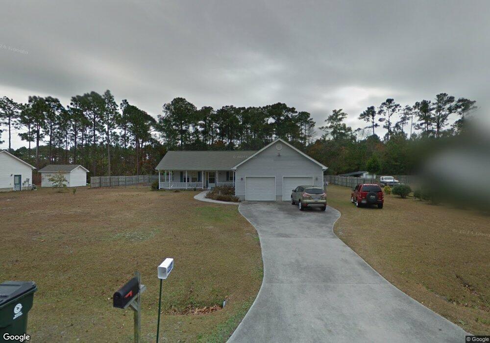
151 Sir Christopher Dr Newport, NC 28570
Estimated Value: $350,000 - $376,000
3
Beds
2
Baths
1,628
Sq Ft
$220/Sq Ft
Est. Value
About This Home
This home is located at 151 Sir Christopher Dr, Newport, NC 28570 and is currently estimated at $358,821, approximately $220 per square foot. 151 Sir Christopher Dr is a home located in Carteret County with nearby schools including Bogue Sound Elementary School, Broad Creek Middle School, and Croatan High School.
Ownership History
Date
Name
Owned For
Owner Type
Purchase Details
Closed on
Jun 2, 2025
Sold by
Young Kathryn M and Munn Young Kathryn
Bought by
Young Kathryn Munn and Kevin Ashley Young Revocable Trust
Current Estimated Value
Purchase Details
Closed on
Feb 24, 2005
Sold by
Young Gary Trent
Bought by
Young Kathryn M
Create a Home Valuation Report for This Property
The Home Valuation Report is an in-depth analysis detailing your home's value as well as a comparison with similar homes in the area
Home Values in the Area
Average Home Value in this Area
Purchase History
| Date | Buyer | Sale Price | Title Company |
|---|---|---|---|
| Young Kathryn Munn | -- | None Listed On Document | |
| Young Kathryn Munn | -- | None Listed On Document | |
| Young Kathryn M | -- | None Available |
Source: Public Records
Tax History Compared to Growth
Tax History
| Year | Tax Paid | Tax Assessment Tax Assessment Total Assessment is a certain percentage of the fair market value that is determined by local assessors to be the total taxable value of land and additions on the property. | Land | Improvement |
|---|---|---|---|---|
| 2025 | $1,151 | $345,296 | $69,192 | $276,104 |
| 2024 | $934 | $189,967 | $47,093 | $142,874 |
| 2023 | $347 | $189,967 | $47,093 | $142,874 |
| 2022 | $989 | $189,967 | $47,093 | $142,874 |
| 2021 | $198 | $189,967 | $47,093 | $142,874 |
| 2020 | $959 | $189,967 | $47,093 | $142,874 |
| 2019 | $740 | $185,840 | $37,179 | $148,661 |
| 2017 | $905 | $185,840 | $37,179 | $148,661 |
| 2016 | $740 | $185,840 | $37,179 | $148,661 |
| 2015 | $684 | $185,840 | $37,179 | $148,661 |
| 2014 | $708 | $192,515 | $47,088 | $145,427 |
Source: Public Records
Map
Nearby Homes
- 121 Guthrie Dr
- 145 Alston Ave
- 111 Hampton Place
- 108 Eudora Dr
- 119 Eudora Dr
- 106 Barbour Dr
- 110 Soundview Dr
- 202 Jones Ridge Ln
- 114 Bluewater Cir
- 265 Bay Run
- 227 Jones Ridge Ln
- 281 Bay Run
- 107 Cribbs Ln
- 421 Old Swansboro Rd
- 126 Bobs Ln
- 676 Broad Creek Loop Rd
- 120 Colony St
- 213 Nine Mile Rd
- 142 Sunny Point Ln
- 680 Broad Creek Loop Rd
- 139 Sir Christopher Dr
- 159 Sir Christopher Dr
- 142 Sir Christopher Dr
- 146 Nicks Ave
- 129 Christopher Dr
- 129 Sir Christopher Dr
- 130 Sir Christopher Dr
- 178 Sir Christopher Dr
- 127 Nicks Ave
- 141 Guthrie Dr
- 158 Nicks Ave
- 119 Sir Christopher Dr
- 120 Sir Christopher Dr
- 167 Guthrie Dr
- 190 Sir Christopher Dr
- 129 Guthrie Dr
- 191 Sir Christopher Dr
- 177 Guthrie Dr
- 114 Sir Christopher Dr
- 412 George Taylor Rd