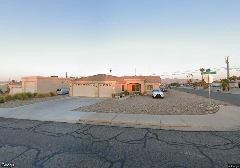
151 Smoketree Ave S Lake Havasu City, AZ 86403
Estimated Value: $395,000 - $596,000
3
Beds
2
Baths
1,533
Sq Ft
$321/Sq Ft
Est. Value
About This Home
This home is located at 151 Smoketree Ave S, Lake Havasu City, AZ 86403 and is currently estimated at $492,472, approximately $321 per square foot. 151 Smoketree Ave S is a home located in Mohave County with nearby schools including Smoketree Elementary School, Thunderbolt Middle School, and Lake Havasu High School.
Ownership History
Date
Name
Owned For
Owner Type
Purchase Details
Closed on
Jun 26, 2025
Sold by
Vo Bay T
Bought by
Vo Bay T and Vu Tin Ngoc Tri
Current Estimated Value
Purchase Details
Closed on
Oct 9, 2008
Sold by
Segura Mark E
Bought by
Vo Bay T
Home Financials for this Owner
Home Financials are based on the most recent Mortgage that was taken out on this home.
Original Mortgage
$225,000
Interest Rate
6.31%
Mortgage Type
Seller Take Back
Purchase Details
Closed on
Feb 6, 2006
Sold by
Horvath Arthur J
Bought by
Segura Ii Mark E and Segura Julie Ann
Home Financials for this Owner
Home Financials are based on the most recent Mortgage that was taken out on this home.
Original Mortgage
$57,000
Interest Rate
6.15%
Mortgage Type
Seller Take Back
Create a Home Valuation Report for This Property
The Home Valuation Report is an in-depth analysis detailing your home's value as well as a comparison with similar homes in the area
Home Values in the Area
Average Home Value in this Area
Purchase History
| Date | Buyer | Sale Price | Title Company |
|---|---|---|---|
| Vo Bay T | -- | None Listed On Document | |
| Vo Bay T | $250,000 | First American Title Insuran | |
| Segura Ii Mark E | $107,000 | Chicago Title Insurance Co |
Source: Public Records
Mortgage History
| Date | Status | Borrower | Loan Amount |
|---|---|---|---|
| Previous Owner | Vo Bay T | $225,000 | |
| Previous Owner | Segura Ii Mark E | $57,000 |
Source: Public Records
Tax History Compared to Growth
Tax History
| Year | Tax Paid | Tax Assessment Tax Assessment Total Assessment is a certain percentage of the fair market value that is determined by local assessors to be the total taxable value of land and additions on the property. | Land | Improvement |
|---|---|---|---|---|
| 2026 | $765 | -- | -- | -- |
| 2025 | $1,549 | $32,013 | $0 | $0 |
| 2024 | $1,549 | $46,052 | $0 | $0 |
| 2023 | $1,549 | $34,468 | $0 | $0 |
| 2022 | $1,492 | $29,220 | $0 | $0 |
| 2021 | $1,692 | $25,762 | $0 | $0 |
| 2019 | $1,608 | $23,392 | $0 | $0 |
| 2018 | $1,554 | $22,517 | $0 | $0 |
| 2017 | $1,528 | $22,039 | $0 | $0 |
| 2016 | $1,354 | $20,086 | $0 | $0 |
| 2015 | $1,318 | $18,184 | $0 | $0 |
Source: Public Records
Map
Nearby Homes
- 211 Columbine Dr
- 1939 Pine Ln
- 1962 Cliffrose Dr
- 1775 Los Lagos Dr Unit B
- 1771 Los Lagos Dr Unit D
- 1926 Swanson Ave
- 1910 Swanson Ave Unit A22
- 1910 Swanson Ave Unit B11
- 1910 Swanson Ave Unit B19
- 1786 Los Lagos Dr Unit A
- 1793 Montana Vista Unit C
- 189 Sunflower Dr
- 276 Lake Havasu Ave N Unit B18
- 276 Lake Havasu Ave N Unit C19
- 276 Lake Havasu Ave N Unit C2
- 276 Lake Havasu Ave N Unit B10
- 276 Lake Havasu Ave N Unit C22
- 1806 Swanson Ave Unit 205
- 1806 Swanson Ave Unit 103
- 1806 Swanson Ave Unit 226
- 159 Smoketree Ave S
- 1800 Cliffrose Dr
- 158 Columbine Dr
- 1871 Cliffrose Dr
- 167 Smoketree Ave S
- 1849 Cliffrose Dr
- 166 Columbine Dr
- 150 Smoketree Ave S
- 2291 Caboose
- 158 Smoketree Ave S
- 1827 Cliffrose Dr
- 1927 Cliffrose Dr
- 174 Columbine Dr
- 147 Smoketree Ave S
- 1794 Cliffrose Dr
- 1940 Cliffrose Dr
- 1864 Beavertail Dr
- 1799 Cliffrose Dr
- 1911 Poplar Dr
- 136 Smoketree Ave S