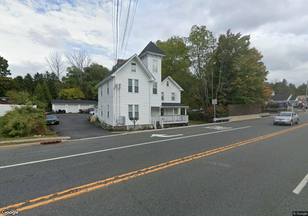
151 State Route 183 Unit 3 Stanhope, NJ 07874
Estimated Value: $513,000 - $806,529
1
Bed
1
Bath
2,846
Sq Ft
$227/Sq Ft
Est. Value
About This Home
This home is located at 151 State Route 183 Unit 3, Stanhope, NJ 07874 and is currently estimated at $644,632, approximately $226 per square foot. 151 State Route 183 Unit 3 is a home located in Sussex County with nearby schools including Valley Road School and Lenape Val Regional High School.
Ownership History
Date
Name
Owned For
Owner Type
Purchase Details
Closed on
May 11, 2022
Sold by
David Beck
Bought by
Dimatteo Liberto and Dimatteo Tricia
Current Estimated Value
Home Financials for this Owner
Home Financials are based on the most recent Mortgage that was taken out on this home.
Original Mortgage
$510,000
Interest Rate
5%
Mortgage Type
New Conventional
Purchase Details
Closed on
Mar 18, 2021
Sold by
Maynard Jan M and Maynard Jennifer M
Bought by
Beck David
Create a Home Valuation Report for This Property
The Home Valuation Report is an in-depth analysis detailing your home's value as well as a comparison with similar homes in the area
Home Values in the Area
Average Home Value in this Area
Purchase History
| Date | Buyer | Sale Price | Title Company |
|---|---|---|---|
| Dimatteo Liberto | $705,000 | Malhorta Karan | |
| Beck David | $330,000 | Land Quest Title Llc | |
| Beck David | $330,000 | New Title Company Name |
Source: Public Records
Mortgage History
| Date | Status | Borrower | Loan Amount |
|---|---|---|---|
| Previous Owner | Dimatteo Liberto | $510,000 |
Source: Public Records
Tax History Compared to Growth
Tax History
| Year | Tax Paid | Tax Assessment Tax Assessment Total Assessment is a certain percentage of the fair market value that is determined by local assessors to be the total taxable value of land and additions on the property. | Land | Improvement |
|---|---|---|---|---|
| 2025 | $12,951 | $286,900 | $55,200 | $231,700 |
| 2024 | $12,695 | $286,900 | $55,200 | $231,700 |
| 2023 | $12,695 | $286,900 | $55,200 | $231,700 |
| 2022 | $10,442 | $241,500 | $55,200 | $186,300 |
| 2021 | $10,387 | $241,500 | $55,200 | $186,300 |
| 2020 | $10,240 | $241,500 | $55,200 | $186,300 |
| 2019 | $10,039 | $241,500 | $55,200 | $186,300 |
| 2018 | $9,933 | $241,500 | $55,200 | $186,300 |
| 2017 | $9,822 | $241,500 | $55,200 | $186,300 |
| 2016 | $9,691 | $241,500 | $55,200 | $186,300 |
| 2015 | $9,329 | $241,500 | $55,200 | $186,300 |
| 2014 | $9,076 | $241,500 | $55,200 | $186,300 |
Source: Public Records
Map
Nearby Homes
- 3 James St
- 25 Dell Rd
- 189 Stonegate Ln
- Griffin Hall Plan at Mount Olive Grove - Carriage Homes
- 49 Brooklyn Rd
- 60 Silas Rd Unit H
- 16-18 King St
- 695 Audubon Ct Unit D95
- Sonata Plan at Mount Olive Grove - Towns
- Lehigh Plan at Mount Olive Grove - Singles
- Columbia Plan at Mount Olive Grove - Singles
- Hudson Plan at Mount Olive Grove - Singles
- 81 Main St
- 79 Main St
- 74 Main St
- 14265 Dell Place Unit 265
- 14250 Dell Place
- 52 River Rd
- 28 Acorn St
- 2 Roberts Place
- 151 State Route 183
- 151 State Route 183 Unit B
- 151 State Route 183 Unit C
- 149 151 State Route 183
- 149 State Route 183
- 149 New Jersey 183
- 1 Dell Rd
- 3 Dell Rd
- 5 Dell Rd
- 141 New Jersey 183
- 141 State Route 183
- 4 Dell Rd
- 7 Dell Rd
- 6 Dell Rd
- 8 Dell Rd
- 2 Young Dr
- 129 New Jersey 183
- 129 New Jersey 183 Unit 129
- 20 Elizabeth Ave
- 4 Young Dr