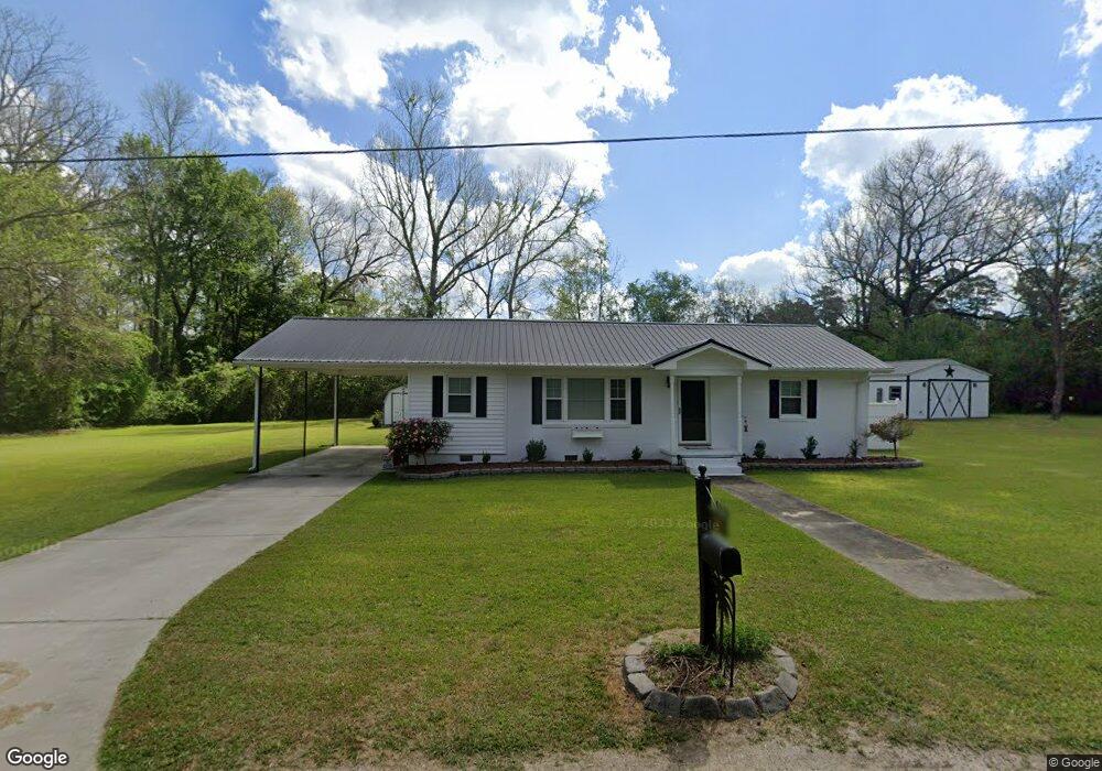
151 Turner Ct Branchville, SC 29432
Estimated Value: $112,000 - $137,000
3
Beds
1
Bath
1,150
Sq Ft
$106/Sq Ft
Est. Value
About This Home
This home is located at 151 Turner Ct, Branchville, SC 29432 and is currently estimated at $122,288, approximately $106 per square foot. 151 Turner Ct is a home located in Orangeburg County with nearby schools including Lockett Elementary, Lockett Elementary School, and Branchville High School.
Ownership History
Date
Name
Owned For
Owner Type
Purchase Details
Closed on
Jun 13, 2007
Sold by
Rimer Beverly Jo Linder and Allen Patricia Gail Linder
Bought by
Walters Susan M
Current Estimated Value
Home Financials for this Owner
Home Financials are based on the most recent Mortgage that was taken out on this home.
Original Mortgage
$65,000
Outstanding Balance
$39,708
Interest Rate
6.16%
Mortgage Type
Purchase Money Mortgage
Estimated Equity
$82,580
Purchase Details
Closed on
Jul 17, 2006
Sold by
Linder Maude B
Bought by
Rimer Beverly Jo Linder and Allen Patricia Gail Linder
Create a Home Valuation Report for This Property
The Home Valuation Report is an in-depth analysis detailing your home's value as well as a comparison with similar homes in the area
Home Values in the Area
Average Home Value in this Area
Purchase History
| Date | Buyer | Sale Price | Title Company |
|---|---|---|---|
| Walters Susan M | $65,000 | None Available | |
| Rimer Beverly Jo Linder | -- | None Available |
Source: Public Records
Mortgage History
| Date | Status | Borrower | Loan Amount |
|---|---|---|---|
| Open | Walters Susan M | $65,000 |
Source: Public Records
Tax History Compared to Growth
Tax History
| Year | Tax Paid | Tax Assessment Tax Assessment Total Assessment is a certain percentage of the fair market value that is determined by local assessors to be the total taxable value of land and additions on the property. | Land | Improvement |
|---|---|---|---|---|
| 2024 | $642 | $3,387 | $435 | $2,952 |
| 2023 | $564 | $2,476 | $368 | $2,108 |
| 2022 | $554 | $2,476 | $368 | $2,108 |
| 2021 | $1,502 | $2,476 | $368 | $2,108 |
| 2020 | $1,399 | $2,476 | $368 | $2,108 |
| 2019 | $1,358 | $2,476 | $368 | $2,108 |
| 2018 | $1,229 | $1,812 | $368 | $1,444 |
| 2017 | $1,215 | $1,812 | $0 | $0 |
| 2016 | $1,208 | $1,812 | $0 | $0 |
| 2015 | $1,155 | $1,812 | $0 | $0 |
| 2014 | $1,155 | $1,813 | $369 | $1,444 |
| 2013 | -- | $1,844 | $368 | $1,476 |
Source: Public Records
Map
Nearby Homes
- 323 Railroad Ave
- 360 Bridge St
- 281 Bridge St
- 1 Freedom Rd
- 00 Freedom Rd
- 0 Calhoun St Unit 25018526
- 0 Calhoun St Unit 170350
- TBD Ellis St
- 1373 Bridge St
- 4756 Edisto River Rd
- Rd
- 2958 Heritage Hwy
- 5837 Freedom Rd
- 646 Briar Creek Rd
- 668 Briar Creek Rd
- 0 Highway 210 Unit 24752850
- 4534 Cattle Creek Rd
- 269 Out Water Ln
- 496 O C 4148
- 1 Parnel Rd