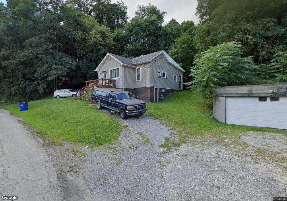
151 Vernia St East Liverpool, OH 43920
Estimated Value: $68,901 - $109,000
2
Beds
1
Bath
928
Sq Ft
$89/Sq Ft
Est. Value
About This Home
This home is located at 151 Vernia St, East Liverpool, OH 43920 and is currently estimated at $82,975, approximately $89 per square foot. 151 Vernia St is a home located in Columbiana County with nearby schools including Westgate Middle School, North Elementary School, and East Liverpool High School.
Ownership History
Date
Name
Owned For
Owner Type
Purchase Details
Closed on
Mar 11, 2019
Sold by
Hunt Kristine
Bought by
Orr Travis
Current Estimated Value
Purchase Details
Closed on
Feb 14, 2002
Sold by
One Stop Mtg Inc
Bought by
Hunt Donald
Home Financials for this Owner
Home Financials are based on the most recent Mortgage that was taken out on this home.
Original Mortgage
$22,152
Interest Rate
7.14%
Mortgage Type
FHA
Purchase Details
Closed on
Jan 11, 2000
Sold by
Brown James
Bought by
One Stop Mtg Inc
Create a Home Valuation Report for This Property
The Home Valuation Report is an in-depth analysis detailing your home's value as well as a comparison with similar homes in the area
Home Values in the Area
Average Home Value in this Area
Purchase History
| Date | Buyer | Sale Price | Title Company |
|---|---|---|---|
| Orr Travis | $30,000 | -- | |
| Hunt Donald | $22,500 | Heritage Title Agency Inc | |
| One Stop Mtg Inc | $24,000 | -- |
Source: Public Records
Mortgage History
| Date | Status | Borrower | Loan Amount |
|---|---|---|---|
| Previous Owner | Hunt Donald | $22,152 |
Source: Public Records
Tax History Compared to Growth
Tax History
| Year | Tax Paid | Tax Assessment Tax Assessment Total Assessment is a certain percentage of the fair market value that is determined by local assessors to be the total taxable value of land and additions on the property. | Land | Improvement |
|---|---|---|---|---|
| 2024 | $453 | $11,030 | $1,230 | $9,800 |
| 2023 | $453 | $11,030 | $1,230 | $9,800 |
| 2022 | $453 | $11,030 | $1,230 | $9,800 |
| 2021 | $521 | $11,620 | $1,190 | $10,430 |
| 2020 | $522 | $11,620 | $1,190 | $10,430 |
| 2019 | $522 | $11,620 | $1,190 | $10,430 |
| 2018 | $506 | $10,580 | $1,090 | $9,490 |
| 2017 | $533 | $10,580 | $1,090 | $9,490 |
| 2016 | $558 | $10,160 | $1,650 | $8,510 |
| 2015 | $497 | $10,160 | $1,650 | $8,510 |
| 2014 | $565 | $10,160 | $1,650 | $8,510 |
Source: Public Records
Map
Nearby Homes
- 920 Mckinnon Ave
- 1519 Saint Clair Ave
- 1507 Saint Clair Ave
- 1520 Smithfield St
- 1714 Allison St
- 1615 Montrose St
- 1178 Oliver St
- 628 Fisher Ave
- 929 Bank St
- 120 Woodbine
- 49536 Sunset Dr
- 2535 Park Way
- 820 Chester St
- 1001 Ambrose Ave
- 755 Minerva St
- 636 River Rd
- 534 1st St
- 938 Ambrose Ave
- 739 Avondale St
- 730 Avondale St
- 1698 Anderson Blvd
- 161 Vernia St
- 6 Auburn St
- 113 Center St
- 5 Auburn St
- 100 Center St
- 100 Center St
- 100 Center St
- 100 Center St
- 100 Center St
- 1680 Anderson Blvd
- 100 Vernia St
- 4 Auburn St
- 177 Beechwood St
- 102 Center St
- 942 Columbia Ave
- 942 Columbia Ave
- 1715 Anderson Blvd
- 1730 Anderson Blvd
- 117 Center St