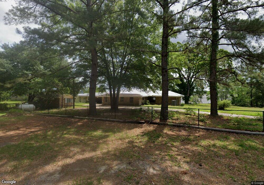
151 White Rd Leesville, LA 71446
Estimated Value: $180,118 - $285,000
Studio
--
Bath
--
Sq Ft
1
Acres
About This Home
This home is located at 151 White Rd, Leesville, LA 71446 and is currently estimated at $211,780. 151 White Rd is a home located in Vernon Parish.
Ownership History
Date
Name
Owned For
Owner Type
Purchase Details
Closed on
Oct 18, 2022
Sold by
Mclean Thomas Eula Mae
Bought by
Thomas Daniel William
Current Estimated Value
Purchase Details
Closed on
Oct 26, 2006
Sold by
Burns Michael Joe and Burns Sabrina Marie Mroczka
Bought by
Thomas Timothy A
Home Financials for this Owner
Home Financials are based on the most recent Mortgage that was taken out on this home.
Original Mortgage
$150,000
Interest Rate
6.28%
Mortgage Type
Stand Alone First
Create a Home Valuation Report for This Property
The Home Valuation Report is an in-depth analysis detailing your home's value as well as a comparison with similar homes in the area
Purchase History
| Date | Buyer | Sale Price | Title Company |
|---|---|---|---|
| Thomas Daniel William | -- | -- | |
| Thomas Timothy Matthew | -- | -- | |
| Thomas Timothy A | $160,000 | -- |
Source: Public Records
Mortgage History
| Date | Status | Borrower | Loan Amount |
|---|---|---|---|
| Previous Owner | Thomas Timothy A | $150,000 |
Source: Public Records
Tax History
| Year | Tax Paid | Tax Assessment Tax Assessment Total Assessment is a certain percentage of the fair market value that is determined by local assessors to be the total taxable value of land and additions on the property. | Land | Improvement |
|---|---|---|---|---|
| 2025 | $1,592 | $13,330 | $320 | $13,010 |
| 2024 | $1,609 | $13,330 | $320 | $13,010 |
| 2023 | $1,650 | $13,330 | $290 | $13,040 |
| 2022 | $1,466 | $13,330 | $290 | $13,040 |
| 2021 | $1,685 | $12,140 | $290 | $11,850 |
| 2020 | $1,861 | $12,140 | $290 | $11,850 |
| 2019 | $1,640 | $12,140 | $290 | $11,850 |
| 2018 | $1,756 | $12,140 | $290 | $11,850 |
| 2017 | $1,614 | $12,140 | $290 | $11,850 |
| 2015 | $1,666 | $12,040 | $190 | $11,850 |
| 2014 | $1,549 | $12,040 | $190 | $11,850 |
| 2013 | $1,811 | $12,040 | $190 | $11,850 |
Source: Public Records
Map
Nearby Homes
- 0 Tbd Hwy 8 & 464 Unit 29-1650
- 0 Hwy 8 & 464 Hwy Unit SWL22004749
- 0 Lot 7 Woodland Park Phase III Unit 29-1652
- 281 Methodist Landing Rd
- 149 Methodist Landing Rd
- 4450 Camp Baker Rd
- 0 Woods Rd Unit RD
- 588 Hickory Ridge Rd
- 0 Empire Point Rd
- 0 Nichols Rd
- 115 Deerhunter Ln
- 1976 Savage Forks Rd
- 728 Section Line Rd
- 708 Woodland Dr
- 147 Blackmon Rd
- 710 Woodland Dr
- 0 Tbd B and G Loop Unit 29-2182
- 1109 Nicholas Dr
- TBD B and G Loop
- 0 Tbd Driftwood Dr
- 151 White Rd Unit Road
- 137 White Rd
- 128 Schwartz Rd
- 139 Schwartz Rd
- 463 Brown Ritter Loop
- 447 Brown Ritter Loop
- 439 Brown Ritter Loop
- 391 Peavy Rd
- 366 Peavy Rd
- 398 Peavy Rd
- 314 Peavy Rd
- 348 Peavy Rd
- 428 Brown Ritter Loop
- 425 Brown Ritter Loop
- 368 Peavy Rd
- 332 Brown Ritter Loop
- 451 Brown Ritter Loop
- 303 Highway 464
- 113 Schwartz Rd Unit 6
- 267 Rabbit Island Ln