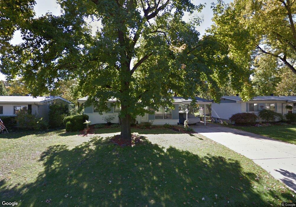
1510 Aspen Dr Florissant, MO 63031
Estimated Value: $151,000 - $167,000
3
Beds
1
Bath
912
Sq Ft
$175/Sq Ft
Est. Value
About This Home
This home is located at 1510 Aspen Dr, Florissant, MO 63031 and is currently estimated at $159,957, approximately $175 per square foot. 1510 Aspen Dr is a home located in St. Louis County with nearby schools including McCurdy Elementary School, Northwest Middle School, and Hazelwood West High School.
Ownership History
Date
Name
Owned For
Owner Type
Purchase Details
Closed on
Sep 29, 2011
Sold by
Richardson Cornell
Bought by
Richardson Johnna L
Current Estimated Value
Purchase Details
Closed on
May 19, 2009
Sold by
Richardson Cornell and Richardson Johnna L
Bought by
Richardson Cornell and Richardson Johnna L
Home Financials for this Owner
Home Financials are based on the most recent Mortgage that was taken out on this home.
Original Mortgage
$97,201
Outstanding Balance
$61,381
Interest Rate
4.84%
Mortgage Type
FHA
Estimated Equity
$98,576
Purchase Details
Closed on
Apr 17, 1998
Sold by
Jacoby Lisa C and Jacoby Lisa C
Bought by
Richardson Cornell C and Richardson Johnna L
Home Financials for this Owner
Home Financials are based on the most recent Mortgage that was taken out on this home.
Original Mortgage
$69,427
Interest Rate
7.21%
Mortgage Type
FHA
Create a Home Valuation Report for This Property
The Home Valuation Report is an in-depth analysis detailing your home's value as well as a comparison with similar homes in the area
Home Values in the Area
Average Home Value in this Area
Purchase History
| Date | Buyer | Sale Price | Title Company |
|---|---|---|---|
| Richardson Johnna L | -- | None Available | |
| Richardson Cornell | -- | Davis Title | |
| Richardson Cornell C | -- | -- |
Source: Public Records
Mortgage History
| Date | Status | Borrower | Loan Amount |
|---|---|---|---|
| Open | Richardson Cornell | $97,201 | |
| Closed | Richardson Cornell C | $69,427 |
Source: Public Records
Tax History Compared to Growth
Tax History
| Year | Tax Paid | Tax Assessment Tax Assessment Total Assessment is a certain percentage of the fair market value that is determined by local assessors to be the total taxable value of land and additions on the property. | Land | Improvement |
|---|---|---|---|---|
| 2025 | $2,171 | $25,090 | $5,420 | $19,670 |
| 2024 | $2,171 | $24,190 | $3,100 | $21,090 |
| 2023 | $2,168 | $24,190 | $3,100 | $21,090 |
| 2022 | $1,817 | $18,010 | $3,570 | $14,440 |
| 2021 | $1,770 | $18,010 | $3,570 | $14,440 |
| 2020 | $1,640 | $15,720 | $3,100 | $12,620 |
| 2019 | $1,615 | $15,720 | $3,100 | $12,620 |
| 2018 | $1,413 | $12,620 | $2,720 | $9,900 |
| 2017 | $1,412 | $12,620 | $2,720 | $9,900 |
| 2016 | $1,452 | $12,810 | $2,360 | $10,450 |
| 2015 | $1,421 | $12,810 | $2,360 | $10,450 |
| 2014 | -- | $12,010 | $2,470 | $9,540 |
Source: Public Records
Map
Nearby Homes
- 1415 Boulder Dr
- 1505 Swallow Ln
- 200 Francisca Dr
- 1395 Bluebird Dr
- 1825 Swallow Ln
- 1155 Mullanphy Rd
- 25 Francisca Dr
- 1120 Bluebird Dr
- 6 Charlotte Dr
- 1150 Verlene Dr
- 1270 Bobolink Dr
- 1405 Miller Dr
- 890 Tyson Dr
- 185 Eldorado Dr
- 660 Herbst Dr
- 1380 Thrush Ln
- 2040 Splendor Dr
- 1625 Charbonier Rd
- 25 Hammes Dr
- 2048 New Sun Dr