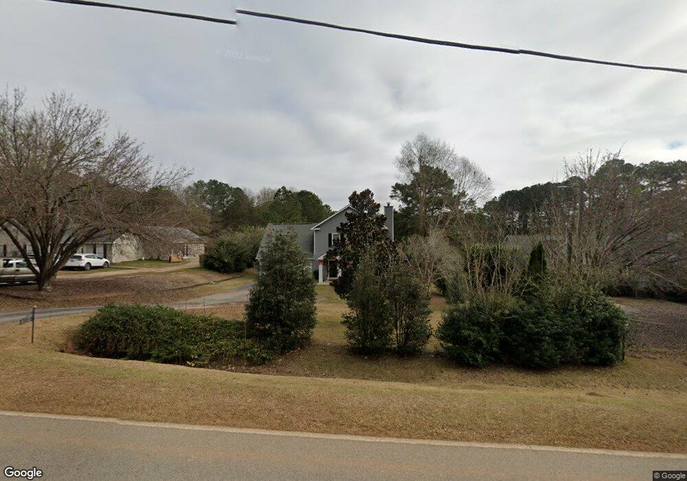
1510 Cannonville Rd Lagrange, GA 30240
Estimated Value: $267,429 - $287,000
3
Beds
3
Baths
1,993
Sq Ft
$139/Sq Ft
Est. Value
About This Home
This home is located at 1510 Cannonville Rd, Lagrange, GA 30240 and is currently estimated at $277,107, approximately $139 per square foot. 1510 Cannonville Rd is a home located in Troup County with nearby schools including Long Cane Elementary School, Berta Weathersbee Elementary School, and Whitesville Road Elementary School.
Ownership History
Date
Name
Owned For
Owner Type
Purchase Details
Closed on
Aug 21, 2020
Sold by
Willie Tammy
Bought by
Alford Calandra
Current Estimated Value
Home Financials for this Owner
Home Financials are based on the most recent Mortgage that was taken out on this home.
Original Mortgage
$176,739
Outstanding Balance
$156,780
Interest Rate
3%
Mortgage Type
FHA
Estimated Equity
$120,327
Purchase Details
Closed on
Sep 2, 1999
Sold by
Boisen Trent M and Boisen Tracy L
Bought by
Willis Mark S and Willis Tammy M
Purchase Details
Closed on
Feb 15, 1995
Sold by
Potts Chas and Potts Angela
Bought by
Boisen Trent M and Boisen Tracy L
Purchase Details
Closed on
Oct 29, 1991
Bought by
Potts Chas and Potts Angela
Purchase Details
Closed on
Apr 2, 1990
Purchase Details
Closed on
May 22, 1989
Create a Home Valuation Report for This Property
The Home Valuation Report is an in-depth analysis detailing your home's value as well as a comparison with similar homes in the area
Home Values in the Area
Average Home Value in this Area
Purchase History
| Date | Buyer | Sale Price | Title Company |
|---|---|---|---|
| Alford Calandra | $180,000 | -- | |
| Willis Mark S | $92,300 | -- | |
| Boisen Trent M | $82,000 | -- | |
| Potts Chas | -- | -- | |
| -- | $76,500 | -- | |
| -- | -- | -- |
Source: Public Records
Mortgage History
| Date | Status | Borrower | Loan Amount |
|---|---|---|---|
| Open | Alford Calandra | $176,739 |
Source: Public Records
Tax History Compared to Growth
Tax History
| Year | Tax Paid | Tax Assessment Tax Assessment Total Assessment is a certain percentage of the fair market value that is determined by local assessors to be the total taxable value of land and additions on the property. | Land | Improvement |
|---|---|---|---|---|
| 2024 | $2,150 | $80,832 | $8,000 | $72,832 |
| 2023 | $1,992 | $75,032 | $8,000 | $67,032 |
| 2022 | $1,919 | $70,752 | $8,000 | $62,752 |
| 2021 | $2,112 | $72,088 | $4,280 | $67,808 |
| 2020 | $1,739 | $59,648 | $4,280 | $55,368 |
| 2019 | $1,760 | $60,336 | $4,280 | $56,056 |
| 2018 | $1,605 | $55,212 | $4,280 | $50,932 |
| 2017 | $1,463 | $50,496 | $4,000 | $46,496 |
| 2016 | $1,425 | $49,230 | $4,000 | $45,230 |
| 2015 | $1,428 | $49,230 | $4,000 | $45,230 |
| 2014 | $1,358 | $46,849 | $4,000 | $42,849 |
| 2013 | -- | $46,598 | $4,000 | $42,598 |
Source: Public Records
Map
Nearby Homes
- 1248 Cannonville Rd
- 0 Robert Hayes Rd Unit 10611067
- 345 Robert Taylor Rd
- 0 Hanson Dr Unit 10641272
- 275 Hanson Dr
- 0 Cannonville Rd
- 22 Freeman Rd
- 118 Woodstream Trail
- 266 Glass Bridge Rd
- 103 Hawthorne Cir
- 288 Bradfield Dr
- 110 Hawthorne Cir
- 808 S Fling Rd
- 114 Westgate Dr
- 102 Franklin Place
- 5714 W Point Rd
- 119 Plymouth Dr
- 0 Bradfield Dr Unit 10568803
- 102 Foxdale Dr
- 610 Ginger Cir
- 1500 Cannonville Rd
- 1520 Cannonville Rd
- 1490 Cannonville Rd
- 1530 Cannonville Rd
- 1546 Cannonville Rd
- 1560 Cannonville Rd
- 6475 Old West Point Rd
- 1357 Cannonville Rd
- 1345 Cannonville Rd
- 204 Upland Ct
- 1635 Cannonville Rd
- 1335 Cannonville Rd
- 1335 Cannonville Rd Unit 3
- 1327 Cannonville Rd
- 207 Upland Ct
- 107 acres Co Rd 222
- 202 Upland Ct
- 1315 Cannonville Rd
- 205 Upland Ct
- 206 Pinebrook Ct