Estimated Value: $298,000 - $322,000
4
Beds
2
Baths
2,150
Sq Ft
$145/Sq Ft
Est. Value
About This Home
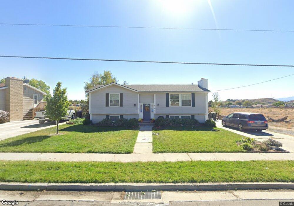
This home is located at 1510 E 800 N, Price, UT 84501 and is currently estimated at $312,139, approximately $145 per square foot. 1510 E 800 N is a home located in Carbon County with nearby schools including Castle Heights School, Mont Harmon Junior High School, and Carbon High School.
Ownership History
Date
Name
Owned For
Owner Type
Purchase Details
Closed on
Aug 18, 2017
Sold by
Wood Darrel G and Wood Marti A
Bought by
Francis Leonard and Francis Tricia B
Current Estimated Value
Home Financials for this Owner
Home Financials are based on the most recent Mortgage that was taken out on this home.
Original Mortgage
$168,658
Outstanding Balance
$145,050
Interest Rate
5.25%
Mortgage Type
FHA
Estimated Equity
$167,089
Purchase Details
Closed on
Mar 16, 2009
Sold by
Wood Darrel and Wood Marti
Bought by
Wood Darrel G and Wood Marti A
Home Financials for this Owner
Home Financials are based on the most recent Mortgage that was taken out on this home.
Original Mortgage
$94,500
Interest Rate
5.15%
Mortgage Type
New Conventional
Create a Home Valuation Report for This Property
The Home Valuation Report is an in-depth analysis detailing your home's value as well as a comparison with similar homes in the area
Home Values in the Area
Average Home Value in this Area
Purchase History
| Date | Buyer | Sale Price | Title Company |
|---|---|---|---|
| Francis Leonard | -- | Bay National Title Company | |
| Wood Darrel G | -- | South Eastern Utah Title Co |
Source: Public Records
Mortgage History
| Date | Status | Borrower | Loan Amount |
|---|---|---|---|
| Open | Francis Leonard | $168,658 | |
| Previous Owner | Wood Darrel G | $94,500 |
Source: Public Records
Tax History Compared to Growth
Tax History
| Year | Tax Paid | Tax Assessment Tax Assessment Total Assessment is a certain percentage of the fair market value that is determined by local assessors to be the total taxable value of land and additions on the property. | Land | Improvement |
|---|---|---|---|---|
| 2025 | $1,909 | $157,098 | $12,271 | $144,827 |
| 2024 | $1,501 | $124,967 | $11,962 | $113,005 |
| 2023 | $1,783 | $158,328 | $11,762 | $146,566 |
| 2022 | $1,784 | $142,083 | $9,779 | $132,304 |
| 2021 | $1,531 | $189,255 | $14,941 | $174,314 |
| 2020 | $1,501 | $93,121 | $0 | $0 |
| 2019 | $1,334 | $86,792 | $0 | $0 |
| 2018 | $1,240 | $82,309 | $0 | $0 |
| 2017 | $1,225 | $82,309 | $0 | $0 |
| 2016 | $1,105 | $82,309 | $0 | $0 |
| 2015 | $1,105 | $82,309 | $0 | $0 |
| 2014 | $1,097 | $82,309 | $0 | $0 |
| 2013 | $1,121 | $83,240 | $0 | $0 |
Source: Public Records
Map
Nearby Homes
- 703 N Windsor Cir
- 688 Birch Cir
- 639 N 1550 E
- 546 Windsor Rd
- 831 N 1820 E Unit 66
- 879 N 1820 E Unit 69
- 1827 E 8th N Unit 79
- 1830 E 840 N Unit 80
- 1829 E 840 N Unit 87
- 1841 E 8th N Unit 78
- 1840 E 840 N Unit 81
- 1843 E 840 N Unit 86
- 1855 E 8th N Unit 77
- 1858 E 840 N Unit 82
- 1857 E 840 N Unit 85
- 1689 Eastridge Rd
- 1860 E 880 N
- 1871 E 840 N Unit 84
- 826 N 900 E
- 824 N 1880 E Unit 74
- 1522 E 800 N
- 1488 E 800 N
- 1519 E 800 N
- 1536 E 800 N
- 1539 E 800 N
- 1481 E 800 N
- 1541 E 800 N
- 775 Briarwood Cir
- 1522 Eastwood Cir
- 1550 E 800 N
- 823 Eastwood Dr
- 807 Pinewood Cir
- 1540 Eastwood Cir
- 810 N 1400 E
- 761 Briarwood Cir
- 833 Eastwood Dr
- 825 Pinewood Cir
- 830 N 1400 E
- 1545 Eastwood Dr
- 845 Eastwood Dr