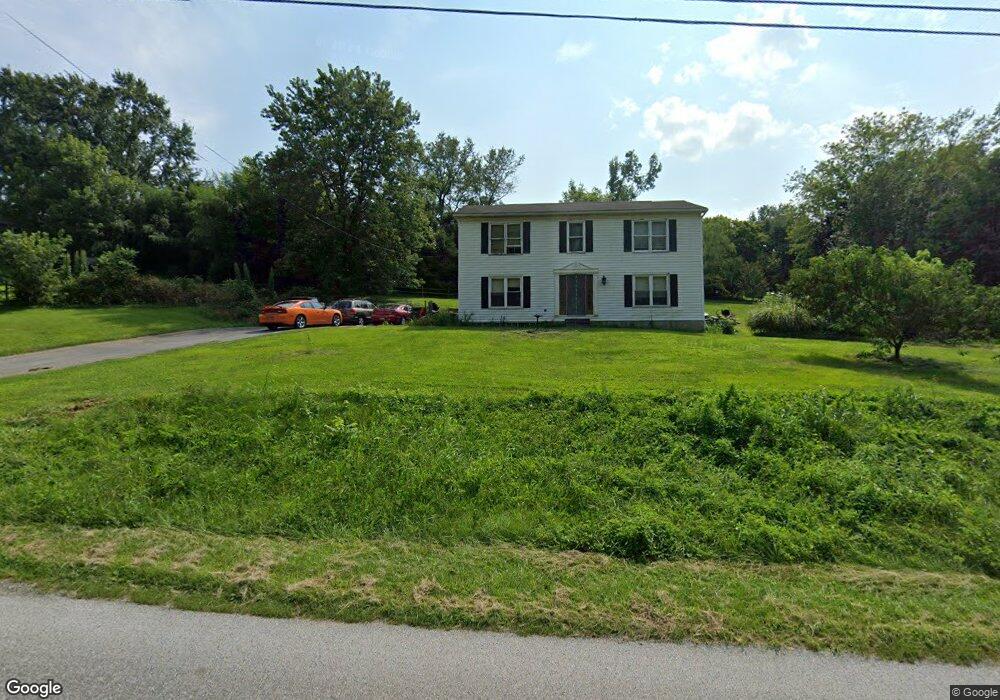
1510 Furniss Rd Drumore, PA 17518
Estimated Value: $367,500 - $462,000
4
Beds
2
Baths
1,920
Sq Ft
$212/Sq Ft
Est. Value
About This Home
This home is located at 1510 Furniss Rd, Drumore, PA 17518 and is currently estimated at $406,375, approximately $211 per square foot. 1510 Furniss Rd is a home located in Lancaster County with nearby schools including Smith Middle School and Solanco High School.
Ownership History
Date
Name
Owned For
Owner Type
Purchase Details
Closed on
Jun 18, 1999
Sold by
Ferrer Jose R and Ferrer Patricia M
Bought by
Duffin Robert J
Current Estimated Value
Home Financials for this Owner
Home Financials are based on the most recent Mortgage that was taken out on this home.
Original Mortgage
$132,850
Outstanding Balance
$34,864
Interest Rate
6.99%
Mortgage Type
VA
Estimated Equity
$371,511
Create a Home Valuation Report for This Property
The Home Valuation Report is an in-depth analysis detailing your home's value as well as a comparison with similar homes in the area
Home Values in the Area
Average Home Value in this Area
Purchase History
| Date | Buyer | Sale Price | Title Company |
|---|---|---|---|
| Duffin Robert J | $129,000 | -- |
Source: Public Records
Mortgage History
| Date | Status | Borrower | Loan Amount |
|---|---|---|---|
| Open | Duffin Robert J | $132,850 |
Source: Public Records
Tax History Compared to Growth
Tax History
| Year | Tax Paid | Tax Assessment Tax Assessment Total Assessment is a certain percentage of the fair market value that is determined by local assessors to be the total taxable value of land and additions on the property. | Land | Improvement |
|---|---|---|---|---|
| 2025 | $2,895 | $180,000 | $78,400 | $101,600 |
| 2024 | $2,895 | $180,000 | $78,400 | $101,600 |
| 2023 | $2,810 | $180,000 | $78,400 | $101,600 |
| 2022 | $2,718 | $180,000 | $78,400 | $101,600 |
| 2021 | $2,625 | $180,000 | $78,400 | $101,600 |
| 2020 | $2,625 | $180,000 | $78,400 | $101,600 |
| 2019 | $2,559 | $180,000 | $78,400 | $101,600 |
| 2018 | $676 | $180,000 | $78,400 | $101,600 |
| 2017 | $2,519 | $146,600 | $45,300 | $101,300 |
| 2016 | $2,519 | $146,600 | $45,300 | $101,300 |
| 2015 | $694 | $146,600 | $45,300 | $101,300 |
| 2014 | $1,658 | $146,600 | $45,300 | $101,300 |
Source: Public Records
Map
Nearby Homes
- 1534 Benton Hollow Rd
- 2143 Bald Eagle Rd
- 121 Black Bear Rd
- 2 Anthony Ct
- 3 Anthony Ct
- 117 Grove Rd
- 603 Poplar Ln
- 866 Quarry Rd
- 293 Grove Rd
- 44 Oak Ridge Dr
- 1109 Susquehannock Dr
- 523 River Rd
- 0 Nottingham Rd
- 440 Scotland Rd
- 999 Hilldale Rd
- 220 Clearview Dr
- 103 Talton Dr
- 225 Cedar Hill Rd
- 98 W Red Hill Rd
- 0 Little Britain Rd N Unit PALA2061636
- 1409 Harmony Ridge Dr
- 1509 Furniss Rd
- 1407 Harmony Ridge Dr
- 1411 Harmony Ridge Dr
- 1401 Harmony Ridge Dr
- 1413 Harmony Ridge Dr
- 1501 Furniss Rd
- 1415 Harmony Ridge Dr
- 1417 Harmony Ridge Dr
- 1417 Harmony Ridge Dr
- 1414 Harmony Ridge Dr
- 1516 Furniss Rd
- 1337 Harmony Ridge Rd
- 1418 Harmony Ridge Dr
- 1421 Harmony Ridge Dr
- 1422 Harmony Ridge Dr
- 1331 Harmony Ridge Rd
- 1423 Harmony Ridge Dr
- 1335 Harmony Ridge Rd
- 1521 Furniss Rd