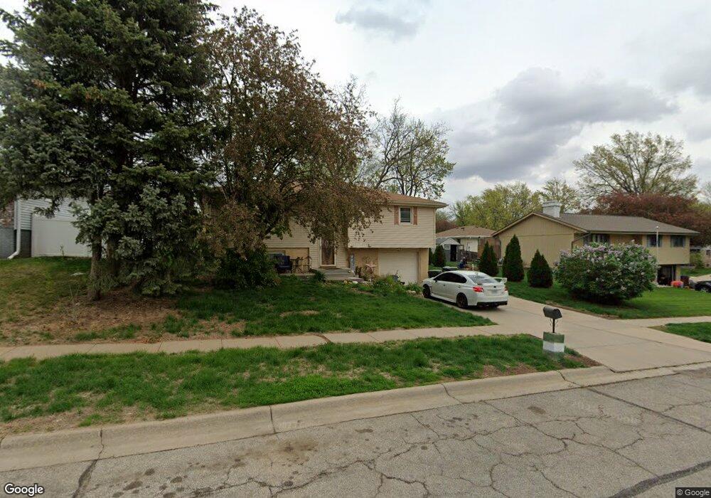
1510 Hays Dr Lincoln, NE 68505
Bethany NeighborhoodEstimated Value: $255,205 - $266,000
3
Beds
2
Baths
1,636
Sq Ft
$159/Sq Ft
Est. Value
About This Home
This home is located at 1510 Hays Dr, Lincoln, NE 68505 and is currently estimated at $260,051, approximately $158 per square foot. 1510 Hays Dr is a home located in Lancaster County with nearby schools including Kahoa Elementary School, Mickle Middle School, and Lincoln Northeast High School.
Ownership History
Date
Name
Owned For
Owner Type
Purchase Details
Closed on
Aug 28, 2006
Sold by
Yusten Peggy Louise and Yusten Cy
Bought by
Chavez Meliton and Arista Teresa
Current Estimated Value
Purchase Details
Closed on
Aug 25, 2006
Sold by
Shaw Rikky Sue
Bought by
Chavez Meliton and Arista Teresa
Purchase Details
Closed on
Aug 26, 2003
Sold by
Prien Richard H and Prien Frances Louise
Bought by
Yusten Peggy Louise and Shaw Rikky Sue
Create a Home Valuation Report for This Property
The Home Valuation Report is an in-depth analysis detailing your home's value as well as a comparison with similar homes in the area
Home Values in the Area
Average Home Value in this Area
Purchase History
| Date | Buyer | Sale Price | Title Company |
|---|---|---|---|
| Chavez Meliton | $115,000 | Ct | |
| Chavez Meliton | -- | Ct | |
| Yusten Peggy Louise | -- | -- |
Source: Public Records
Tax History Compared to Growth
Tax History
| Year | Tax Paid | Tax Assessment Tax Assessment Total Assessment is a certain percentage of the fair market value that is determined by local assessors to be the total taxable value of land and additions on the property. | Land | Improvement |
|---|---|---|---|---|
| 2025 | $3,074 | $238,300 | $52,000 | $186,300 |
| 2024 | $3,074 | $222,400 | $49,500 | $172,900 |
| 2023 | $3,727 | $222,400 | $49,500 | $172,900 |
| 2022 | $3,402 | $170,700 | $40,000 | $130,700 |
| 2021 | $3,218 | $170,700 | $40,000 | $130,700 |
| 2020 | $2,799 | $146,500 | $40,000 | $106,500 |
| 2019 | $2,800 | $146,500 | $40,000 | $106,500 |
| 2018 | $2,649 | $138,000 | $40,000 | $98,000 |
| 2017 | $2,673 | $138,000 | $40,000 | $98,000 |
| 2016 | $2,459 | $126,300 | $35,000 | $91,300 |
| 2015 | $2,442 | $126,300 | $35,000 | $91,300 |
| 2014 | $2,464 | $126,700 | $35,000 | $91,700 |
| 2013 | -- | $126,700 | $35,000 | $91,700 |
Source: Public Records
Map
Nearby Homes
- 7611 Fairfax Ave
- 1624 N 73rd St
- 7601 Holdrege St
- 1736 N 76th St
- 1324 Meadow Dale Dr
- 7140 Starr St
- 7301 Colby St
- 7101 Colby St
- 6927 Holdrege St
- 1131 N 79th St
- 1011 Scenic Ln
- 7321 York Ln
- 6810 Holdrege St
- 2308 Dorothy Dr
- 7909 Leo Ln
- 1630 Sawyer St
- 820 E Avon Ln
- 7620 Vine St
- 6644 Dudley St
- 2345 Nancy Dr