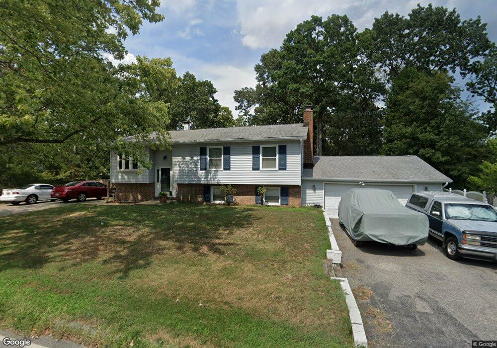
1510 Long Point Rd Pasadena, MD 21122
Estimated Value: $470,220 - $596,000
Studio
2
Baths
1,902
Sq Ft
$283/Sq Ft
Est. Value
About This Home
This home is located at 1510 Long Point Rd, Pasadena, MD 21122 and is currently estimated at $538,305, approximately $283 per square foot. 1510 Long Point Rd is a home located in Anne Arundel County with nearby schools including Bodkin Elementary School, Chesapeake Bay Middle School, and Chesapeake High School.
Ownership History
Date
Name
Owned For
Owner Type
Purchase Details
Closed on
Jun 25, 2004
Sold by
Hook Ronald B
Bought by
Hook Ronald B and Hook Maureen A
Current Estimated Value
Purchase Details
Closed on
Jun 23, 2004
Sold by
Hook Ronald B
Bought by
Hook Ronald B and Hook Maureen A
Purchase Details
Closed on
Sep 4, 1998
Sold by
Caple Ruth A
Bought by
Hook Ronald B
Create a Home Valuation Report for This Property
The Home Valuation Report is an in-depth analysis detailing your home's value as well as a comparison with similar homes in the area
Home Values in the Area
Average Home Value in this Area
Purchase History
| Date | Buyer | Sale Price | Title Company |
|---|---|---|---|
| Hook Ronald B | -- | -- | |
| Hook Ronald B | -- | -- | |
| Hook Ronald B | $150,500 | -- |
Source: Public Records
Mortgage History
| Date | Status | Borrower | Loan Amount |
|---|---|---|---|
| Closed | Hook Ronald B | -- |
Source: Public Records
Tax History
| Year | Tax Paid | Tax Assessment Tax Assessment Total Assessment is a certain percentage of the fair market value that is determined by local assessors to be the total taxable value of land and additions on the property. | Land | Improvement |
|---|---|---|---|---|
| 2025 | $3,164 | $401,600 | -- | -- |
| 2024 | $3,164 | $348,600 | $207,600 | $141,000 |
| 2023 | $3,083 | $346,600 | $0 | $0 |
| 2022 | $2,894 | $344,600 | $0 | $0 |
| 2020 | $2,760 | $332,000 | $0 | $0 |
| 2019 | $2,713 | $321,400 | $0 | $0 |
| 2018 | $3,152 | $310,800 | $177,600 | $133,200 |
| 2017 | $2,549 | $294,467 | $0 | $0 |
| 2016 | -- | $278,133 | $0 | $0 |
| 2015 | -- | $261,800 | $0 | $0 |
| 2014 | -- | $261,800 | $0 | $0 |
Source: Public Records
Map
Nearby Homes
- 4785 Mountain Rd
- 151 Wileys Ln
- 225 Pennsylvania Ave
- 0 Cornfield Rd Unit MDAA2129542
- 0 Cornfield Rd Unit MDAA2129524
- 511 Sylvan Way
- 0 Maryland Ave
- 304 Maryland Ave
- 8384 Forest Dr
- 8329 Sail Ct
- 1146 Valley Dr
- 8292 Shilling Rd
- 1585 Marco Dr
- 1807 Mountain Bay Road - Baltimore Model
- 5084 Mountain Road - Baltimore Model
- 2123 Beach Dr
- 8108 Forest Glen Dr
- 8138 Forest Glen Dr
- 5108 Mountain Rd
- 2164 Springdale Rd
- 152 Ibis Dr
- 1500 Long Point Rd
- 1514 Long Point Rd
- 1521 Puffin Ct
- 151 Sillery Bay Rd
- 1517 Puffin Ct
- 1496 Long Point Rd
- 146 Sillery Bay Rd
- 1525 Puffin Ct
- 1495 Long Point Rd
- 150 Sillery Bay Rd
- 1511 Long Point Rd
- 1518 Long Point Rd
- 154 Sillery Bay Rd
- 1492 Long Point Rd
- 1529 Puffin Ct
- 1513 Puffin Ct
- 1491 Long Point Rd
- 1509 Puffin Ct
- 155 Sillery Bay Rd
Your Personal Tour Guide
Ask me questions while you tour the home.